The Snæfellsnes Peninsula: Iceland in Two Days, Without the Ring Road
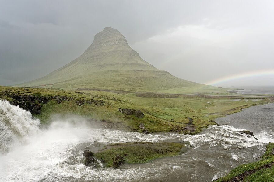
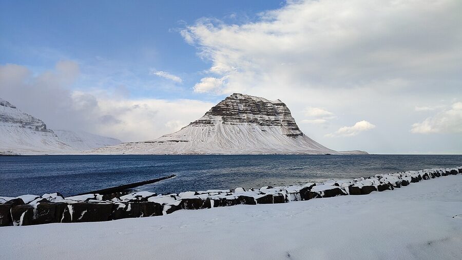
Drive Snæfellsnes anti-clockwise. Every guidebook and every tour bus heads clockwise out of Borgarnes, hits Ytri Tunga seal beach by mid-morning, eats lunch in Arnarstapi, and reaches Kirkjufell in the afternoon. By then the famous mountain is in shadow. Kirkjufell faces north. The light hits the front face in the morning, not the afternoon. So you do the loop the other way round, sleep in Stykkishólmur on the north coast, and you’re at Kirkjufellsfoss for the 9am light while the clockwise crowd is still at Búðakirkja taking the same photo I’ll talk you out of taking.
This is the loop most Iceland trips skip. People with seven days book the Ring Road. People with three or four days think they have to choose between staying in Reykjavík and seeing nothing, or driving the full circuit and seeing it all in a hurry. Snæfellsnes is the answer to that. It’s a 90km peninsula two hours north of Keflavík, with a glacier, three black-sand beaches, the most photographed mountain in the country, a working fishing town that takes ferries to the Westfjords, lava fields you can drive through, a lighthouse at the western tip nobody else stops at, and one road that loops the whole thing in a single day if you’re rushing it. Two days is better. Three is comfortable. Anything longer and you start running out of new things to look at.
I’ve done the peninsula loop seven or eight times now, in winter and summer, in a 2WD hatchback and once in a borrowed Land Cruiser, with two people and once alone, and the structure that holds up is this: arrive late afternoon, sleep in Stykkishólmur, drive the loop the next day going west then south then back via Búðir, and either head back to Reykjavík that evening or sleep at Búðir or Hellnar and add a slower second day for Snæfellsjökull and the cave. What follows is the version I’d tell a friend.
In This Article
- What Snæfellsnes actually is
- Should you do this instead of the Ring Road?
- Getting there from Reykjavík
- Driving the loop the right way round
- Stykkishólmur: where to base yourself
- Stop one: Ytri Tunga seal beach
- Búðakirkja, the black church
- Arnarstapi and the basalt arch
- Hellnar and the walk back the other way
- Snæfellsjökull and Vatnshellir cave
- Djúpalónssandur, the black-pebble beach
- Lóndrangar and Saxhóll: the western tip stops
- Hellissandur and Ólafsvík
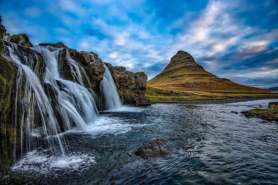
- Kirkjufell and Kirkjufellsfoss
- Grundarfjörður
- Berserkjahraun: the lava field nobody drives
- Bjarnarhöfn: the shark farm question
- Gerðuberg basalt cliffs
- Lóndrangar to Stykkishólmur the slow way
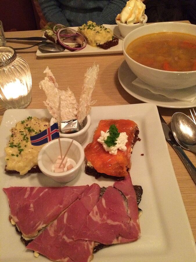
- Eating on the peninsula
- The Stykkishólmur ferry to the Westfjords
- The Helgafell hike
- Snæfellsjökull, Jules Verne, and the strange tourist trail of a 1864 novel
- Winter on the peninsula
- Summer on the peninsula
- The 4WD question and Route 570
- Two days, three days, four days
- What I’d skip
- The seasons in one paragraph
- The thing nobody tells you
What Snæfellsnes actually is
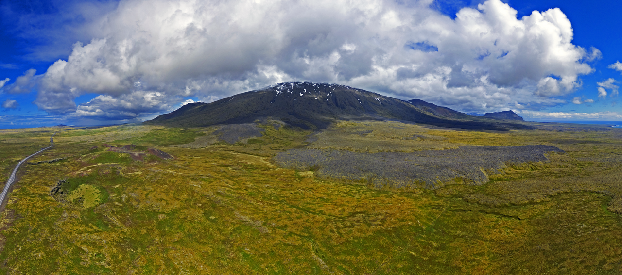
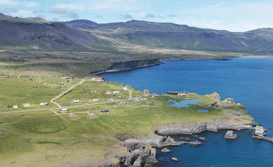
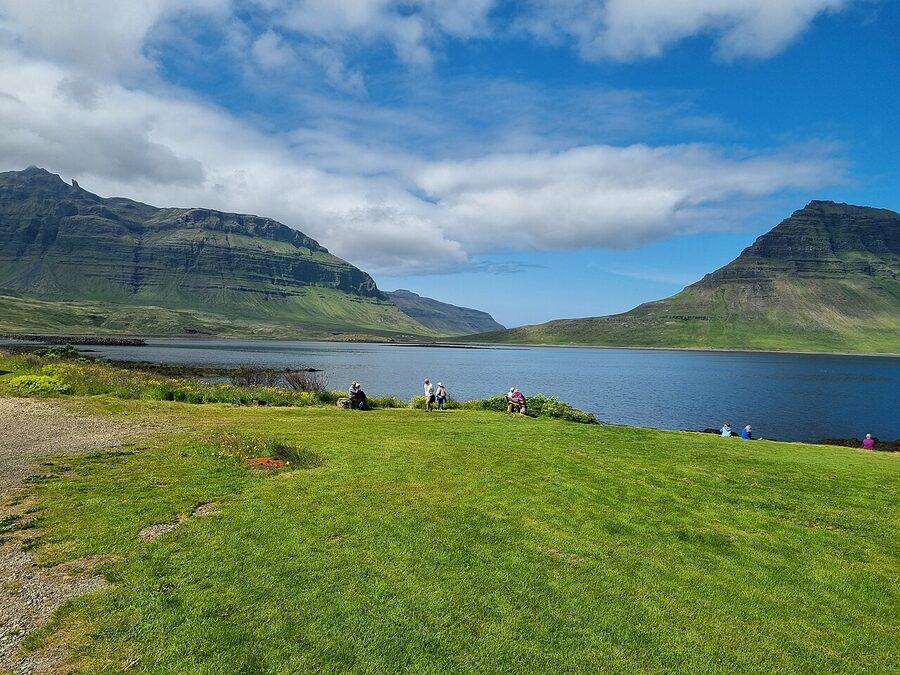
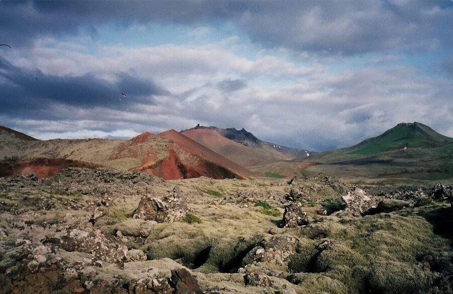
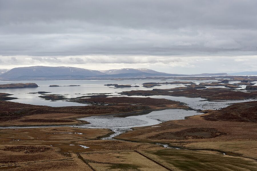
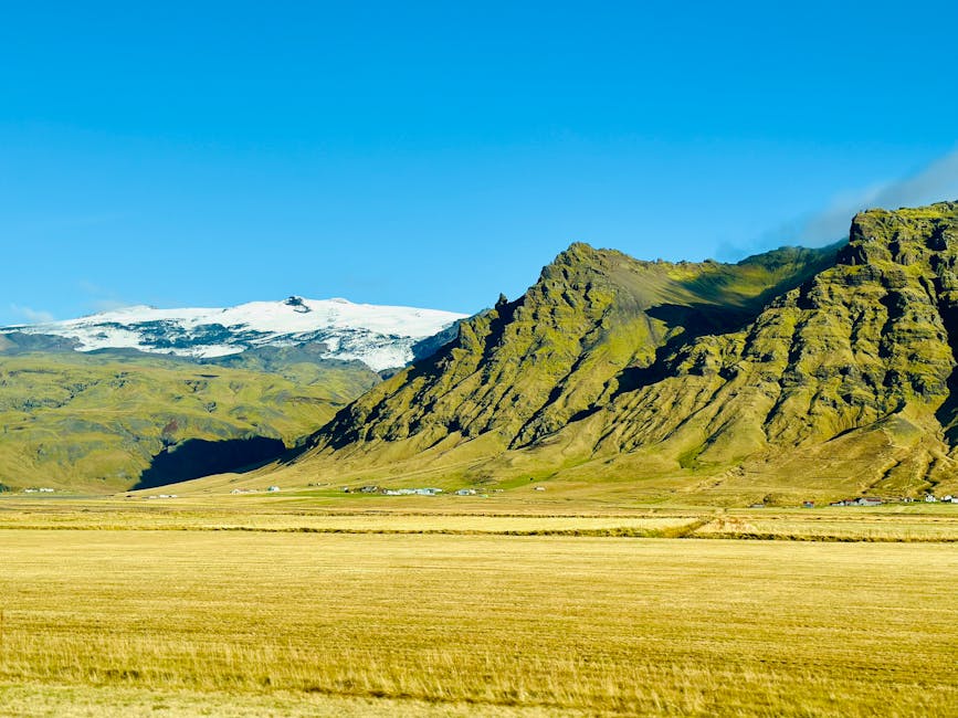
The peninsula is about 90km long and 20km wide, shaped like a finger pointing west into the Atlantic. The mountains run down the spine. The glacier-volcano Snæfellsjökull sits at the tip, 1,446 metres, last erupted around 200 AD, white most of the year. Route 54 (Snæfellsnesvegur) loops the whole peninsula on tarmac. The two main detour roads are Route 574 (Útnesvegur) along the southern western tip, and Route 558 (Berserkjahraunsvegur), the lava-field gravel road most rentals are fine with in summer.
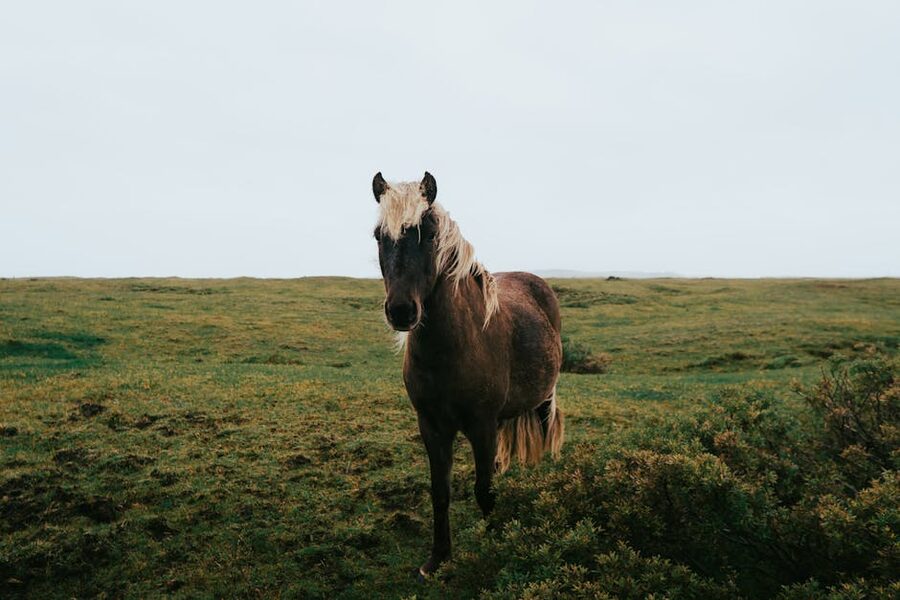
The marketing line is “Iceland in miniature”. For once it’s defensible. You get a glacier-capped volcano, three black-sand beaches, basalt sea-stacks, a basalt cliff that looks like organ pipes, a lava cave, multiple waterfalls, two crater hikes, fishing villages, a famous shark farm, seal beaches, and the kind of empty road where you stop the car for fifteen minutes because there’s a lone Icelandic horse standing in the wind looking philosophical. All of it within a 90-minute drive of itself.
Should you do this instead of the Ring Road?
Honest answer: yes, if you have less than five clear driving days. The Ring Road is 1,332km. With seven days and decent weather you can do it without rushing. With six you’re rushing. With five you’re pretending you’ve seen things that you mostly drove past in the rain. With four, do Snæfellsnes instead and see what you actually came to see.
Snæfellsnes also wins in winter. The Ring Road’s east coast (Höfn, the eastfjords) is genuinely difficult between November and March: weather closes Route 1, there are days you can’t safely cross the open sections, and tour operators cancel. Route 54 around Snæfellsnes is shorter, mostly close to settlements, and gets cleared faster. I’ve driven it in early February in a 2WD and never had to turn back. I would not say the same about the eastfjords.
What you give up by skipping the Ring Road: the south coast (Vík, the black sand at Reynisfjara, Skógafoss, Seljalandsfoss), Jökulsárlón glacier lagoon, and Diamond Beach. If those are non-negotiable, do the Ring Road. If you’ve never been to Iceland, want a representative slice without the bus driving, and have three days, do Snæfellsnes. If you’ve already done the Ring Road once and want to spend more time in fewer places, also do Snæfellsnes. For the longer comparison piece, my Iceland Ring Road 7-day itinerary walks the full version.
Getting there from Reykjavík
From Reykjavík you drive Route 1 north through the Hvalfjörður tunnel and turn off at Borgarnes (about 75km, an hour). From Borgarnes, Route 54 takes you onto the peninsula proper. Total Reykjavík to Stykkishólmur: 175km, give or take 2 hours 15 minutes if you don’t stop, three hours with one petrol-and-coffee stop in Borgarnes. The Geirabakarí bakery in Borgarnes is the obvious stop. The cinnamon rolls are good. Petrol on the peninsula is more expensive than in Borgarnes, so fill up before Route 54. If you’re basing in the capital first, my Reykjavík guide covers the obvious stops there.
From Keflavík airport, add 45 minutes to all of the above. If your flight lands in the morning and you don’t want to sleep in Reykjavík first, drive straight up the peninsula. It’s tiring but doable. If you land at midnight, sleep in Reykjavík, drive up the next morning rested.
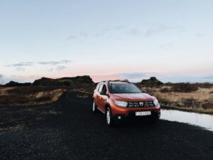
You can do Snæfellsnes by bus combination, but it’s slow and you’ll need a tour or rental once on the peninsula to see anything. I won’t pretend the bus version works. For the rental decision, see my Iceland car rental survival guide; the short version for Snæfellsnes is that a 2WD is fine in summer, a 4WD is more comfortable in winter, and you do not need a “super jeep” unless you’re driving the F575 mountain road below the glacier (which is closed half the year anyway).
Driving the loop the right way round
Here’s the thing about Snæfellsnes that almost no other guide tells you straight: the major photo stops face different directions, so the direction you drive the loop matters. Kirkjufell, on the north coast at Grundarfjörður, faces south-east; the iconic Kirkjufellsfoss-with-Kirkjufell-behind composition wants morning light. Búðakirkja, the famous black church on the south coast, faces north-west; afternoon to evening light is best on the front. Arnarstapi’s cliffs face the open Atlantic to the south and west, so they’re fine any time of day. Lóndrangar’s two basalt towers face roughly north-west, so morning is good for the eastern viewpoint and afternoon for the western.
This is why anti-clockwise (Borgarnes → Stykkishólmur → Grundarfjörður → west tip → Arnarstapi → Búðir → Borgarnes) makes more sense. You arrive on the north coast in the late afternoon of day one, sleep in Stykkishólmur, hit Kirkjufellsfoss before 10am day two while the front face is bright, then chase the loop round the western tip in midday and back along the south coast for the late-afternoon Búðakirkja shot. Clockwise gets you to Kirkjufell at 4pm, when half the mountain is shadow.
If you only have one day on the peninsula and you’re starting from Reykjavík at first light, you can do it clockwise (Borgarnes → Búðir → Arnarstapi → west tip → Grundarfjörður → Stykkishólmur → Borgarnes), reaching Kirkjufell in the late afternoon. Photographically it’s a worse outcome but you save a hotel night.
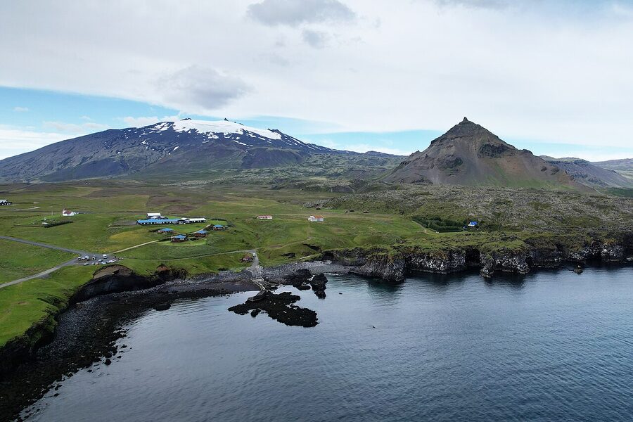
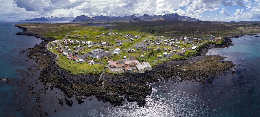
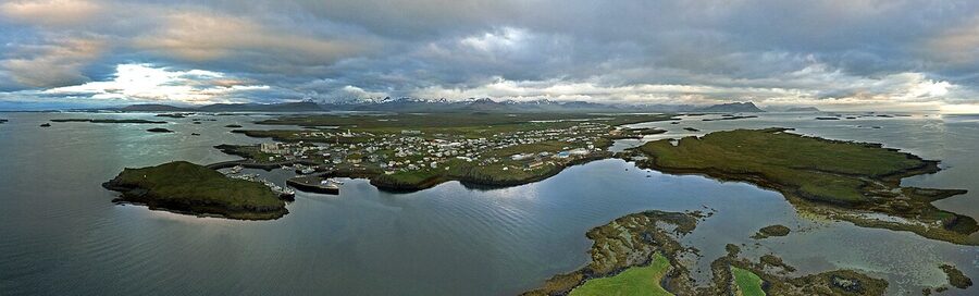
Stykkishólmur: where to base yourself
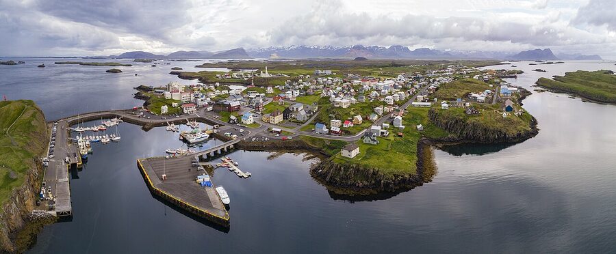
If you’re sleeping one night, sleep in Stykkishólmur. It’s the biggest town on the peninsula (1,200 people), has a working harbour, two real restaurants, a 24-hour petrol station, a supermarket, and the most accommodation choice. It also looks the part: the corrugated-iron houses painted orange, red and mustard, the basalt island in the harbour, the modern Sigurður Guðmundsson church on the hill that you can either love or hate (I’m in the hate camp; it looks like a 1990s curling rink).
Three places I’ve slept here and would again:
Hótel Egilsen, in a restored 1867 timber house at the harbour, 9 rooms, the cosiest in town. Around 24,000 ISK (~€160) in low season, 38,000 ISK (~€255) in summer. Book early. The breakfast is good, the front-desk staff give actually-useful tips, and the rooms are small but Icelandic-cosy in the way that means thick walls and good linen rather than Scandi-shop cushions.
Hótel Fransiskus, a former Franciscan convent on the hill above town, repurposed as a 50-room hotel. It looks austere from outside and is a bit institutional inside. From around 28,000 ISK (~€185). Quiet, parking right outside, breakfast is fine. Take this if Egilsen is full or if you want simple over charm.
Fosshotel Stykkishólmur, the 90-room conference-style hotel above the harbour, panoramic windows, restaurant on site. Functional, never charming, but reliable in winter when the weather closes the smaller places’ kitchens. From around 32,000 ISK (~€215). The view from the top-floor rooms over the harbour is genuinely good.
Two alternatives if you want to stay further round the loop instead.
Hellnar / Arnarstapi (south coast). Fosshotel Hellnar sits at the foot of Snæfellsjökull, around 35,000 ISK (~€235), basic but the location is unbeatable for early-morning glacier light, and they do a hot meal in the evening because there’s nothing else open. Arnarstapi Cottages, around 30,000 ISK (~€200), are small wooden cabins with a shared kitchen, better value if you’re cooking.
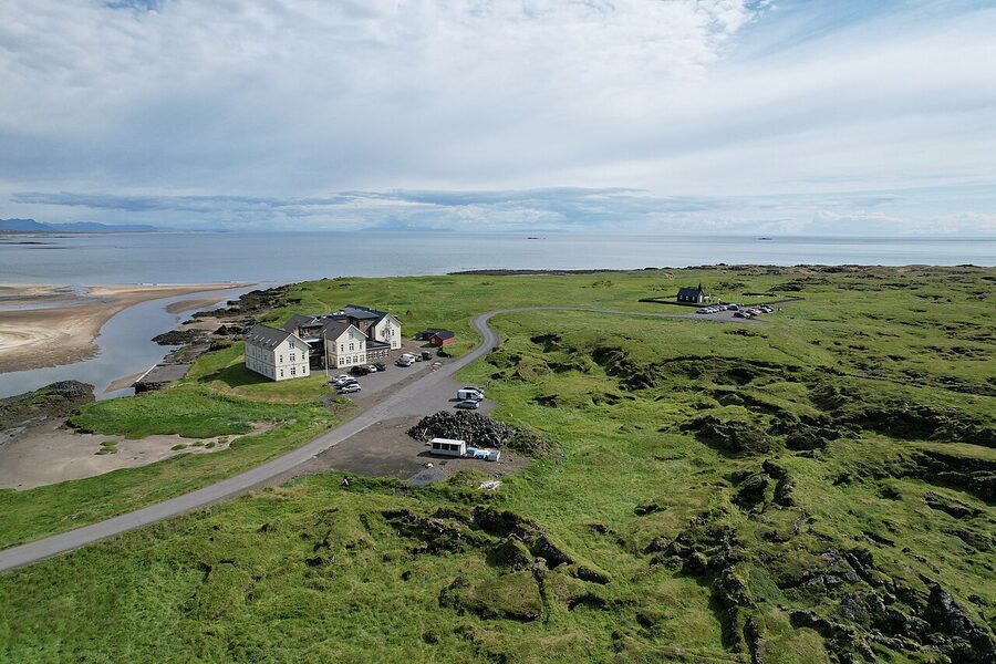
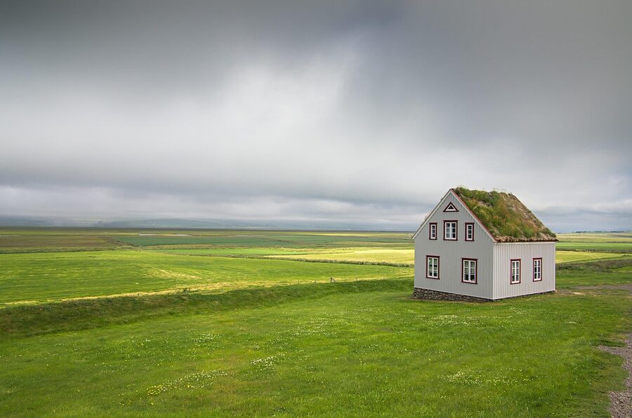
Búðir. Hotel Búðir sits next to the black church in a wide flat lava plain. Easily the most atmospheric place to sleep on the peninsula. Around 45,000 ISK (~€300) in summer, restaurant is properly good (and you’ll need it; nearest alternative is 30km away). Worth doing once.
Stop one: Ytri Tunga seal beach
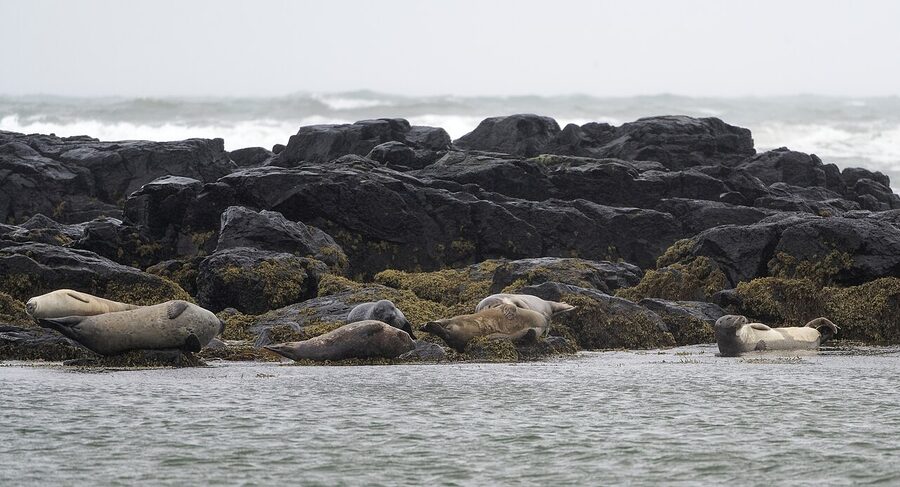
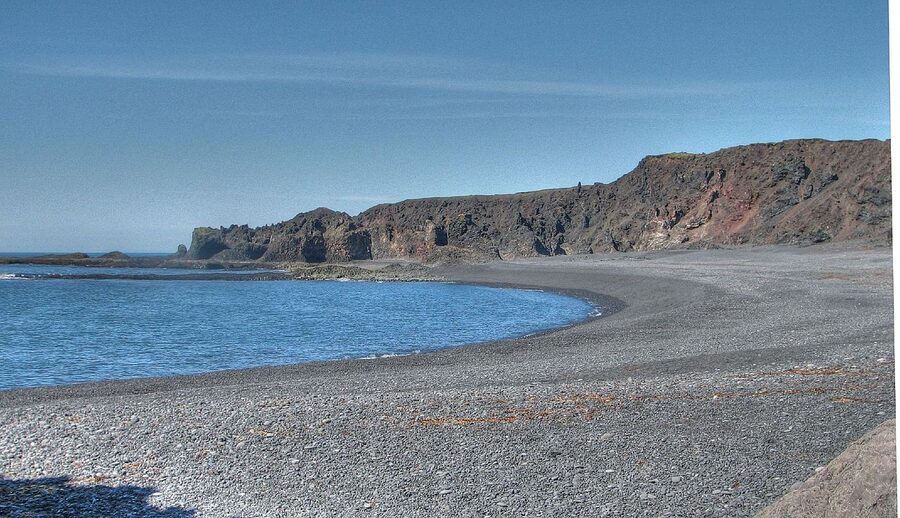
Driving anti-clockwise this is your last stop on day two before you turn for Borgarnes, but for travellers doing the loop clockwise it’s the first proper stop. Either way: Ytri Tunga is a yellow-sand beach (rare for Iceland, where most beaches are black) on the south coast, about 12km west of Búðir, that has a colony of harbour seals on the offshore rocks. They show up most days, more reliably at low tide. The beach itself is pretty in an unflashy way, the sand is genuinely yellowish, an oddity caused by ground shells.
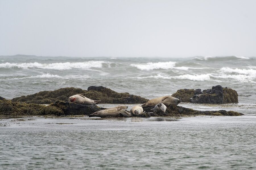
Practical: free, parking right next to the beach, a small toilet block. 30 minutes is enough. Wind off the Atlantic is fierce, wear what you’d wear in a Scottish winter even if it’s July.
Búðakirkja, the black church
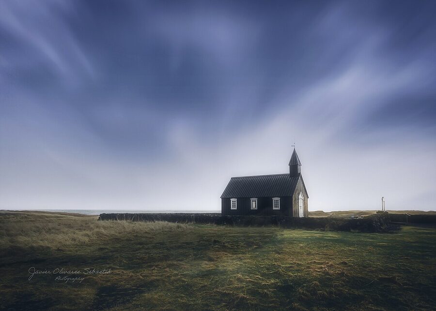
The black church at Búðir is the single most photographed building on the peninsula. There’s a reason. It sits alone in a wide, flat coastal lava plain with the sea at its back and the mountains rising behind. The cemetery wall in the foreground, low and lichen-stained, gives every photograph the same composition. It is almost too easy. Whatever you take here will look like the picture you’ve already seen on Instagram, which is part of the problem.
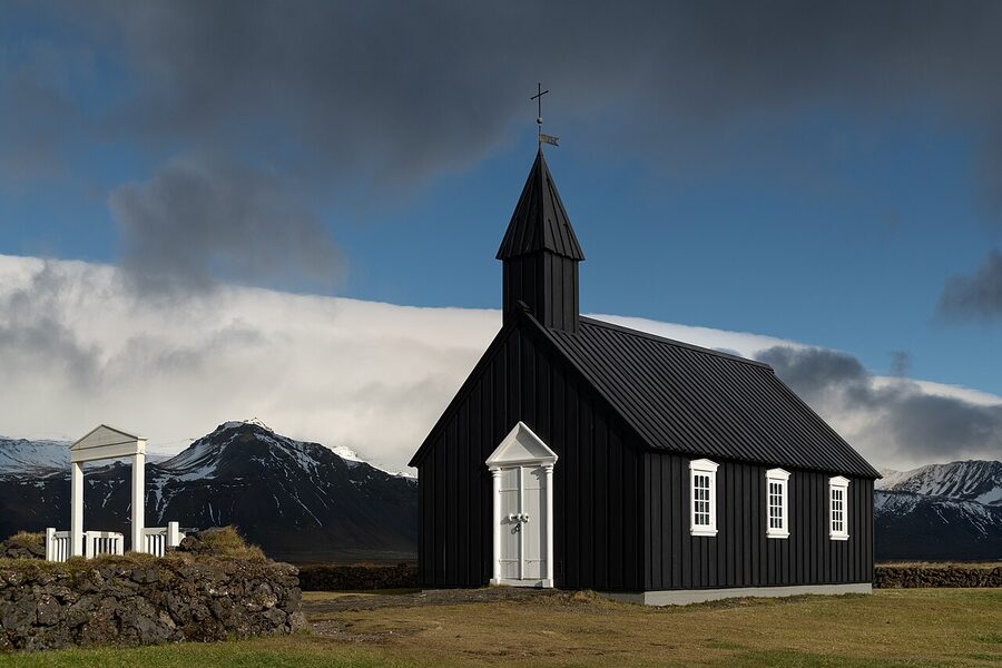
The church is locked outside services. You can’t go in unless there’s a wedding or a funeral. The cemetery is open, the path round the church is open, and the lava field around it is fine to walk on so long as you stay on the trodden tracks (the moss is hundreds of years old and never grows back if you crush it). Free, always accessible, parking on the gravel at the junction with Route 54.
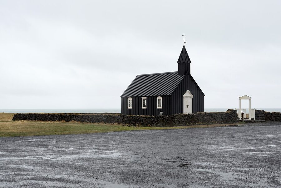
Time it for late afternoon if you can. The church faces north-west, so the front is in soft side-light from about 4pm in summer through to sunset. In winter the same window is roughly 1 to 3pm, the whole day’s brief brightness. Mid-morning, the front is in flat shadow.
Arnarstapi and the basalt arch
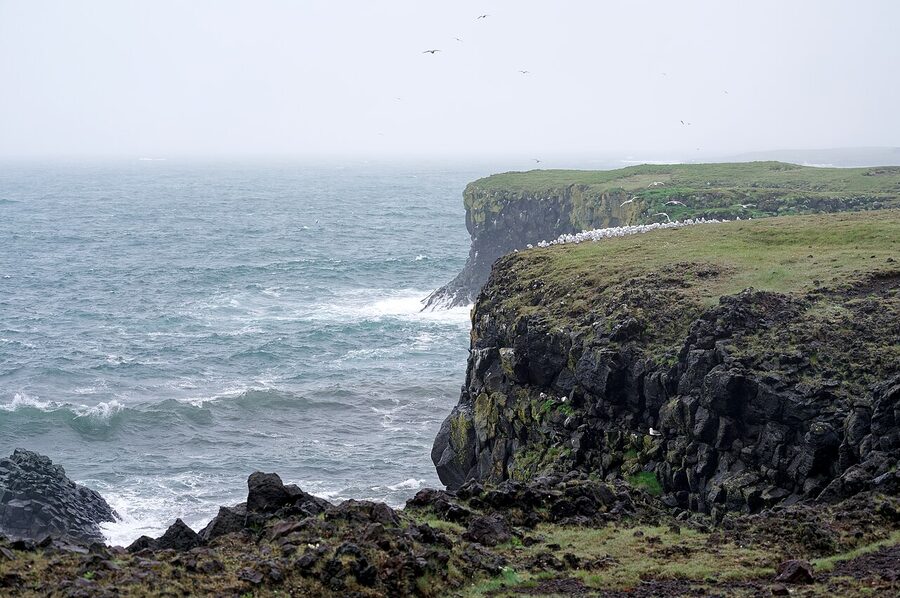
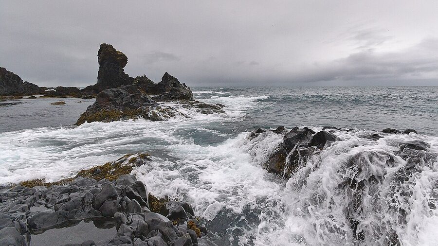
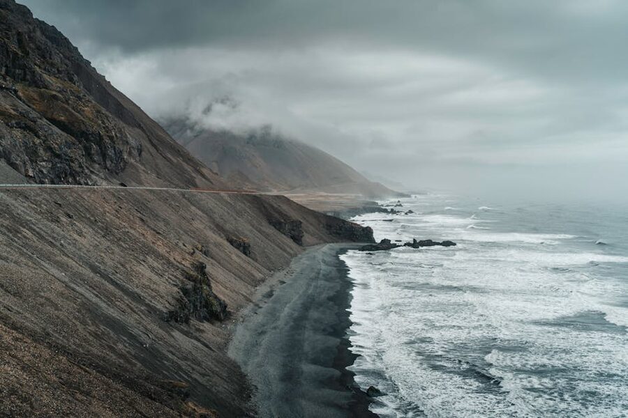
Arnarstapi is a one-row fishing hamlet on the southern coast of the peninsula. There’s a campsite, two restaurants, a small harbour, and a 2.5km cliff path that walks east along the coast to Hellnar (or back, depending which way you’re going). The path is the reason to come. It runs along basalt sea-cliffs cut and shaped by the Atlantic, with a famous natural arch (Gatklettur) at one point and bird colonies (puffins, fulmars, kittiwakes) breeding in the columns.
The full Arnarstapi-to-Hellnar walk takes about an hour each way, two if you stop to watch birds. You can also walk it half-way and turn back. The path is well-marked but unfenced, and the cliffs drop sheer in places. In strong wind, don’t take small kids past the arch. In winter the path can be ice-glazed; bring proper grip soles.
Eat at Sjávarpakkhúsið in Stykkishólmur (more on that below) rather than the Arnarstapi options if you can plan the day that way; the seafood here at Arnarstapi is fine but pricier than what you get for the same money in Stykkishólmur. There’s a paid car park at Arnarstapi (around 800 ISK / ~€5.50, by SMS or app). Pay it; the wardens do check.
Hellnar and the walk back the other way
If you’re doing the cliff walk, do it Hellnar → Arnarstapi rather than the more popular reverse. The view of the Snæfellsjökull glacier opens up as you approach Arnarstapi, walking in the direction of the cliff statue, and the cafés and restaurants are at the Arnarstapi end so you have something to walk to. Park at Hellnar (free, often empty), walk one hour, eat lunch, taxi or hitch back to your car, or walk the second hour back if you have it in you.
Hellnar’s Fjöruhúsið café (open May to September only) sits on the rocks below the village, in what used to be a fishing hut. Soup of the day, fish stew, dense rye bread. It’s properly local and properly small, eight tables, so on a busy summer day you queue. In winter it’s shut.
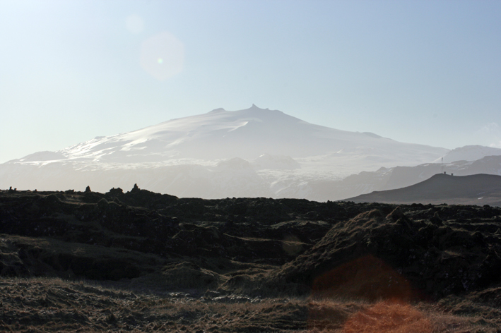
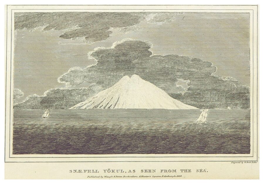
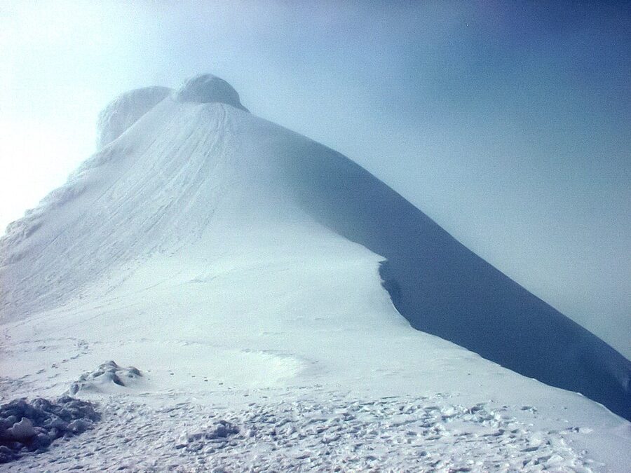
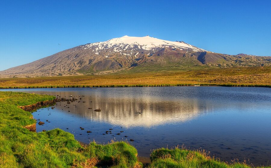
Snæfellsjökull and Vatnshellir cave
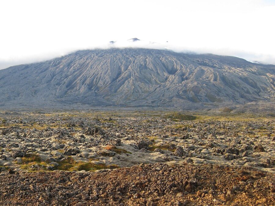
Snæfellsjökull is the volcano under the glacier at the western tip of the peninsula. 1,446 metres. Last erupted about 200 AD. White most of the year. The glacier sits inside the volcano’s caldera and gives the mountain its iconic shape, a rounded white dome with two horns, visible from Reykjavík on a clear day across the bay. If a hot soak at the end of the day is on your list, the cheaper alternative to the lagoon-tourist traps is the local geothermal pool culture, covered in my Iceland public pools guide; for the lagoon decision itself see Blue Lagoon vs Sky Lagoon.
To climb the glacier you need a guided tour (six to seven hours, around 30,000 ISK / ~€200, runs from Arnarstapi spring through autumn). It’s not technical alpine but it’s not a stroll, you’ll be in crampons and roped, and you should have a level of fitness above casual hiker. Most people don’t climb. Most people drive Route 574 round the western tip and stop at Vatnshellir.
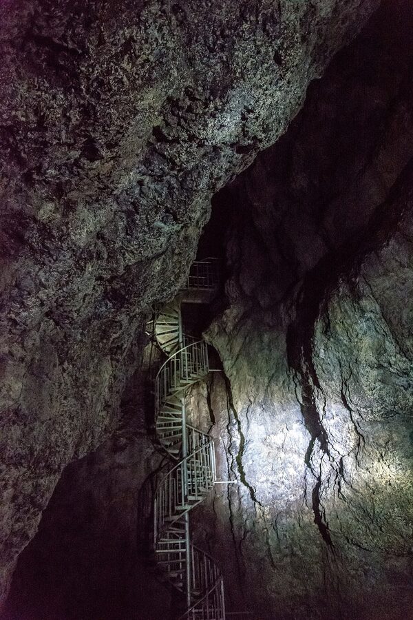
Vatnshellir is an 8,000-year-old lava tube about 200 metres long, accessed by a guided tour run by Summit Adventure Guides on behalf of the national park. The tour is 45 minutes, 5,500 ISK (~€37) for adults, 2,750 ISK for children, helmets and torches included, runs hourly from 10am to 6pm in summer. They take roughly 15 people per tour and they sell out by midday in July and August. Book online a few days ahead in summer. Walking-up in low season is fine.
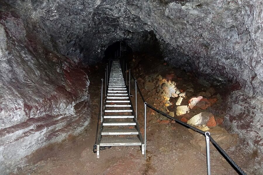
Verdict: worth it once if you’ve never been in a lava tube. Skip it if you’ve already done one (the much larger Raufarhólshellir near Reykjavík, or Þríhnúkagígur). Vatnshellir is dry, well-lit-by-headlamp, and the staircase makes it accessible for most adults. Children under 5 don’t usually do well with the descent.
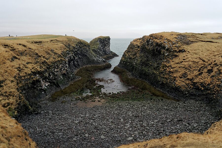
Djúpalónssandur, the black-pebble beach
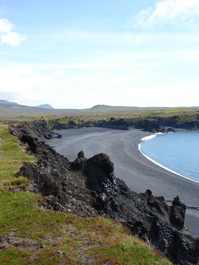
Djúpalónssandur is the dramatic-looking black-pebble beach inside Snæfellsjökull National Park. The pebbles are the photogenic part. They’re round, black, polished by surf, and the size of cherries; they fill the beach in tens of thousands. Walk the cove, look at the four “lifting stones” the local fishermen used to test their strength (Fullsterkur, “Full strong”, 154kg; Hálfsterkur, 100kg; Hálfdrættingur, 54kg; Amlóði, “weakling”, 23kg). You’re invited to try lifting them; almost nobody manages the heaviest.
From the car park it’s a 10-minute walk down a stepped path to the beach. The walk back up is the gym session. There’s no café, no toilet at the beach itself (the toilet is at the car park). Around 30 to 45 minutes does it.
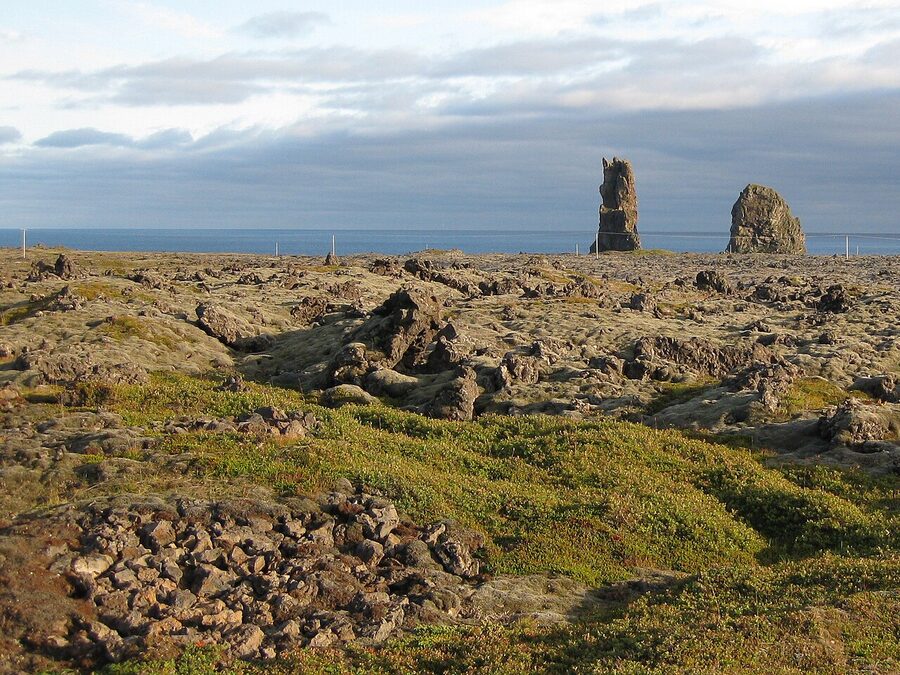
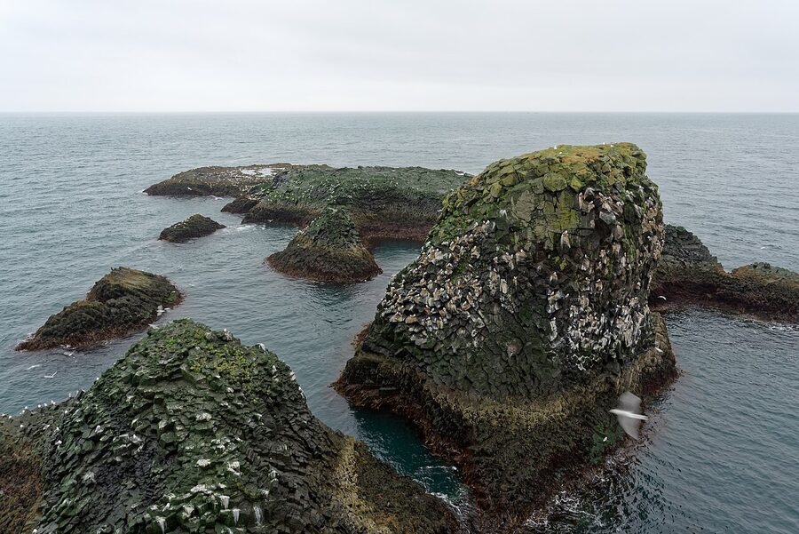
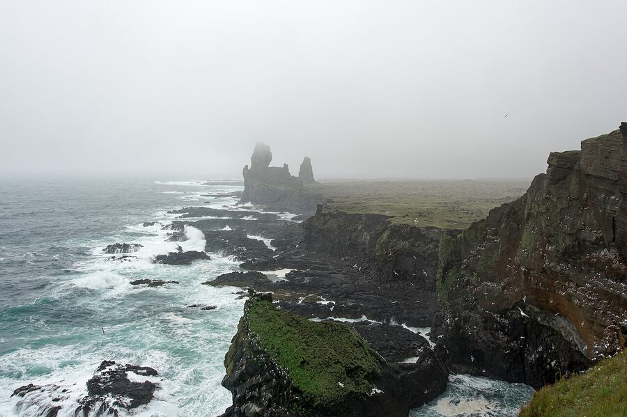
Lóndrangar and Saxhóll: the western tip stops
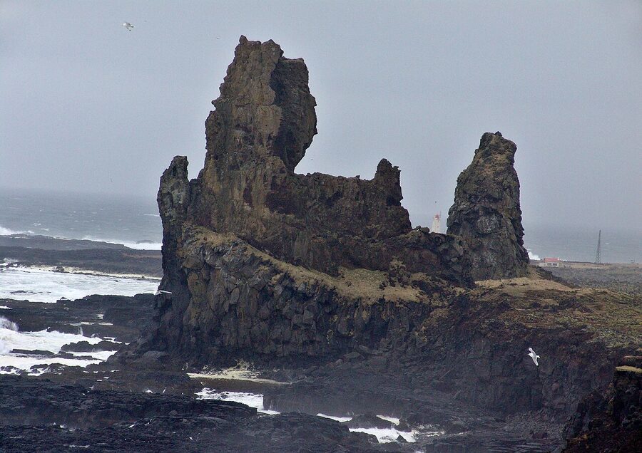
Lóndrangar is a pair of basalt sea-stacks just east of Malarrif on the south coast of the western tip. There are two viewpoints, a higher one on the east accessed by a 5-minute walk from a roadside car park, and a lower one to the west reached from Malarrif. The eastern viewpoint is better in the morning, the western in the afternoon. Bring a coat regardless; the wind here is the worst on the peninsula.
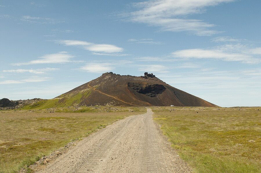
Saxhóll is a 100-metre red volcanic crater off Route 574, accessible by a maintained metal staircase to the rim. The staircase has 396 steps. The view from the top is one of the best on the peninsula because it’s the only stop along the loop where you stand above the lava field rather than driving through it. 15 minutes up, 5 minutes round the rim, 10 down. Free, parking right at the base.
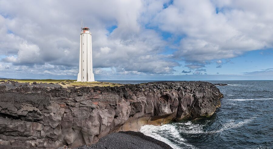
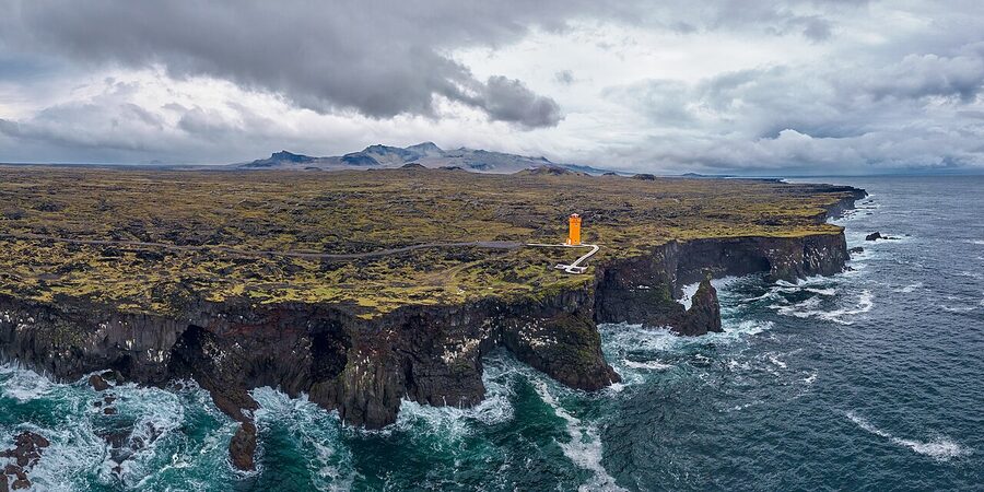
Svörtuloft is the orange-painted lighthouse at the western tip itself, 10km north of Saxhóll. Most people don’t drive out here. The road in (Route 579) is gravel and rough but passable in a 2WD in summer. From the lighthouse you walk five minutes to a clifftop view that’s one of the most isolated on the loop. I’ve stood up here in mid-June with no one in sight in any direction.
Hellissandur and Ólafsvík
Two small fishing towns on the north-western corner: Hellissandur (population 400) and Ólafsvík (population 1,000). Most travellers drive through both. They’re worth a slow walk-around if you have time. Hellissandur has the open-air Sjómannagarður maritime museum (free to walk through, the old boats and salt-houses are outside year-round; the indoor exhibit, 1,500 ISK / ~€10, is summer-only). Ólafsvík has petrol, the Hraun bistro for soup, and a working harbour where you can usually watch boats unloading.
Whale-watching from Ólafsvík (boats run by Láki Tours, around 11,500 ISK / ~€78, 3 hours, March to October) is the best chance on the peninsula to see orcas in late winter and early spring; sperm whales appear in summer. They’ve a strong sighting rate, but it’s not guaranteed. The boats are smaller than the Reykjavík ones, the crews more genuinely fishing-based, and the trip feels less like an industry. If you’re choosing between the Reykjavík option and this one, this one.
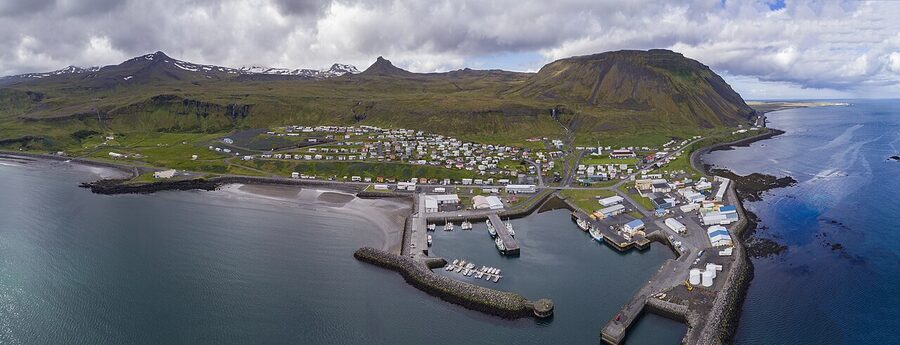
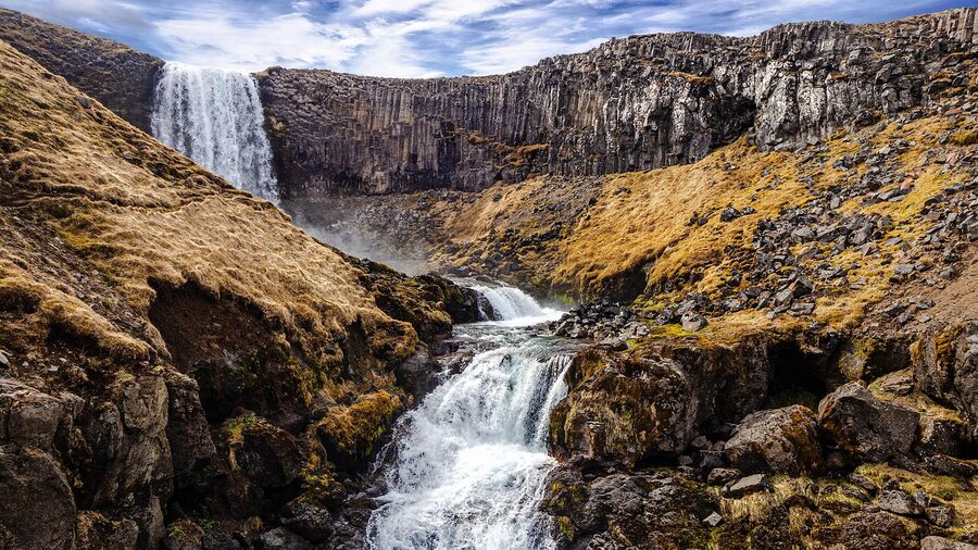
Kirkjufell and Kirkjufellsfoss
Kirkjufell is the steep-sided cone of a mountain on the north coast at Grundarfjörður, 463m, the most photographed mountain in Iceland and the second most photographed (after Sólheimajökull) in any guide. Game of Thrones shot it in season seven as the “arrowhead mountain”, which has not helped the queueing. Kirkjufellsfoss, the small triple waterfall in front of it, is what makes the photo work. The composition only goes one way.
The car park at Kirkjufellsfoss has a fee, about 1,000 ISK (~€7) for a few hours, by SMS or app. Pay it. The cameras catch the freeloaders and rentals get charged. The waterfall has two viewpoints: the lower one ten metres from the road, where everyone takes the photo from the same spot; and the upper one, a five-minute walk uphill round the back, which gives you the same composition with no people in the foreground. Take the upper one.
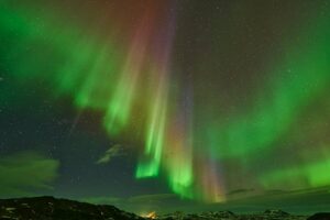
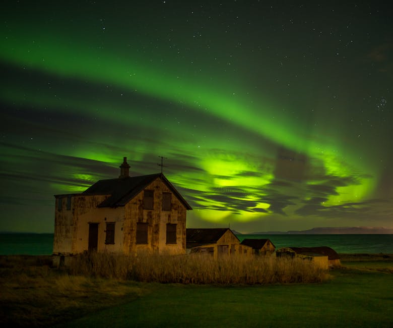
Photographer’s verdict: morning before 10am is the only time the front face of Kirkjufell is properly lit. Aurora season (late September to mid-March) the mountain is a popular foreground because Kirkjufellsfoss faces north-east, the right direction for the lights. If you have one good cloudless winter night, this is the place. For the wider winter aurora discussion see my northern lights in Iceland piece.
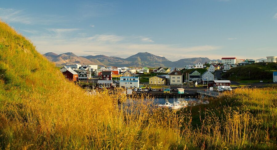
Grundarfjörður
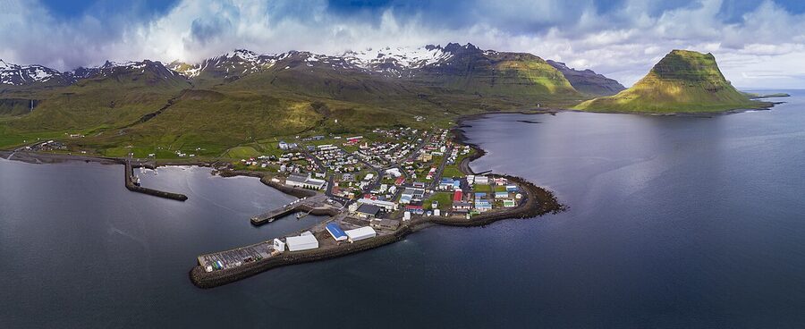
Grundarfjörður (population 850) is the working town below Kirkjufell. There’s nothing showy here. Petrol, supermarket (Samkaup, smaller selection than Bónus but adequate), a bakery, two restaurants. The reason to stop is dinner at Bjargarsteinn Mathús, a small wooden house on the harbour with one of the best fish menus on the peninsula. Cod, langoustine, lamb. Around 6,500 ISK (~€44) for a main, 12,500 ISK (~€85) for the three-course set menu. Reservations are essential; turn up without one and you’re not eating. They open at 5pm. They close in winter for parts of February.
If you want to sleep here for the morning Kirkjufell shot rather than driving in from Stykkishólmur, Kirkjufell Hotel by Snæfellsnes Peninsula West Iceland (the awkward new name; locals still call it Hotel Framnes) is the obvious choice. Around 30,000 ISK (~€200) in summer, half that in winter. Some rooms face the mountain.
Berserkjahraun: the lava field nobody drives
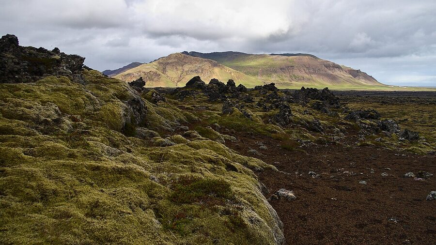
Between Stykkishólmur and Grundarfjörður you have a choice: stay on Route 54, the paved main road, or turn off onto Route 558 (Berserkjahraunsvegur), the gravel detour through the lava field. Route 558 is 8km, takes 15 minutes, and is one of the more scenic short drives on the peninsula. It’s open in summer (typically June through October), gets snow-blocked in winter. Most rentals are fine on it; check your contract for gravel-road clauses.
Practical: pull over at any of the wide gravel spots, walk five steps onto the lava, look around, get back in. Don’t walk on the moss; the woolly fringe-moss that covers the older lava is hundreds of years old, takes another hundred to grow back where boots compress it, and is the single most damaged thing in Iceland because of casual photo stops.
Bjarnarhöfn: the shark farm question
Hákarl is fermented Greenland shark, the local cured meat that survives because the fresh shark is toxic and the curing is the only way to make it edible. The Bjarnarhöfn farm is the most famous producer in Iceland. They run a small museum and tasting on the farm itself, just off Route 54 about 20km north-west of Stykkishólmur, 1,800 ISK (~€12), 30 to 45 minutes, includes a piece of hákarl, a shot of brennivín (“the black death” caraway schnapps), and a guided talk through the curing sheds.
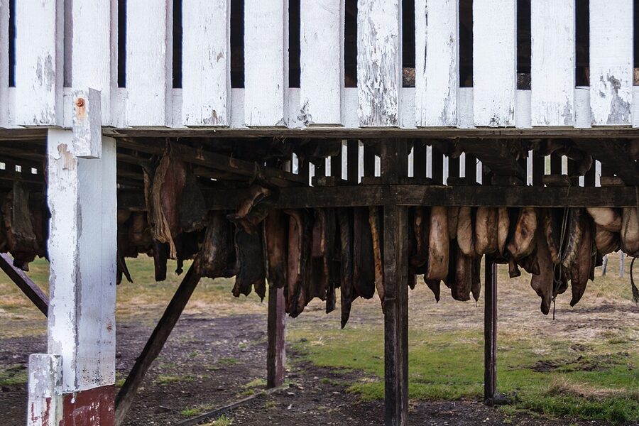
Verdict: go if you’re curious about the food culture and have never tasted hákarl. The farm is genuine, family-run, the curing sheds are real, and the explanation is worth more than the cube of shark. If you’ve already tried hákarl in a Reykjavík bar (it’s on every “tasting platter” in town) you can skip Bjarnarhöfn. The little turf-roofed church next door is two minutes and free; stop for that even if you skip the museum.
Gerðuberg basalt cliffs
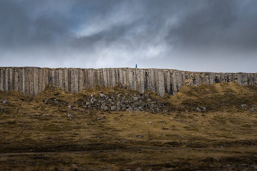
Gerðuberg is a 500-metre wall of hexagonal basalt columns on the south side of the peninsula’s neck, the eastern entrance, in effect, before you commit to the loop. Most travellers stop here on the way in or out. It’s a 10-minute walk along the base of the columns from the small gravel car park, and a steeper 20-minute scramble to walk up onto the top.
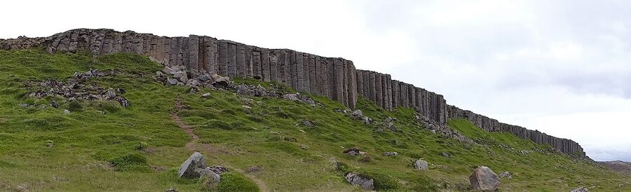
Honest verdict: Gerðuberg is fine but not a highlight. The Reynisfjara basalt steps on the south coast are more dramatic; Hallgrímskirkja’s facade in Reykjavík is the same geometry, polished. If you’re tight on time, skip it. If you’ve got an hour and you’re driving past anyway, ten minutes here costs nothing and the columns are genuine.
Lóndrangar to Stykkishólmur the slow way
If you’re driving the loop in two days, the comfortable cadence is: day one, leave Reykjavík by 10am, arrive Borgarnes for coffee at 11, Gerðuberg at 12:30, Ytri Tunga around 1:30, Búðakirkja in the afternoon, Arnarstapi cliff walk by late afternoon, sleep at Hellnar or Búðir. Day two, drive west via Hellnar → Lóndrangar → Vatnshellir → Saxhóll → Svörtuloft → Hellissandur → Ólafsvík → Grundarfjörður (lunch) → Kirkjufell → Berserkjahraun → Stykkishólmur for the night, or skip the night and head back to Reykjavík via Bjarnarhöfn.
That’s the loop the way I’d do it for someone who hasn’t done it before. If you’ve done it before, do it the other way round and stop at the things you missed.
Eating on the peninsula
You eat in the towns. Out on the loop there’s almost nothing. The list, north to south:
Stykkishólmur: Sjávarpakkhúsið on the harbour is the standout. Seafood-led, smaller plates 3,500 to 5,500 ISK (~€24-37), mains around 6,000 ISK (~€41). The langoustine soup is the order. Reservations needed in summer. Open year round. Narfeyrarstofa, in a 1906 timber house on the harbour square, is the slightly fancier alternative, set menus around 11,000 ISK (~€75). Both close in February for a couple of weeks.
Grundarfjörður: Bjargarsteinn Mathús, mentioned above. The other option in town is Bjorgvin Bistro at the Kirkjufell Hotel, less interesting but reliable.
Ólafsvík: Hraun is the soup-and-fish-cake stop. Fast, cheap by Iceland standards, around 2,800 ISK (~€19) for soup and bread.
Arnarstapi: Arnarbær on the harbour is the main option, lamb and fish, 5,500 ISK (~€37) mains. Open lunch and dinner.
Hellnar: Fjöruhúsið café is the soup-and-coffee stop on the cliff path, May to September only, around 2,500 ISK (~€17) for soup. Lovely setting, eight tables, queues in summer.
Búðir: Hotel Búðir’s restaurant is the destination meal on the south coast. Three courses around 13,000 ISK (~€90), no menu surprises but everything’s done well. The dining room looks at the church through plate glass; book a window table for sunset.
If you’re doing this on a budget, the supermarket play is Bónus in Borgarnes (cheapest in west Iceland), filled-bread breakfast, supermarket dinner, one good restaurant lunch in Stykkishólmur or Grundarfjörður. For the longer money discussion see my piece on what Iceland actually costs.
The Stykkishólmur ferry to the Westfjords
If you’re chaining Snæfellsnes onto a Westfjords trip, the smartest combo most people don’t try, the Baldur car ferry from Stykkishólmur saves you the long northern road around. 2 hours 45 minutes to Brjánslækur, runs twice a day in summer (about 6,000 ISK / ~€40 per adult passenger, 10,500 ISK / ~€71 per car). The crossing is across Breiðafjörður, the bay that holds the country’s biggest archipelago. There’s a stop at Flatey island in summer, a single-village place with no cars, where the boat pauses for ten minutes and a few passengers get on or off.
Book ahead in summer; the ferry sells out the morning slot most days. Book at saeferdir.is. In winter the schedule drops and the crossing is genuinely rough; sometimes cancelled.
The Helgafell hike
If you’ve got an extra hour in Stykkishólmur, do Helgafell. It’s a 73-metre hill 5km south of town with a well-trodden 15-minute trail to the top. The local tradition: walk up without speaking, without looking back, and at the top face east and make three wishes, they’ll come true if your conduct was right. The hill is in Laxdæla saga, one of the major medieval Icelandic sagas, as the hill of Guðrún Ósvífursdóttir. Whether you buy the wish ritual or not, the view across the islands of Breiðafjörður is one of the best in the area.
Park at the marked Helgafell farm, walk past the small church (the original was built in 1184; the current one is 19th century), follow the path. Free, always open, no facilities at the trailhead.
Snæfellsjökull, Jules Verne, and the strange tourist trail of a 1864 novel
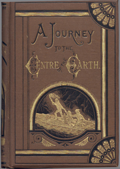
One short historical aside, because it explains why Snæfellsjökull is the volcano people in mainland Europe have heard of and Hekla is the one Icelanders talk about. In 1864, Jules Verne published Voyage au centre de la Terre (“A Journey to the Centre of the Earth”), in which a German professor and his nephew descend into the crater of Snæfellsjökull and find a hollow earth. The novel sold widely; it was filmed (the 1959 James Mason version is the famous one); it is, even now, the reason a percentage of foreign visitors to Iceland have heard the volcano’s name before they read about it in a guidebook.
The peninsula doesn’t trade hard on Verne. There’s no themed museum, no descent re-enactment, no costumed character. The Vatnshellir cave tour will mention the novel briefly. The Snæfellsjökull glacier-hike guides will sometimes joke about it. Mostly it sits in the background as a piece of cultural cachet that brought a particular kind of literary tourist here a hundred years before Game of Thrones brought another kind to Kirkjufell. The peninsula has been doing this longer than most.
Winter on the peninsula
The peninsula is doable in winter, with caveats. Route 54 is the main road and gets cleared. The detours (Route 558 through Berserkjahraun, Route 579 to Svörtuloft, the upper part of Route 570) are seasonal closures and may be impassable. Vatnshellir cave runs winter tours (check website; sometimes cancelled in heavy weather). The Arnarstapi cliff path is open but icy; bring grip soles. Hotels, restaurants and museums all reduce hours from late October to March; some close entirely between January and February.
The morning Kirkjufell shot in winter snow is one of the great Iceland photographs and the only thing you give up driving the loop in shoulder season is a few of the optional detours. November to early March is also aurora season and Snæfellsnes light pollution is among the lowest of any easily-accessible part of Iceland.
The check-this-every-morning rule for winter driving in Iceland: umferdin.is for road conditions, vedur.is for weather warnings. If a yellow or orange wind warning is up for the area, don’t be the person who tries to outrun it. The wind in west Iceland flips cars; people die in this every couple of years.
Summer on the peninsula

Summer is when most people come and the loop handles it easily, there are no choke points outside Kirkjufellsfoss car park. June and July add the midnight sun, which on Snæfellsnes means useful daylight from about 3am to 11pm. If you’ve got a flexible schedule, drive the western tip between 9pm and midnight; the light is gold, the tour buses have gone, and Lóndrangar in late evening is a different photograph from the one everyone takes at 2pm.
What summer’s busy with: Kirkjufellsfoss between 11am and 4pm (queues for the lower viewpoint), the Vatnshellir cave (book ahead), the Búðakirkja parking. What summer’s still quiet on: Berserkjahraun, Svörtuloft, the Helgafell hike, Hellissandur’s open-air museum, and the entire western tip after 8pm. Snæfellsnes does not get Reykjanes Peninsula or Golden Circle levels of crowd. It’s busy, not packed.
The 4WD question and Route 570
You see this question a lot in trip planners: “do I need a 4WD for Snæfellsnes?” The answer depends on whether you want to drive Route 570 (Jökulshálsvegur), the steep gravel mountain road that climbs up onto the flank of Snæfellsjökull from the south. It’s open July to September only, sometimes shorter. It’s an F-road in everything but designation; the Icelandic regulator hasn’t classified it F because there’s no river crossing, but it’s narrow, gravel, steep, and rough enough that 2WD rentals are usually banned by their contracts.
If you don’t drive 570, a 2WD is fine for the entire peninsula loop in summer. Route 54 is paved. Route 574 is paved. Route 558 (Berserkjahraun) is gravel but flat and easy. The road to Svörtuloft (Route 579) is gravel but rideable in 2WD with care. In winter a 4WD is more comfortable but Route 54 is the only road most travellers actually need, and it’s plowed.
Two days, three days, four days
One day from Reykjavík: leave 7am, drive direct to Kirkjufellsfoss for the morning shot, then anti-clockwise round the western tip via Vatnshellir, Lóndrangar, Saxhóll, Arnarstapi cliff walk, Búðakirkja, back to Reykjavík by 8pm. You see the highlights, miss the slow stops, and skip Stykkishólmur and Helgafell. Doable but tiring.
Two days, one night: arrive Stykkishólmur late afternoon day one (Gerðuberg + Ytri Tunga + Búðakirkja en route), do the loop day two, sleep in Reykjavík or fly out next morning. This is the comfortable minimum.
Three days, two nights: night one in Stykkishólmur, night two in Hellnar or Búðir. Slower pace, second-day glacier hike if you want it, time for Helgafell and the Helgafell saga walk. This is what I’d recommend most travellers actually do.
Four days plus: chain it onto a Westfjords trip via the Stykkishólmur ferry, or chain onto the Golden Circle via Borgarnes → Þingvellir. If you’re picking between this and the south-coast Westman Islands hop, see my Westman Islands guide; the two are different trips on different ferries and choosing well is half the planning.
What I’d skip
Snæfellsnes does have some greatest-hits stops that consistently underdeliver. In my opinion, in honest reverse order:
- Rauðfeldsgjá gorge. The hike into the gorge is short, slippery, and queues in summer. Wet feet, claustrophobic, and the payoff (a tiny waterfall in a slot you can’t really see properly) doesn’t justify it. Skip unless you’re a canyoneering enthusiast.
- Lýsuhóll hot spring. The only paid pool on the peninsula and the algae-floor is a feature most travellers don’t expect. Fine if you’re staying nearby and want a swim; not worth a detour.
- Eldborg crater. A real volcanic crater you can hike round in two hours. The hike is good if you like hikes; the actual crater is not visually exceptional. If Saxhóll’s already on your day, skip Eldborg.
- The Snæfellsjökull glacier hike, unless the weather is genuinely clear. 30,000 ISK (~€200) for six hours is a lot of money to walk on a cloudy snowfield. I’ve seen it called off three times for fog when the booking would have happily charged anyway. Worth doing only if the morning forecast is good.
The seasons in one paragraph
May and September are the best compromise. Daylight is long, prices are off-peak, the tour buses are few. June and July add midnight sun and the puffin colonies but lose you the aurora and double the room rates. October and February both work for aurora hunting if you’ve got luck with weather. November to mid-January are short days (light from 11am to 3pm in deep December) and the only window I’d hesitate to recommend the peninsula in. March and April are the underrated months, long days return, snow still hangs on the peaks, prices haven’t yet climbed.
The thing nobody tells you
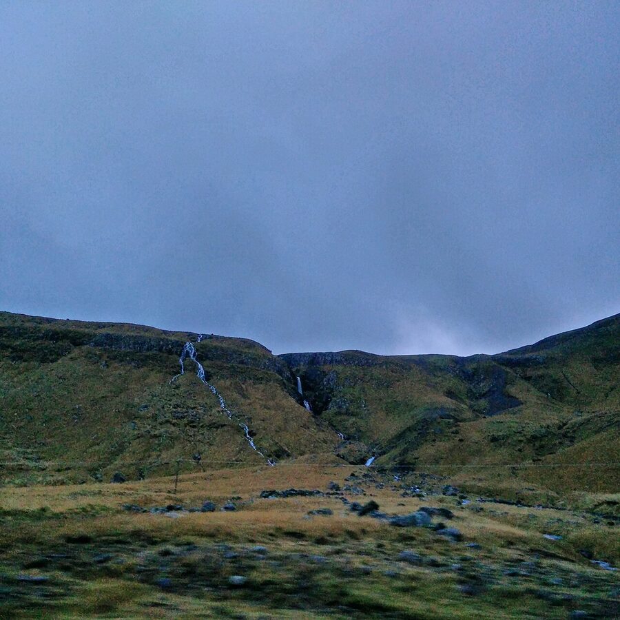
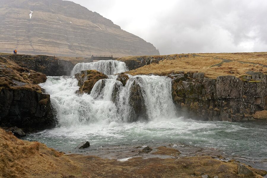
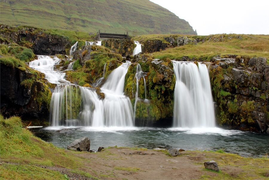
The good stuff on Snæfellsnes isn’t on the list. It’s the drive between things. Route 54 from Búðir north to Stykkishólmur runs along the south coast of Breiðafjörður with the islands in front of you and the mountains rising on your left. There are unnamed waterfalls every few kilometres. There are pull-ins where nobody stops because the next stop is “famous” and worth the wait. The first time I drove the loop I made the mistake of trying to get every named photograph. The second time I learned to pull over more, look at the things between things, get out, walk five minutes, get back in. That’s the right way to do this. The named stops are good. The road between them is better.
Drive anti-clockwise. Sleep in Stykkishólmur. Eat at Sjávarpakkhúsið. Take the upper viewpoint at Kirkjufellsfoss. Walk the cliff path Hellnar to Arnarstapi the right way. Skip Bjarnarhöfn if you’ve already had hákarl. And put the camera down for half the day. The peninsula isn’t actually a list of stops. It’s the road that connects them.