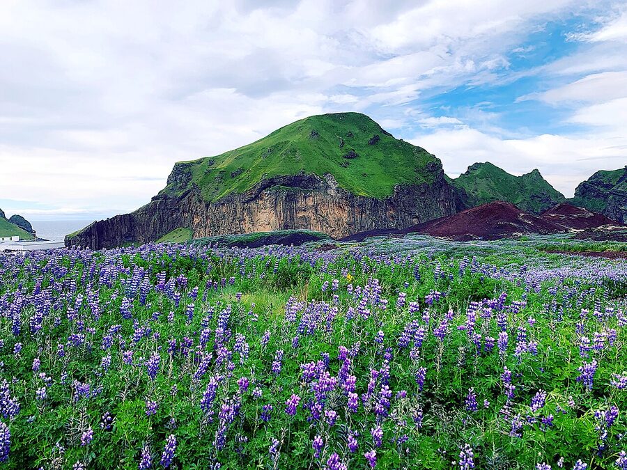
On the night of 23 January 1973, a 1.6-kilometre fissure opened on Heimaey’s eastern flank, half a kilometre from the edge of town. The fishing fleet was, by accident, all in port. By dawn the entire population of around 5,300 had been ferried across to the mainland. They came back five months later and pumped seawater on the advancing lava for nearly half a year to save the harbour, the only thing the island’s economy was built on. They saved it. They also lost about 400 houses, gained a 200-metre volcano, and watched their island grow by a fifth. That is the story Heimaey is still built on, fifty-three years later, and you can walk through some of the houses they pulled out of the ash.
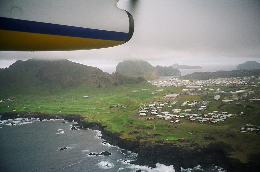
The Westman Islands, Vestmannaeyjar in Icelandic, are a 15-island archipelago about 10 kilometres off Iceland’s south coast. Only one of the islands, Heimaey, is inhabited, with a population a touch over 4,300. From the south-coast Ring Road you can see them on a clear day from the cliff at Dyrhólaey. They look closer than they are. Most travellers passing through south Iceland never go. The ones who do tend to over-rotate the other way and try to do it as a six-hour day trip, which is the wrong call. What follows is the practical guide to doing it properly: the ferry vs the flight, when the puffins are actually there, what the Eldheimar museum is for, why you do not go in the first weekend of August, and where to sleep so that you have time to do any of it.
In This Article
- What you need to get straight first: Vestmannaeyjar, Heimaey, and the Westman Islands
- How to actually get there
- The ferry from Landeyjahöfn
- The flight from Bakki, or Reykjavík
- The 1973 eruption, in fifteen minutes
- What actually happened
- The seawater pumps
- Eldheimar: the museum that earned its existence
- Walking the lava field, and reading the streets that aren’t there
- Climbing Eldfell
- Puffins, and when they’re actually here
- The dates that matter
- Where to go to see them
- The puffling patrol
- Heimaklettur and the harbour cliffs
- The stave church, the parish church, and a 1627 problem
- Surtsey, the island that’s younger than the lift in your hotel
- The outlying islands: Bjarnarey, Elliðaey, Suðurey, Brandur
- Þjóðhátíð, the festival you don’t accidentally book
- Eating, briefly
- Where to sleep
- Hotel Vestmannaeyjar
- Sunnuhóll Guesthouse
- Pier Apartments and Vestmannaeyjar Central
- Guesthouse Hamar
- Puffin Nest Capsule Hostel
- Day trip vs overnight, the actual answer
- Driving to Landeyjahöfn (the bit nobody mentions)
- What to skip
- If the weather closes in
- One last thing about the place
What you need to get straight first: Vestmannaeyjar, Heimaey, and the Westman Islands
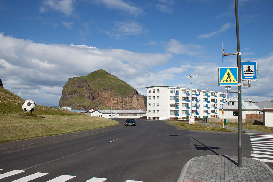
The naming trips up everyone, including a lot of guidebook writers. The whole archipelago is Vestmannaeyjar. The single inhabited island is Heimaey, which means home island. The town on Heimaey is also called Vestmannaeyjar, sometimes spelled Vestmannaeyjabær. So you take the ferry to Heimaey, in the Vestmannaeyjar archipelago, and you sleep in the town of Vestmannaeyjar. In English the whole lot is called the Westman Islands, supposedly because the first settlers chased a band of Irish slaves out here in the 870s, the slaves being “western men” relative to Norway. The name has stuck for 1,150 years.
Practical implication of the geography: Heimaey is small. About five square kilometres, walkable end to end in a long morning. You can do without a car if you’ve come for two nights and you don’t mind a steep walk to Stórhöfði. You’ll want one (or a bike) if you’ve got a single day and you want to see the eastern lava field, the southern bird cliffs, and the harbour walks all in one go.
How to actually get there
Two options. Ferry, or a small plane. Both have catches.
The ferry from Landeyjahöfn
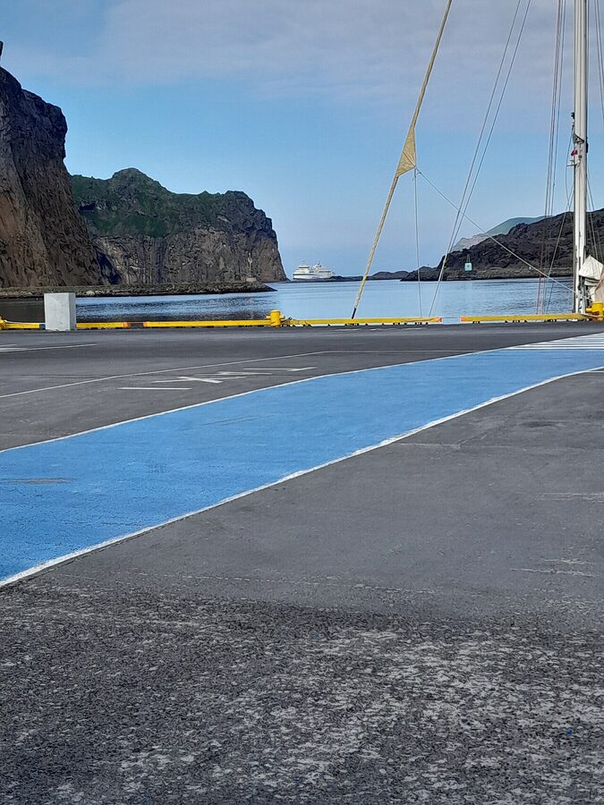
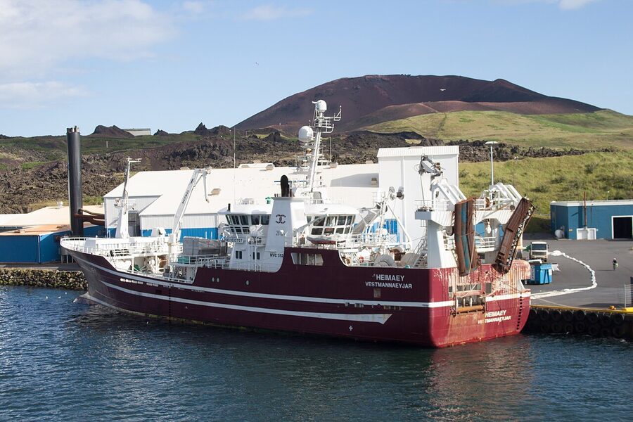
The ferry is the Herjólfur, run by Herjólfur ohf., the third boat to carry the name. It runs between Landeyjahöfn on the south coast and Heimaey, and the crossing takes 35 to 40 minutes. As of 2026 a foot-passenger return is around 3,500 ISK (~€24); a small car is about 6,000 ISK (~€41) return. Cabins aren’t a thing on this route, the boat’s too small and the trip’s too short.
Landeyjahöfn is a purpose-built harbour, dredged into a sandy stretch of the south coast in 2010, and it’s almost exactly where you want it: about 130 km from Reykjavík, just past the Seljalandsfoss/Skógafoss section of the Ring Road, and reachable in two hours from the capital in good conditions. The catch is silt. The harbour fills with sand in winter, and when it fills, the Herjólfur runs instead from Þorlákshöfn, an hour west, doubling the crossing to 2 hours 45 minutes. From October to February you should check the website the morning of travel before driving out.
Two practical bits the booking page won’t tell you. One: the south coast is famous for sand storms blowing across the open car park at Landeyjahöfn. There are reports of cars getting their paintwork scoured back to bare metal. If the wind is up, leave your rental at Hella or Hvolsvöllur and walk on as a foot passenger. Two: weather cancellations are real and not rare. The Faxaflói and Suðurland forecasts at vedur.is are your friend; if either is showing 12+ m/s southerly, the afternoon’s sailings are at risk.
The flight from Bakki, or Reykjavík
Eagle Air (Ernir) flies into Vestmannaeyjar from Reykjavík’s domestic airport in about 25 minutes on a Twin Otter or a Jetstream. The price is the bit that makes most people look twice: usually around 16,000-22,000 ISK (~€110-150) one way, though I’ve seen it as low as 9,500 ISK (~€65) when the carrier runs sales for residents. From Bakki, a small grass strip on the south coast roughly opposite Landeyjahöfn, summer-only flights run as a 5-minute hop in good weather; this is more of a curiosity than a useful service unless you’re already at Bakki for one of the riding stables.
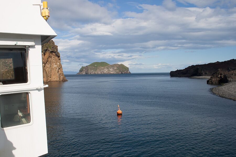
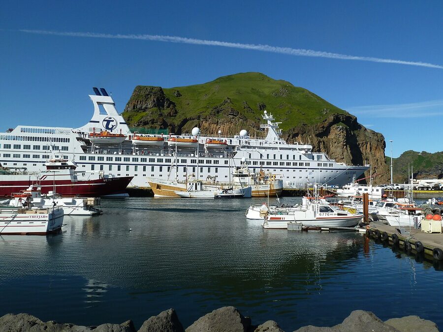
Ferry vs flight, in practice: take the ferry unless you specifically want the view, or the ferry’s been cancelled and you’ve got a non-refundable hotel waiting. The flight is more weather-cancellable than the boat, lower frequency, and considerably more expensive. The crossing on the boat is a proper part of the trip, not a logistical hop. You see the cliffs of Heimaklettur rising out of the water, you pass Bjarnarey with its single hut, and when the wind drops you sometimes see fulmars threading the spray.
The 1973 eruption, in fifteen minutes
You’ll hear the comparison once or twice on the island. Locals don’t love it, but they accept it: Vestmannaeyjar got called Pompeii of the North in the international press in 1973, partly because journalists love a tagline and partly because the buried-by-volcano image is a real one. The locals will quietly add that nobody died in the lava. One older man died from gas inhalation in his cellar, and that was the only fatality. So it’s the comparison they live with, not the comparison they would have picked.
What actually happened
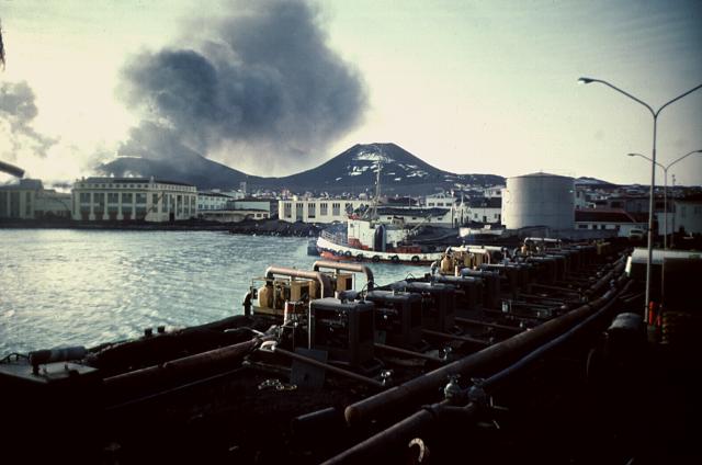
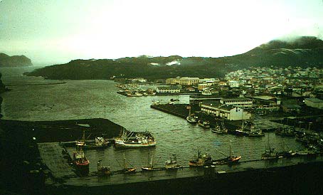
Just after 1.55am on 23 January 1973, a fissure 1.6 km long ripped open between Helgafell and the eastern coast. The opening cracks were less than 200 metres from the edge of town. The first lava fountains hit 100 metres within the hour. Most of the islanders were already in bed; in fact, half the town was unaware until the church bells started ringing. By a string of strokes of luck, the entire fishing fleet had come into harbour earlier that evening because of bad weather. Within six hours, all 5,300 inhabitants had been evacuated by boat, except about 200 emergency workers who stayed behind.
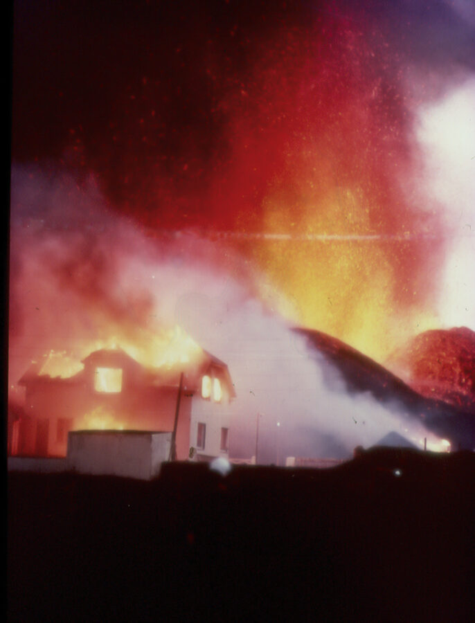
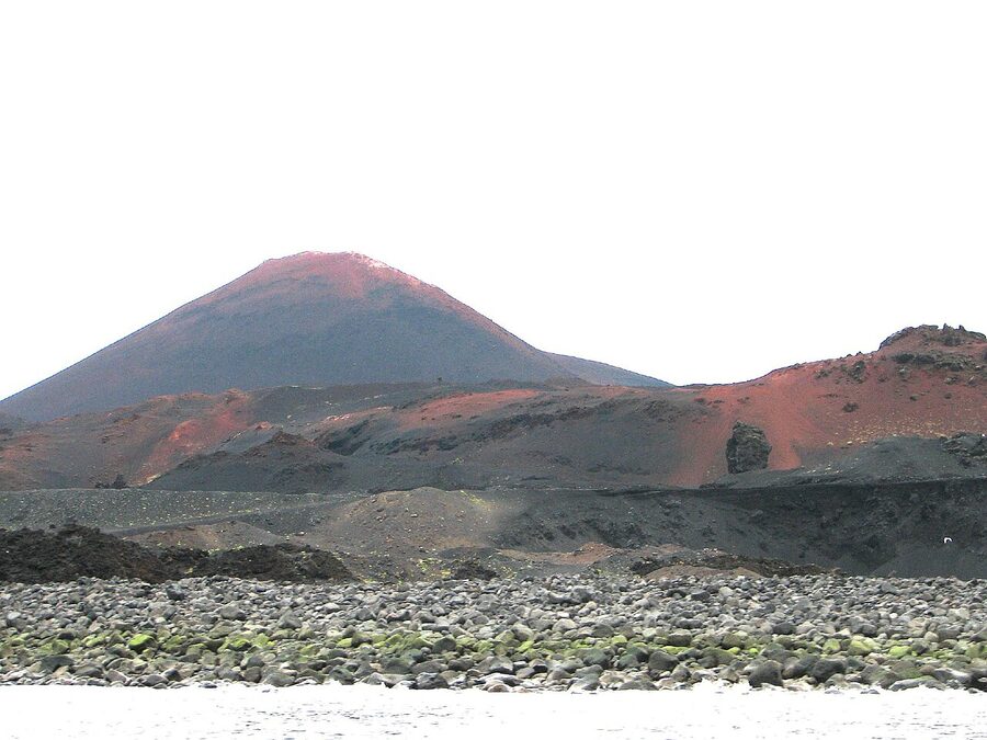
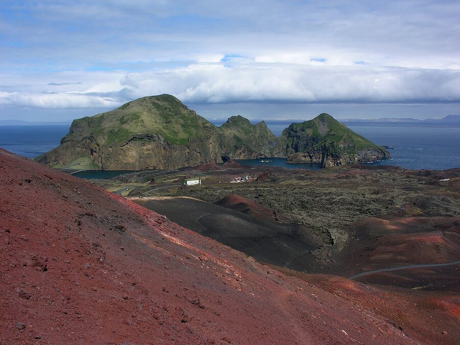
The eruption ran for five months. Lava and tephra piled up to twenty metres deep in places. About 400 houses were buried or burned, roughly a third of the town’s buildings. The new cone, named Eldfell (“fire mountain”) on the spot, kept growing, eventually settling at 200 metres high. The most pressing problem was not the buildings, though. It was the harbour. By February the lava was advancing on the harbour mouth, and if it sealed it, the island’s entire fishing economy was finished. The town would not come back.
The seawater pumps
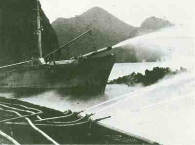
The fix is one of the great pieces of stubbornness in the modern history of disaster response. A local engineer, Þorbjörn Sigurgeirsson, had been arguing for years that lava could be cooled with seawater, against the orthodoxy that said you can’t slow lava, you can only get out of the way. As the flow approached the harbour, he persuaded enough people to try. The first pumps were fishing-boat fire pumps; eventually, the operation scaled to dozens of high-capacity pumps and several thousand metres of pipe. They sprayed about 6 million cubic metres of seawater onto the advancing front over six months.
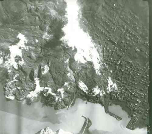
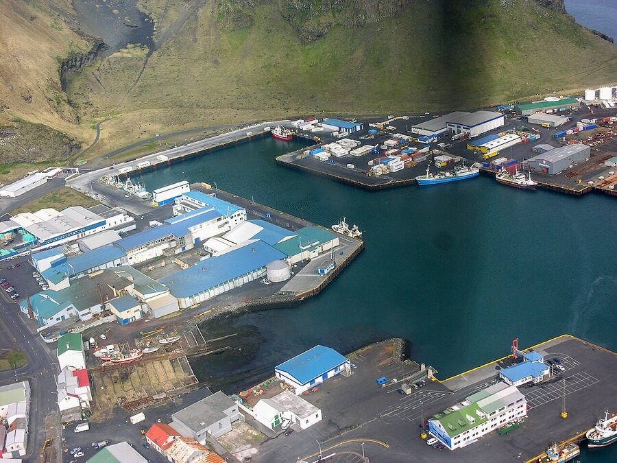
It worked. The harbour mouth narrowed (you’ll see how much, when you sail in), but it didn’t close. By a small irony, the new lava actually improved the natural breakwater, and the harbour today is more sheltered than it was in 1972. The town came back: by July most evacuated families had returned and started shovelling tephra off their roofs. Around a fifth of the population never came back, and the post-1973 population sits at about 80% of the pre-eruption number.
Eldheimar: the museum that earned its existence
If you do one thing on Heimaey, do this. Eldheimar opened in 2014 as a community museum built around the literal excavation of one buried house. For three decades after the eruption the town had a few semi-buried ruins to show visitors. Then someone in city hall had the idea: dig down the streets and see what’s there. Most of the houses they unearthed had been crushed flat by the weight of lava on top of them. One on Gerðisbraut had survived, partly. The municipality got permission from the family, dug it out, and built the museum on top. You stand on a walkway looking down into the kitchen and the bedrooms.
The exhibits beyond the house are arranged in four chronological sections (pre-eruption life, the night, the rebuilding, and the long aftermath), and they’re done with a calmness the subject doesn’t have any natural right to. There’s an exhibit on the smaller, even less-known offshore eruption that built Surtsey ten years before Eldfell, and the article comes back to it later. Audio is on geolocated headsets, no plaques, so the gallery is mostly silent and the only sound is your own ear.
Practical bits. Eldheimar is open daily May to September from 11.00 to 18.00, and Wednesday to Sunday in winter from 13.00 to 16.00 (always check the day-of via eldheimar.is; the winter schedule shifts). Adult admission is 3,500 ISK (~€24). Allow ninety minutes if you’re skimming, two and a bit hours if you’re reading every panel. The audio guide is included.
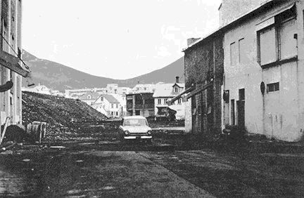
Walking the lava field, and reading the streets that aren’t there
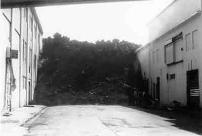
The Eldheimar building sits at the western edge of Eldfellshraun, the lava field. Walk east from there and you’re on it. The path is signed; there’s a gentle, looping route that winds around the new ground above the buried town. What you’re looking at is essentially a 1973-era neighbourhood shrunk-wrapped under twenty metres of basalt. Halfway through the field there are signs at intervals reading Suðurvegur, Helgafellsbraut, Strembugata: those are street names. The streets are still there, in the sense that they exist on a map. They’re just twenty metres below your feet.
The signage is restrained, which makes it work. There are no stage-managed dramatics, just the occasional sign-and-arrow saying something to the effect of here was the corner of x and y. By the harbour there’s a panel where someone has overlaid the pre- and post-eruption maps, and you can stand and find what used to be the corner shop and what is now a lava bluff.
There’s a so-called ash pole at the eastern edge of town, opposite the modern Hotel Vestmannaeyjar, that marks the actual depth of pumice on that exact corner. There’s a photograph laminated on the post showing the pole during the cleanup, with the family’s roof appearing about halfway up. Standing at the bottom of it and looking up is more affecting than the photograph in any guidebook.
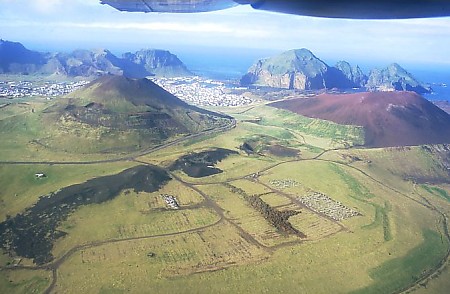
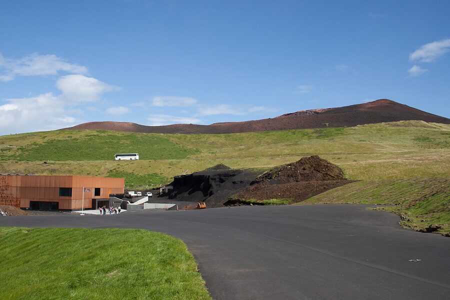
Climbing Eldfell
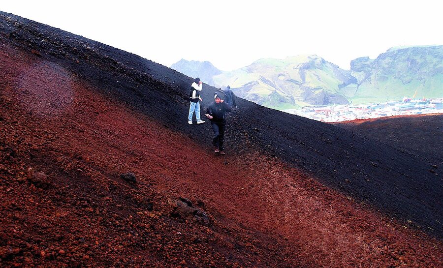
You can summit Eldfell in 25 to 40 minutes from the trailhead, and you absolutely should. The path starts on the eastern edge of town, off Helgafellsbraut where the buried street signs begin. It’s loose, reddish scoria most of the way, with a few zig-zags that get steeper near the top. Total ascent is about 200 metres. Bring proper shoes; trainers and the scoria will be a struggle.
Two non-obvious things at the top. One: in places along the rim, the ground is still warm, and on a cold morning you can see vapour rising from it. The cone is not extinct, just dormant; it last erupted within living memory of half the people you’ll see in town. Two: there’s a signpost partway up with a 1973-era photograph attached, taken from that exact spot, showing the eruption in progress. It’s the cleanest before-and-after I’ve seen at any volcanic site.
If you do this in midsummer, do it at 8 or 9pm. The sun barely sets in late June and early July, the air is cleaner than midday, and the cone glows red in the low light. You’ll often have it to yourself; most ferry day-trippers leave on the 6pm boat. Take a wind-shell, even on a still afternoon. The rim is exposed and the temperature drops fast.
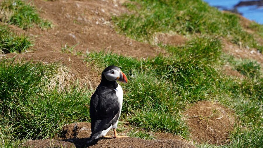
Puffins, and when they’re actually here
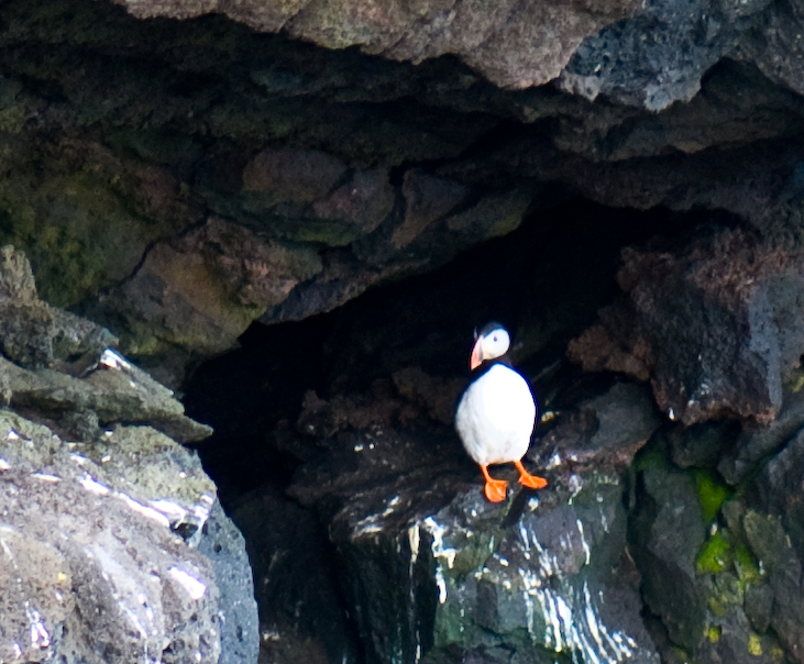
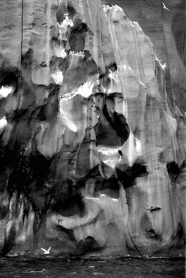
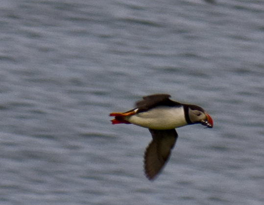
Vestmannaeyjar holds the world’s largest single Atlantic puffin colony. The number you’ll see in older guides is around 1.1 million pairs; recent counts have it lower, somewhere between 700,000 and 850,000 pairs in a bad year, and the population has been under pressure since about 2005 from sand-eel collapses. They’re still here. They’re still the largest colony anywhere. A good summer evening at Stórhöfði you can see hundreds in the air at once, threading the cliffs with that fast, bee-like wingbeat that doesn’t look like it should keep them up.
The dates that matter
The viewing window is short. Puffins arrive at the colonies around mid-April. The first eggs are laid in early May. Chicks hatch in mid-June. Adults are most active around the burrows from late May through July. The chicks fledge in mid-August. By the third week of August, the cliffs are empty, the birds gone back to the open Atlantic for the eight months of their year that they spend at sea.
If you’ve come for the puffins, target late May through the first week of August. Mid-June to mid-July is peak. Outside that window you will see no puffins. None. I cannot count the people I have heard report a Vestmannaeyjar trip in late September who say they didn’t see a single puffin. They wouldn’t have. They aren’t there.
Where to go to see them
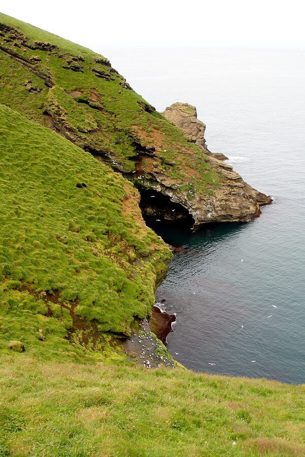
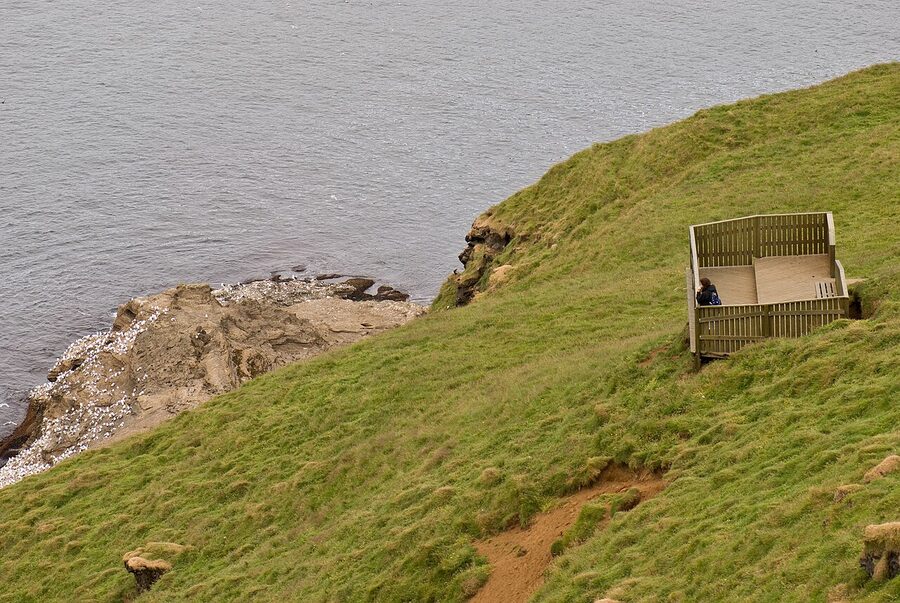
The headline spot is Stórhöfði, the southern headland. There’s a small wooden bird-watching hide on the cliffs, with two slit windows angled towards the burrows; sit quietly inside and the birds will come within two metres of the openings. Bring binoculars if you can; a 8×42 pair turns the cliff opposite into a noticeably better picture. Visit in the morning before the wind picks up, or in the long evening light if the day’s been calm. Avoid midday; the colony is least active when the sun is high.
The other reliable spot is the cliff edge above the western harbour, on the road that climbs out of town toward Stórhöfði. Park near the golf course and walk; there’s a fence-line above the cliff with viewpoints. Less dramatic than Stórhöfði but closer to town and you’ll see good numbers in the burrows along the path.
The third option, the boat tour, gets you closest of all. Ribsafari and Viking Tours both run circumnavigations of Heimaey and side-trips to the outlying islands. RIB rides are 90 minutes, around 12,000 ISK (~€82); the slower Viking boat (Þrasi) is 90 minutes for around 9,500 ISK (~€65). Both nose into sea caves under the southern cliffs and run close enough to the puffin colonies that you can see individual birds without binoculars. Book a couple of days ahead in July.
The puffling patrol
Mid-August into early September is when the chicks (pufflings) leave the burrows. They’re meant to head out to sea, navigating by moonlight and starlight. They are also confused by the lights of Vestmannaeyjar town, and most years a few thousand pufflings end up in Heimaey gardens, parking lots and football pitches. The town’s response, going back generations, is that families with cardboard boxes and torches go out at dusk to collect them. The next morning the birds are weighed, checked, and released off the southern cliffs.
If you’re here in late August you can join the rescue. The local Sea Life Trust / Beluga Whale Sanctuary visitor centre runs an evening session for visitors. Take a torch and a shoe-box. Don’t grab a chick by the wings; cup your hands around the body. It’s the most charming hour you’ll spend on the trip.
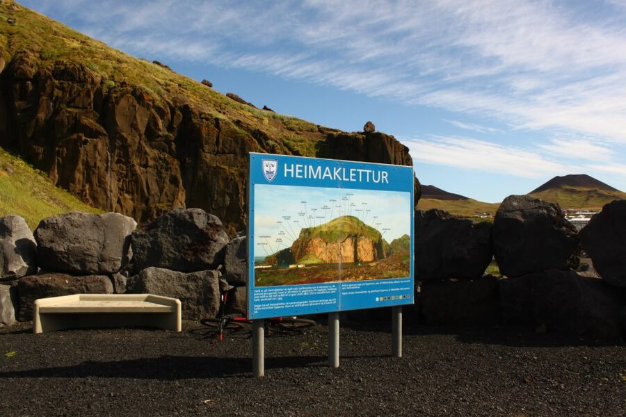
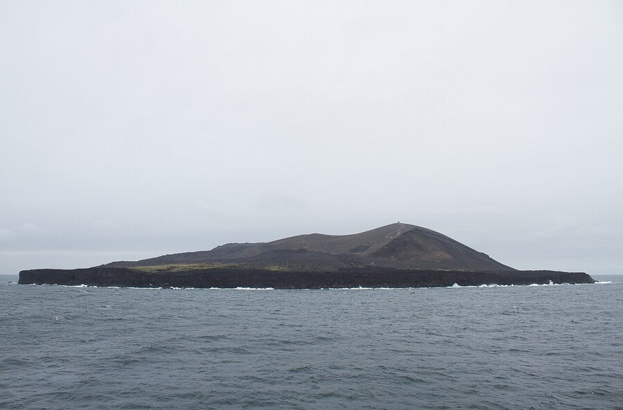
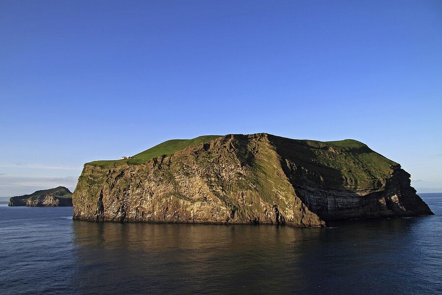
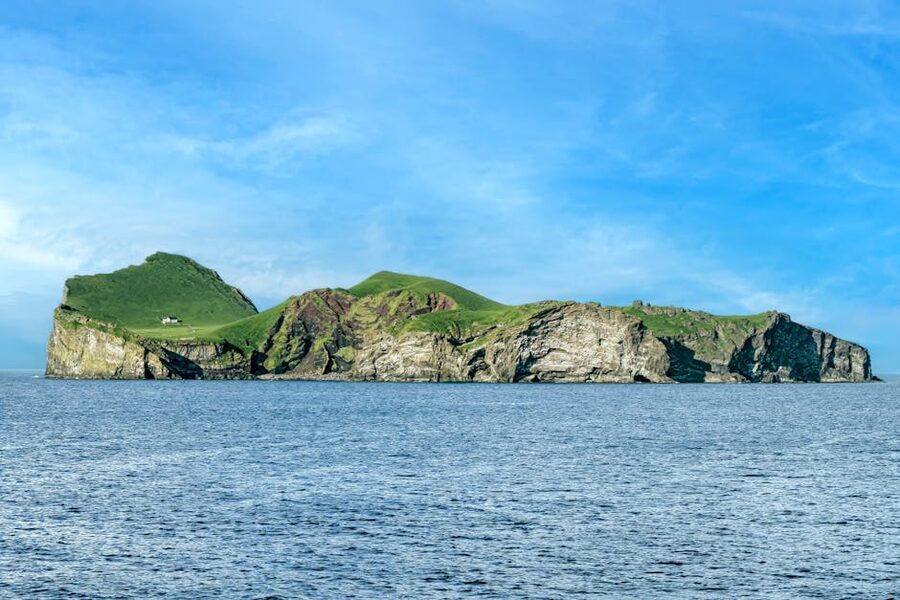
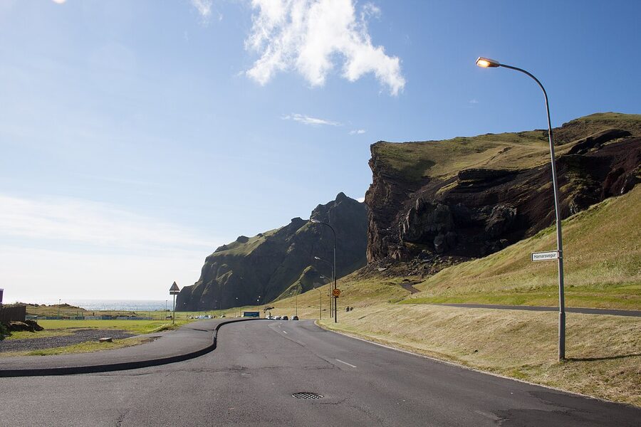
Heimaklettur and the harbour cliffs
Heimaklettur, the Home Rock, is the 283-metre cliff that forms the northern side of the harbour. From the ferry deck on the way in it’s the wall on your left. From the town, it’s the dominating presence to the north; just about every photograph of Vestmannaeyjar has it in frame. You can climb it. It is not for everyone.
The route involves four ladders bolted to the rock, several stretches of fixed chain, and a final grass-and-scree push to the summit ridge. The total climb is about 280 metres of vertical from the harbour. Easy by mountaineer standards; not easy at all by tourist standards, especially if you don’t like exposure. People do it in trainers in summer. People also occasionally fall. Iceland Search and Rescue have called the route in for a reform a few times; for now, it remains a use-at-your-own-risk hike on signed but not engineered terrain.
If you’re a confident hiker, do it. The view from the summit ridge takes in the whole archipelago, the south-coast glaciers (Eyjafjallajökull, Mýrdalsjökull) on a clear day, and the fishing fleet coming in. Allow three hours up and down with margin. Don’t do it in rain; the chains and the grass section both turn lethal.
If you don’t fancy the climb, the harbour walk is the consolation. Follow the road around the eastern side of the harbour, past the fish-processing plants, to the Skansinn area: a small earthwork remnant of the 1627 corsair raid (more on that in a minute), the Stafkirkjan stave church, and a wide flat headland with views back to town. It’s about an hour’s loop with a coffee stop in town at the end. The Skansinn fortress is mostly low grass mounds now but the headland was where the seawater pumps were rigged in 1973.
The stave church, the parish church, and a 1627 problem
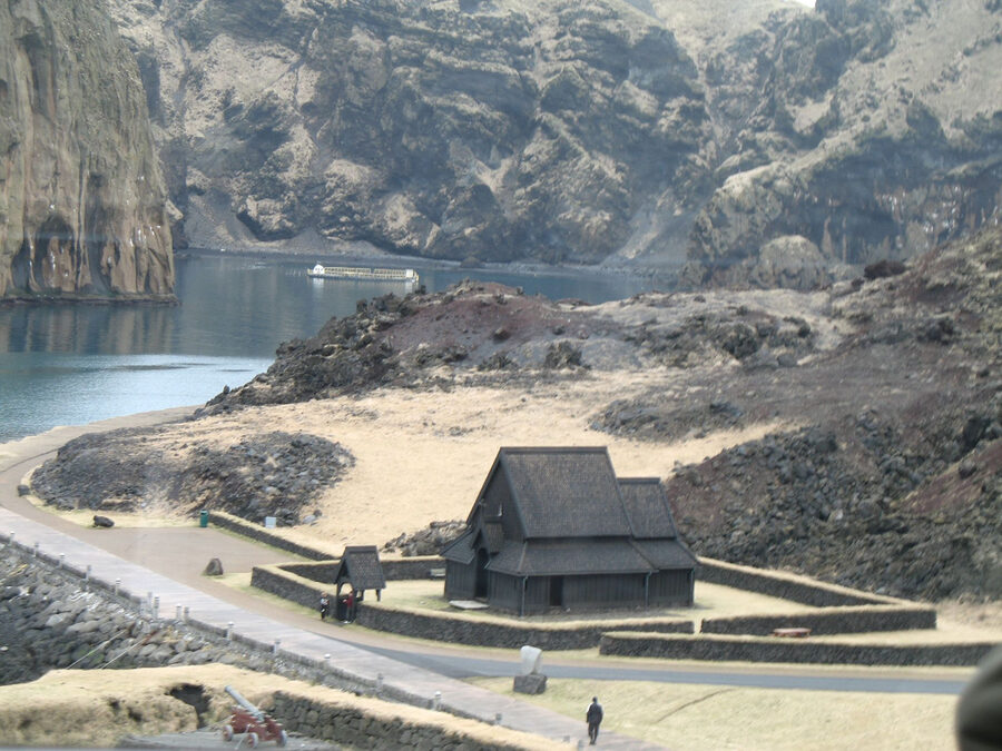
The Stafkirkjan, the wooden stave church on the eastern edge of the harbour, is a 2000 gift from Norway to Iceland to mark the millennium of Christian conversion. Iceland never had stave churches in the medieval period, mainly because there wasn’t enough timber to build them with, so this is a curiosity rather than a heritage object: a perfect copy of Haltdalen kirke from Trøndelag, all dark stained pine and steeply pitched eaves, dropped onto an Icelandic shore. The interior is bare-boned, with a small altar and the smell of tar. A useful five-minute stop on the harbour walk.
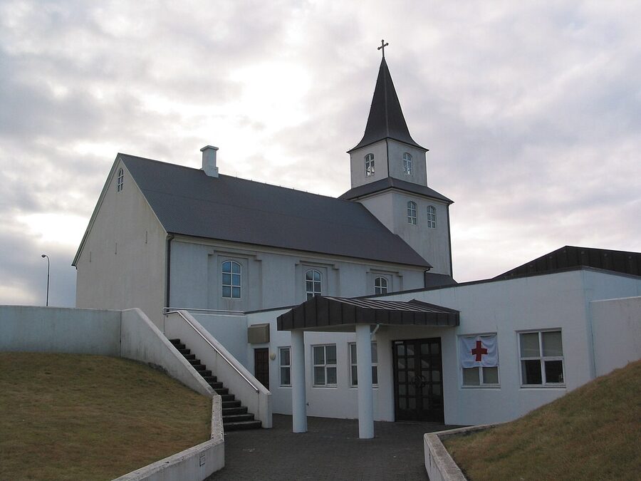
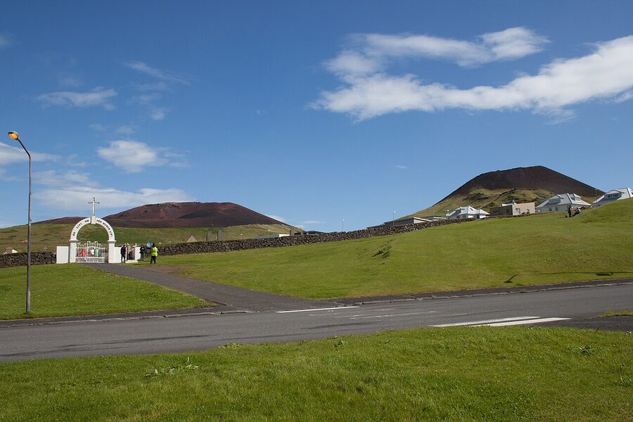
For the actual local heritage piece, walk the other way: Landakirkja, the parish church, sits on the rise above the town. Built in 1778, weathered grey, with a thick stone base. It is one of Iceland’s oldest stone churches, and one of the few buildings in eastern Vestmannaeyjar to survive 1973 (the lava stopped a couple of hundred metres short of its eastern wall). The famous photograph at Eldheimar of the church silhouetted against the rumbling new cone is taken from here, looking east.
The Sagnheimar Folk Museum, on the upper floor of the town library on Kirkjuvegur, is the best place to read the rest of the island’s history. Allow an hour. The standout exhibit is the so-called Turkish Abduction, the 1627 raid by Barbary corsairs, who landed at the south of Heimaey, killed 36 islanders, and carried 242 off into slavery in Algiers. The story is told here in panel-by-panel illustration, and despite the cartoon look the content is unflinching. It’s also a story almost no English-language guidebook bothers with, even though it’s one of the more remarkable episodes in 17th-century Atlantic history. The pastor of the time, Ólafur Egilsson, was carried off with his family, eventually freed, walked back across Europe, and wrote a memoir that’s still in print.
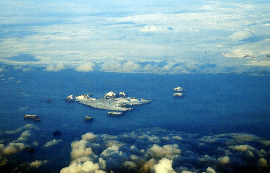
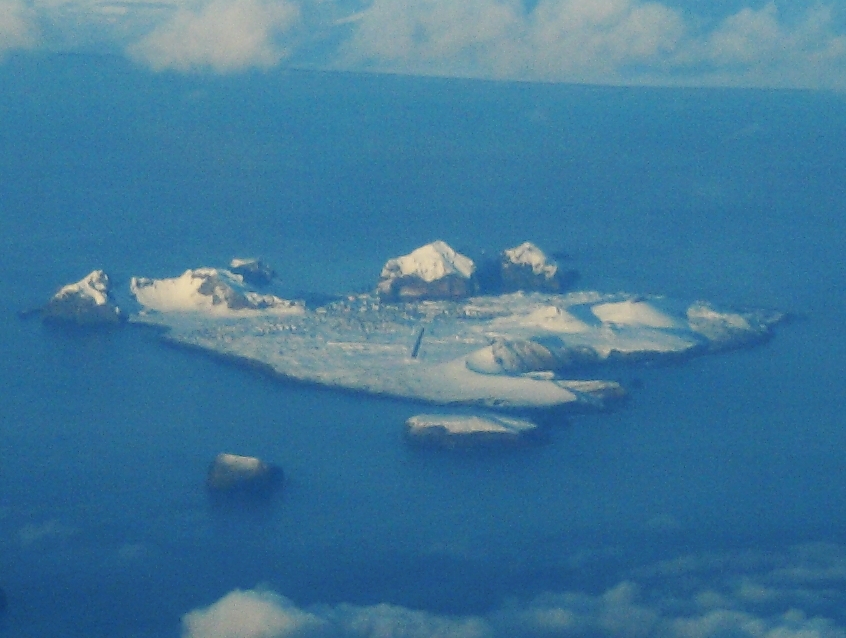
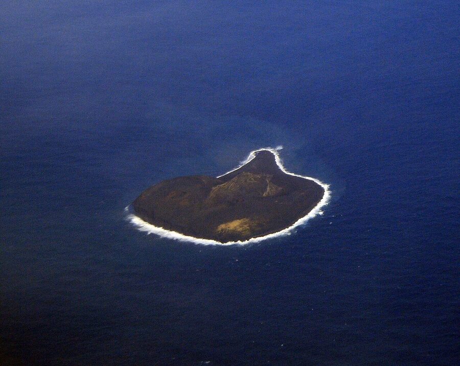
Surtsey, the island that’s younger than the lift in your hotel
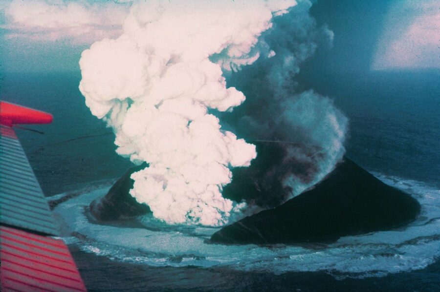
Surtsey is the southernmost of the Vestmannaeyjar archipelago, and it is also younger than most of the people reading this. It rose out of the Atlantic in November 1963, when a fishing crew east of Heimaey noticed dark smoke on the horizon. Over the next three and a half years, the eruption built an island roughly two square kilometres at its peak. The Icelandic state moved fast: from day one, Surtsey was placed under a strict no-landing rule (only scientists with permits, and only on tightly controlled visits) so that the colonisation of the new ground by plants, fungi, insects and birds could be tracked from a clean baseline. It became one of the most-studied volcanoes in modern science, and a UNESCO World Heritage site in 2008.
You cannot land on Surtsey. The closest you’ll get is from the deck of the Ribsafari boat or from the summit of Eldfell on a clear day; on a still afternoon you can see the ground-hugging shape on the horizon to the south-west. The Eldheimar museum has a good upstairs exhibit on the eruption and the science programme, with footage from the early years that’s worth watching. There’s also footage of the geologists who arrived by boat days after the eruption ended and stuck Iceland’s first long-term ecology monitoring posts into the still-warm tephra.
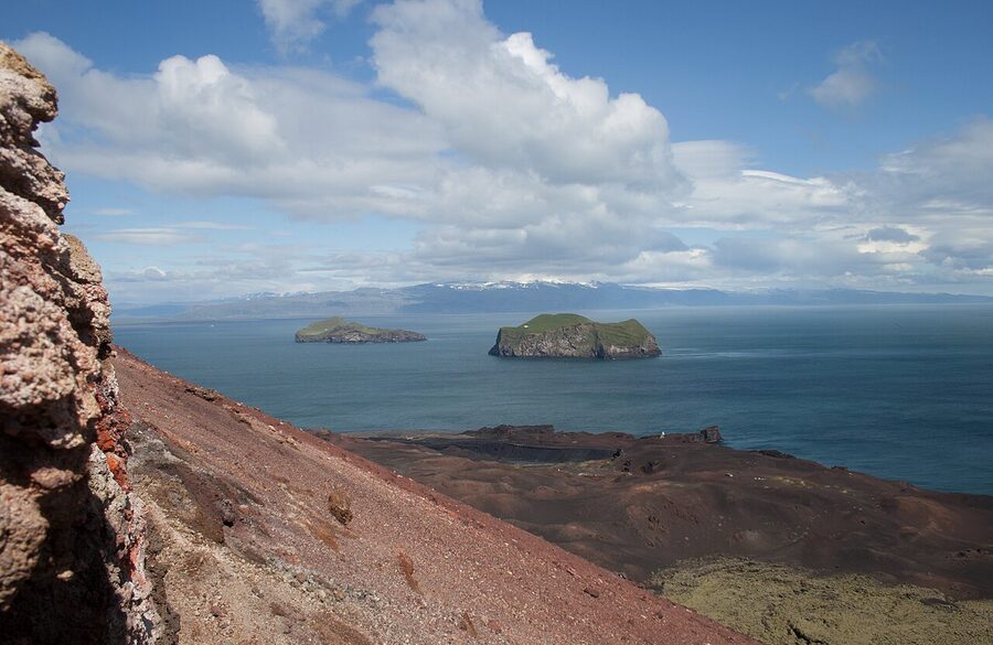
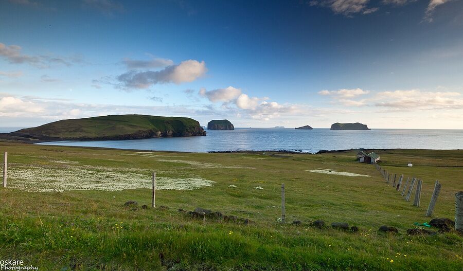
The outlying islands: Bjarnarey, Elliðaey, Suðurey, Brandur
You’ll see them on the boat tour or from the Eldfell summit. Bjarnarey, Elliðaey, Suðurey, Brandur and a string of smaller stacks and skerries. Two of them, Bjarnarey and Elliðaey, have a single hut on top, perched in the middle of grass meadows surrounded by sea cliffs. Both are owned by hunting clubs that go out for puffin- and fulmar-hunting weekends in season; the buildings are not abandoned, despite a long-running internet meme to the contrary. The Elliðaey hut is sometimes posted online as the “loneliest house in the world”, with a story attached saying a billionaire bought it as a doomsday bunker. The story is rubbish; it’s a club hut, built in 1953, owned by Elliðaeyjarfélag, the local hunting association.
If you take the boat tour, you’ll round Elliðaey, see Bjarnarey from the channel, and most operators duck into one of the sea caves on the south of Heimaey. The caves are big enough to motor a small boat into; some captains kill the engine and ask everyone to be quiet, and the kids on board hum to fill the silence. The acoustic echo inside is something else.
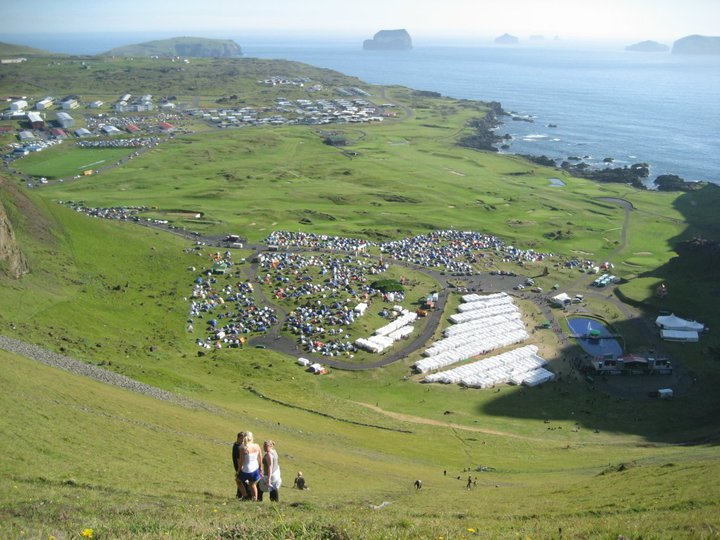
Þjóðhátíð, the festival you don’t accidentally book
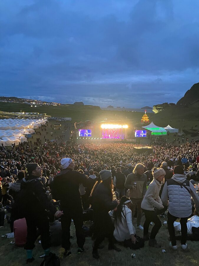
This is the warning section. The first weekend of August is Þjóðhátíð (the National Festival, but in practice the Vestmannaeyjar festival), Iceland’s biggest annual gathering. About 18,000 people pour into a town of 4,300, almost all of them Icelandic, almost all of them in tents in Herjólfsdalur valley. There’s a brennan bonfire on the cliffs, a song competition on the Friday night, and an unbelievably loud collective sing-along on the Saturday after midnight. Tickets for the weekend are sold out by April; ferry tickets that weekend are sold out by February; hotels are booked a year in advance.
If you are 25, Icelandic, and have friends camping, Þjóðhátíð is unbeatable. If you are none of those things, it is not the weekend to come. The town is unwalkable, the puffin sites are closed, the museum opening hours move around, and you’ll struggle to find a bed unless you’ve planned twelve months ahead and don’t mind paying a 2x summer rate. The brief period to avoid is roughly Wednesday to Tuesday across the first weekend of August. Come the weekend before, or the weekend after; the rest of summer is fine.
Smaller, cleaner alternative for the cultural anchor: Goslokahátíð, the End-of-Eruption Festival, runs the first weekend of July. It’s a town-only event, families and former residents marking the anniversary of the eruption ending; you’ll get harbour-side concerts, fireworks, and a queue at every café, but you can still book a room and walk the lava field.
Eating, briefly
For a town of 4,300, Vestmannaeyjar punches above its weight. The standout is Slippurinn, in a converted boat-engine workshop on the harbour. Chef Gísli Matt was the founding name behind the modern New Nordic-on-the-Westman-Islands movement; the restaurant has had a Michelin Bib Gourmand and is regularly listed in Iceland’s top ten. Six-course tasting menu about 18,500 ISK (~€127); à la carte mains around 4,500-6,500 ISK (~€31-45). Open seasonally, late April to late September; book a few days ahead in July. Worth the money once.
Next door, Einsi Kaldi is the same family-owned operation, more relaxed pricing, mainly fresh fish, mains around 3,800-5,500 ISK (~€26-38). Vinaminni, on Vesturvegur, is the local pub-and-burger spot most evenings, the kind of place where you’ll see the same faces twice in a weekend. Gott, on Bárugata, is the easy lunch stop with proper coffee and pastry. For groceries and the Icelandic-prices-trick, there is a Krónan supermarket on Strandvegur, near the ferry terminal; if you’re saving money on this trip, it’s where you build a hike-day lunch.
One thing worth saying about the food: in a town this small, almost everything has been on a Vestmannaeyjar boat in the last 24 hours. Plokkfiskur (a smashed-cod-and-potato comfort dish) and the pan-fried haddock with lemon butter are the things to order; ask for whatever the kitchen got off the day’s catch. Skip puffin on the menu (yes, it’s there). Beyond the question of whether you should eat the bird that’s the reason you came, the puffin populations are stressed and the dish is cured-ham-textured anyway. There are better ways to spend the calorie.
Where to sleep
The accommodation stock is small. You have one proper hotel, two or three good guesthouses, and a handful of apartments. Outside the festival weekend, summer rooms book a couple of weeks ahead; in May or September, you can usually walk in.
Hotel Vestmannaeyjar
The town’s main hotel is Hotel Vestmannaeyjar, a four-star on Vestmannabraut about three minutes’ walk from the harbour. Rooms are simple, clean, modern; the breakfast is generous; the in-house restaurant Eldur og Ís is decent if Slippurinn’s full. From around 28,000 ISK (~€192) a night for a double in summer; closer to 18,000 ISK (~€124) in shoulder season. The thing it has that the guesthouses don’t is consistency: book it once, in or out of season, you know what you’re getting.
Sunnuhóll Guesthouse
For a more local feel and a cheaper bill, Guesthouse Sunnuhóll on Vestmannabraut is the long-running family guesthouse, a few doors from the hotel. Shared bathrooms, decent kitchen access, no fuss. From about 14,000 ISK (~€96) for a double room in summer. The owners know everyone in town; ask them for the puffling-patrol night.
Pier Apartments and Vestmannaeyjar Central
Pier Apartments by the harbour and Vestmannaeyjar Central are two of the better self-catered options in town, both in renovated harbourside buildings. Useful for two nights with kids, or for the budget-conscious end of summer. Around 22,000-26,000 ISK (~€151-178) for a small apartment in July.
Guesthouse Hamar
Guesthouse Sunnuhóll aside, Guesthouse Hamar on Faxastígur is a short walk uphill from the harbour, calmer than the seafront, and well-reviewed for breakfast. Around 16,000-19,000 ISK (~€110-130) summer, doubles with shared bath; a few en-suite rooms at the upper end of that range.
Puffin Nest Capsule Hostel
For solo travellers and tight budgets, Puffin Nest Capsule Hostel on Faxastígur is the only capsule-style place in town, very Icelandic in its directness (here is your pod, here is the fridge, sleep well). Beds from about 8,500 ISK (~€58) a night. There are also more options across Vestmannaeyjar accommodation on Booking, including a few apartment listings that don’t have a fixed brand name behind them.
Day trip vs overnight, the actual answer
You can do this as a day from the south coast. People do. The earliest summer ferry from Landeyjahöfn lands you on Heimaey just after 9am; the latest one back leaves at 7.30pm. So you’ve got ten hours, of which forty minutes is on the boat, leaving you a working day on the island. Enough for Eldheimar, the lava field walk, an Eldfell summit, a meal, and either a puffin viewpoint or the harbour walk. Not both.
The case for staying over is straightforward: the day-trip version makes you ration. You pick the museum or the puffins, the cone or the cliffs, the boat tour or Stafkirkjan, never both. You miss the long evening light, which is the actual reason to be here in summer; midnight in late June, the cone glows pink, and the pubs are still open. You miss the option of a morning at Stórhöfði, when the puffins are at their most active. And you miss what’s actually the best thing about Vestmannaeyjar, which is that it’s a town, not a museum. People live here; the local pool is open until 10pm; the church bells ring on Sunday morning; the butcher knows what fish you cook.
The best version of this is two nights. The first day for the museum, the cone and the lava walk; the second for puffins at Stórhöfði in the morning, the boat tour around the islands in the afternoon, and an evening on Heimaklettur (or, if you’ve decided the climb isn’t for you, dinner at Slippurinn followed by the harbour walk in the long light). On the third morning you ferry back to the mainland and pick up the south coast where you left it.
If you’re driving the Iceland Ring Road and have only seven days, you can absorb a single overnight in Vestmannaeyjar by reordering: do Day 4 (south coast: Seljalandsfoss, Skógafoss, Vík) up to Skógafoss, then double back to Landeyjahöfn for the afternoon ferry. You’d add a day in net. It’s worth it. If you’re starting from Reykjavík with a few days only, a two-night Vestmannaeyjar trip out and back via the south coast is a stronger week than a longer Reykjavík stay padded with day tours.
Driving to Landeyjahöfn (the bit nobody mentions)
If you’re driving down from Reykjavík, the route is Ring Road 1 to Hvolsvöllur, then south on Route 252 to Landeyjahöfn. About 130 km, two hours in good weather. The last 12 km off the Ring Road are flat farmland; the harbour itself appears suddenly behind the dunes.
Some practical tips most travel sites don’t bother with. One: if you’re driving in winter, check road conditions on road.is as well as the ferry. The 12-km stretch from Hvolsvöllur to Landeyjahöfn is exposed to coastal wind and crosses one bridge that closes when storms hit. Two: petrol is cheaper at Hvolsvöllur (the N1) than at the harbour (no petrol at the harbour itself, fill up before you leave the Ring Road). Three: there’s a small café at Landeyjahöfn with proper coffee and not-bad cake; if your ferry’s been moved you’ll be glad of it. Four: leave 30 minutes’ margin if you’ve booked the boat with a car. The car-loading queue lines up about 25 minutes before sailing and they don’t run late for stragglers.
If you’re flying into Iceland and want to skip the driving, the BSÍ bus to Hvolsvöllur connects with a local shuttle to Landeyjahöfn, all timed against the ferry. Reykjavík to Heimaey door-to-door is about four and a half hours. For the road version, see the practical breakdown in the Iceland car rental guide; rental rates and 4WD-or-not advice all apply, with the small caveat that you don’t need 4WD for Landeyjahöfn or for Heimaey itself.
What to skip
A few skip-this calls. The Sea Life Trust beluga whale sanctuary, on the harbour, is well-meaning and visit-able, but the two captive belugas (Little White and Little Grey, transferred from Shanghai) live in an indoor pool; the marketing photographs of them in the open sea bay aren’t a typical visit. Charity-run, decent intentions, but unless you’re already there for the puffling rescue, the entry fee (3,800 ISK, ~€26) doesn’t quite earn itself.
The Sagaheimar Saga Centre (not to be confused with Sagnheimar, which is the folk museum mentioned earlier) is a well-meaning but thin private exhibit on the early settlement period. Skip unless your kids are eight and the weather is awful.
The drive (or walk) to the southern tip of the island past Stórhöfði will take you to a series of “viewpoints” that are basically just lay-bys with concrete benches. Stick with Stórhöfði itself. The other lay-bys are wind-shadow and not worth the time.
Helgafell, the older, paler cone next to Eldfell, is climbable and barely climbed. There is no path, the slope is steep grass, and the view is essentially the same as Eldfell minus the historical interest. Skip.
If the weather closes in
Heimaey gets a lot of weather. Three out of every five days in October-November are rain or wind; three out of every five days in July are clear or cloudy-pleasant. Either way, the wet-day plan is the same: Eldheimar, an hour or two; the Sagnheimar folk museum, an hour; lunch indoors; the indoor public pool (Sundlaug Vestmannaeyja) on Brimhólabraut, which has hot pots and a steam room and costs around 1,300 ISK (~€9) for an adult; an early dinner at Slippurinn or Einsi Kaldi. You can ride out a 36-hour storm with that schedule and not feel cheated.
What you can’t do in heavy weather: the boat tour (cancelled), the Heimaklettur climb (closed in rain), Stórhöfði outdoors (you won’t last twenty minutes in 15 m/s wind), and often the ferry back. If a major storm is forecast for your last night, consider taking the earlier ferry the day before.
One last thing about the place
The thing I keep coming back to about Vestmannaeyjar is how matter-of-fact it is about its own history. Pompeii became a museum, Herculaneum became a museum, Plymouth Rock got fenced off. Vestmannaeyjar built houses on the new lava and walks past the buried ones to school. The 1973 cone is a Saturday morning hike. The puffins are something the kids round up in cardboard boxes in August. Surtsey is the geologic-time equivalent of next-door’s garden, except locals know the year it appeared because their parents fished a few miles east of it. Every dramatic thing about this place is also somehow domestic.
Most of the south coast’s headline list (the waterfalls, the black-sand beach, the glacier lagoon) you visit and tick off and drive on. Vestmannaeyjar is the south-coast stop you can come back to. I’ve come back twice and I’d do it again. Two nights, a clear evening on Eldfell, an hour at Stórhöfði, the ferry and a long drive home with a couple of plokkfiskur leftovers in the cool bag. If you have to pick one south-coast detour to actually deepen rather than rush past, this is it.
For the rest of the regional context, the guide to the Iceland aurora covers the autumn-and-winter angle (yes, the lights do appear over Heimaey, and the Stórhöfði lighthouse is one of the better foregrounds in south Iceland for it). For the wider trip planning, the Reykjavík city guide sets up the logistics out from the capital, and the Ring Road 7-day itinerary shows where this fits in the bigger drive. The car rental guide handles the practical end of the south-coast drive itself. From wheels to ferry to a buried street under your boots in less than half a day; that’s the thing this island still has on most of the rest of Iceland.