The Iceland Ring Road is 1,332 kilometres of paved Route 1 looping the entire country, and you can technically drive it in 16 hours of seat time at the 90 km/h limit. Seven days is the floor for actually seeing it, and even then the maths is sharp: roughly 200 km of driving every day, plus stops, plus the inevitable hour spent staring at a waterfall longer than you meant to. This is a trip you have to plan as a moving object, not a checklist of photo stops, and almost every itinerary you find online underestimates how full it is.
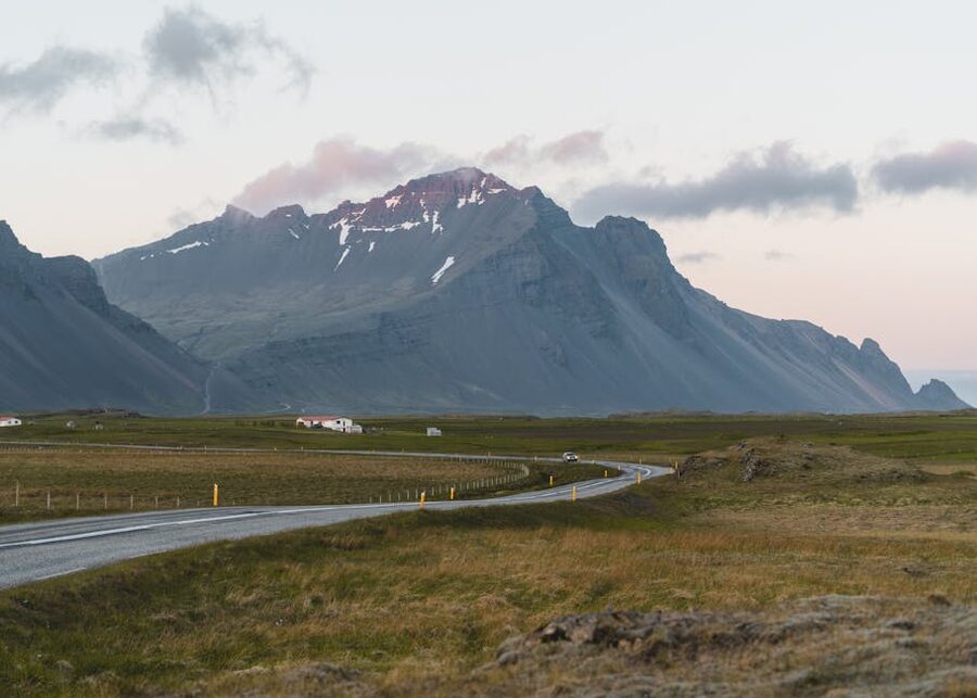
I have driven the loop twice, once at a deeply unhurried pace over twelve days and once on a tight seven-day run with two evening flights bookending it. The seven-day version works. It just isn’t the soft-focus version Instagram sells you. This is the day-by-day I actually use when friends ask, with real driving distances, the specific places worth slowing down for, the ones where a 20-minute photo stop is genuinely enough, and the parts of the country that deserve being skipped in seven days so you can give the rest its due.
One contrarian recommendation up front, which I will defend below: most first-timers should drive it anti-clockwise, doing the busy south coast on Days 1 and 2 and finishing the quiet stretches across the north and west. The crowds thin as your week progresses, which is a much nicer trajectory than the reverse, and Day 1’s logistics work better. The clockwise camp has its arguments. They’re weaker than they sound.
In This Article
- What 7 days on the Ring Road actually looks like
- Clockwise or anti-clockwise (most people pick wrong)
- The real cost of a week here
- Before you go: the four things that quietly ruin trips
- The hire-car insurance ambush
- Weather, and especially shoes
- F-roads and gravel detours
- Booking accommodation late
- Day 1: Keflavík to Flúðir, via Þingvellir
- Day 1 quick numbers
- Day 2: Flúðir to Vík, the south coast crunch
- Day 2 quick numbers
- Day 3: Vík to Höfn via Vatnajökull
- Day 3 quick numbers
- Day 4: Höfn through the East Fjords
- Seyðisfjörður or Egilsstaðir?
- Day 4 quick numbers
- Day 5: East Iceland to Mývatn
- Optional detour: Stuðlagil Canyon
- Dettifoss
- Hverir and Lake Mývatn
- Day 5 quick numbers
- Day 6: Mývatn morning to Akureyri
- Day 6 quick numbers
- Day 7: Akureyri to Reykjavík
- Option A: the Vatnsnes Peninsula
- Option B: Grábrók and Kolugljúfur
- Day 7 quick numbers
- Day 8: Reykjavík and the flight home
- What this itinerary skips, and why
- If you’re going in winter
- Getting there: flights and ferries
- The 7-day Ring Road, summarised
What 7 days on the Ring Road actually looks like
Total driving over seven days, the way I lay it out below, comes to about 1,500 km. That is roughly 215 km a day on average, but the daily totals are not even. The biggest day is around 280 km plus stops. The lightest is 110 km. You’ll be in the car between three and five hours most days, before you add any photo pulls or detours, and the detours are where time disappears in Iceland. A 4 km gravel-road sign will pull you in for an hour you didn’t plan, and on Day 5 you will need it back.
The pacing I use:
- Day 1: Keflavík to Selfoss / Flúðir area via Þingvellir. About 140 km. Easy first day, designed to absorb a morning arrival.
- Day 2: The big one. Golden Circle finish plus the south coast to Vík. About 245 km, and you will feel every minute.
- Day 3: South coast to Höfn via Vatnajökull and Jökulsárlón. About 270 km, much of it spectacular.
- Day 4: Höfn through the East Fjords to Egilsstaðir or Seyðisfjörður. About 280 km, the slowest-feeling stretch because you keep wanting to stop.
- Day 5: East Iceland to Lake Mývatn via Dettifoss. About 250 km. Add an hour or two if you’re tempted by Stuðlagil.
- Day 6: Mývatn morning, west to Akureyri via Goðafoss. The relaxed day. About 110 km.
- Day 7: Akureyri across the north and west to Reykjavík. About 380 km. The second-longest driving day, and the one most people misjudge.
If you’re still in seat-of-the-pants mode and reading “ah, only seven days, sounds chill,” look at Day 7 again. 380 km in Iceland in summer is fine. 380 km in Iceland on Day 7 of a road trip when you’re already a bit tired is the day people start hating their car. Plan to be on the road by 9am and stop driving by mid-afternoon if you can.
Clockwise or anti-clockwise (most people pick wrong)
You can drive the loop in either direction. The internet treats it as a coin flip. It isn’t. Anti-clockwise is the better choice for a 7-day first trip, and here is why.
The south coast is where the day-trippers from Reykjavík go. Seljalandsfoss, Skógafoss, Reynisfjara, Sólheimasandur. All four get day-tour buses every morning until early afternoon, then a second wave of Golden Circle traffic by 4pm. The Eastfjords and the north see a fraction of those numbers. So your two real choices are:
- Anti-clockwise: tackle the crowded south on Days 1 and 2 while you’re still fresh, then move into progressively quieter country. The trip gets calmer, not more frantic, as the week goes on. Day 7’s drive home through the west feels like a wind-down.
- Clockwise: start in solitude across the north and east, then spend Days 6 and 7 fighting tour buses on the south coast as you’re tiring out. You also lose the Day 1 logistics advantage (more on that below).
The clockwise camp’s main argument is that “you’ll be driving against the day-tripper traffic” on the south coast, so the road itself feels less busy. That’s true on Route 1 the road, and irrelevant at the actual stops. The waterfalls are crowded whether you arrived east-to-west or west-to-east. The flow argument is also weaker than it sounds because most of the south coast bottlenecks are car parks and viewing platforms, not the highway.
The Day 1 advantage matters more. After a flight to Keflavík, almost nobody has the gas left to do a 200 km opening drive into the Tröllaskagi Peninsula. Anti-clockwise lets Day 1 stay short and southern, with Þingvellir and either the Blue Lagoon or Sky Lagoon as a low-energy first day’s work. Clockwise pushes a bigger Day 1 onto a tired traveller. Pick the harder option only if you have a strong reason.
Below I write everything anti-clockwise. If you genuinely want clockwise, run the days from Day 7 backwards. The stops are the same.
The real cost of a week here
Iceland is expensive. Plan on roughly €4,500 to €6,500 for two people for a week, all-in, if you stay in mid-range guesthouses, eat about half your meals from supermarkets, and do one or two paid activities. You can do it cheaper with hostels and serious self-catering. You can do it considerably more expensive with hotels and daily tours. There isn’t really a budget version that involves restaurants every night.
Here’s where the money actually goes for a typical seven-day summer trip in 2026:
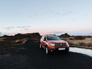
- Car hire: a 2WD hatchback runs roughly 14,000 to 22,000 ISK (€90 to €145) per day with basic insurance. A small 4×4 is 28,000 to 42,000 ISK (€185 to €275) per day. You don’t need a 4×4 to drive Route 1 itself, only for any F-roads or rough gravel. Add gravel and sand-and-ash protection at booking time, not at the desk.
- Fuel and the new road tax: from January 2026, Iceland scrapped fuel duty and replaced it with a per-kilometre road charge of about 6.95 ISK (~€0.045) per km for a standard car. Petrol dropped from around 320 ISK to 185–230 ISK per litre as a result. Most rental companies bake the road charge into a daily fee or settle it on return. Net cost is similar to what it was before. Budget around 6,000–9,000 ISK (€40–€60) per day for fuel plus the kilometre charge combined.
- Accommodation: a mid-range double room runs 24,000 to 45,000 ISK (€160 to €300) per night in summer. Hostel dorm beds run 7,500 to 15,000 ISK (€50 to €100). Reykjavík is most expensive; the east and north are cheapest. Book at least three months ahead for July and August; some towns on the route have very limited accommodation and they fill up.
- Food: a main course at a sit-down restaurant runs 3,000 to 6,000 ISK (€20 to €40). A main and a beer at a pub is reliably 4,500–7,500 ISK (€30 to €50). Realistic daily food budget for two: 12,000–20,000 ISK (€80–€135) if you mix supermarket lunches with one decent dinner. Bonus and Krónan are the cheapest supermarkets. Most guesthouses have kitchens. Petrol-station hot food in Iceland is unexpectedly decent and reasonably priced.
- Activities and parking: most of the famous sights (waterfalls, beaches, viewpoints) are free to enter. Parking at the busy stops costs 750 to 1,500 ISK (€5 to €10) and is paid via the Parka.is app. Install it before you land, the fines are aggressive. Paid activities vary widely: Blue Lagoon entry from 9,990 ISK (€67), a glacier hike from around 18,000 ISK (€120), a whale-watching trip from Húsavík from around 13,000 ISK (€87).
The category that surprises people is food. A restaurant dinner for two with drinks lands at 18,000 ISK (€120) at unremarkable places. A nice three-course at somewhere good is 30,000 ISK plus (€200+). Eat out every night for a week and you’ve spent over €1,000 on food alone. Mitigate by self-catering at least lunch, and a couple of dinners.
Before you go: the four things that quietly ruin trips
None of these is the kind of thing the “10 reasons you’ll love Iceland” articles tell you. They’re the things that, in my experience, separate a brilliant week from one with a bad taste at the end.
The hire-car insurance ambush
You arrive at Keflavík jet-lagged at 6am, you walk to the rental desk, and someone explains that without “essential” gravel protection, sand-and-ash protection, and an upgraded collision waiver, you are basically driving an uninsured tin can. The numbers feel designed for tired arrivals. You sign because you can’t be bothered to argue.
Decide on insurance before you land. Northbound lets you bundle Iceland-specific cover (gravel, sand and ash) into a rental booking at sane prices. Gravel protection is genuinely worth it on Iceland’s mixed surfaces, since flying stones from oncoming cars chip windscreens regularly. Sand-and-ash protection is mostly relevant on the south coast in volcanic-ash conditions. You don’t need them at desk-panic prices.
Weather, and especially shoes
Summer in Iceland is not summer in Italy. June to August averages around 12 to 15°C with a stiff coastal wind. It will rain on you, possibly every day. Pack proper waterproofs (jacket and trousers, not a softshell over jeans), warm layers including a hat and gloves even in July, and, this is the one, waterproof shoes with grip. The waterfalls will soak you, the basalt at Reynisfjara is slippery, and a week in wet shoes is a special kind of misery I’d rather you not learn first-hand.
F-roads and gravel detours
Somewhere around Day 3 or 4 you’ll see a gravel road going off somewhere dramatic and a small voice will say “let’s just see where it goes.” This is how people wreck rental cars and have €2,500 conversations they hadn’t budgeted for. F-roads (highland routes prefixed with F) are legally restricted to 4×4 vehicles with high clearance, and your insurance excludes damage from F-road driving even if you have full cover. Some apparently-innocent gravel side-roads also damage 2WD undercarriages.
If you want to drive F-roads, rent a proper 4×4 from the start. And even then, read your insurance. F-road tow charges are eye-watering.
Booking accommodation late
Vík, Höfn, Mývatn and Egilsstaðir each have a small handful of guesthouses and one or two hotels. They fill up months ahead for July and August. The “we’ll figure it out as we go” approach that works in mainland Europe doesn’t work here. Wild camping is not legal in Iceland, so sleeping in the car if everything’s full isn’t a fallback. Book at least three months ahead for peak summer.
Day 1: Keflavík to Flúðir, via Þingvellir
Distance: about 140 km. Driving time: 2 hours plus stops. Sleep: Flúðir or Laugarvatn area.
Day 1 is intentionally light. You’ve just flown, your body clock is wrong, and the temptation to “make the most of it” by stacking the Blue Lagoon, the full Golden Circle and a sunset at Reynisfjara into Day 1 is the first stupid mistake of the trip. Don’t.
Pick up your car at Keflavík (the rental shuttle is a 5-minute hop from the terminal) and drive east. If the Blue Lagoon is on your list and you’ve pre-booked a slot (it sells out, you can’t turn up), head there straight from the airport. It’s a 20-minute drive. Allow 2 to 3 hours for the visit. The water is genuinely the milky blue the photos show, the on-site changing setup is well-organised, and the swim-up bar is not as overrun as the reviews suggest if you go off-peak.
If you aren’t sold on the Blue Lagoon, the Sky Lagoon south of Reykjavík is newer, often less crowded, and has an ocean-view infinity edge that genuinely earns the photographs. My preference is to skip both today and instead use the Mývatn Nature Baths in the north on Day 5, which is cheaper, less busy, and has a better view than either. Day 1 is fine without a hot soak. The trip won’t be ruined.
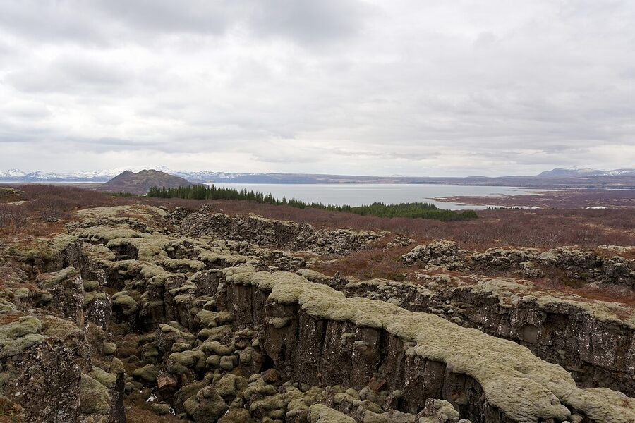
From the airport area, pick up Route 1 east to Selfoss, then Route 35 north to Þingvellir. Þingvellir National Park is the only stop I’d argue for as non-negotiable on Day 1. It’s one of the oldest continuously documented parliamentary sites on earth (the Alþingi met here from 930 to 1798) and it’s also where the Eurasian and North American tectonic plates pull apart, which means you can walk along the rift valley between two continents. Allow 90 minutes including the short walk to Öxarárfoss.
If you have time on the way back south, Kerið Crater is a 3,000-year-old volcanic crater lake about 20 minutes off Route 35 with a small entry fee (700 ISK / ~€5). The walk around the rim takes 30 minutes. It’s photogenic and breaks up the drive nicely, but if you’re flagging, skip it.
Sleep tonight in the Flúðir or Laugarvatn area, well-positioned to finish the Golden Circle in the morning. The Hill Hotel in Flúðir is comfortable mid-range with an on-site restaurant. Budget travellers can look at the dorm options around Selfoss and Hvolsvöllur. If your flight arrived in the late afternoon or evening, ditch the Þingvellir plan today, drive 20 minutes to Northern Light Inn next to the Blue Lagoon, sleep, and start fresh on Day 2. Better than driving tired in the dark.
Day 1 quick numbers
- Keflavík to Þingvellir: 89 km, 1h 10min
- Þingvellir to Flúðir: 65 km, 1h
- Þingvellir entry: free, parking 750 ISK (€5)
- Kerið Crater entry: 700 ISK (~€5)
- Blue Lagoon entry: from 9,990 ISK (~€67), pre-book required
Day 2: Flúðir to Vík, the south coast crunch
Distance: about 245 km. Driving time: 4 hours plus serious stop time. Sleep: Vík or Kirkjubæjarklaustur.
Day 2 is the heaviest day of the itinerary by a margin and I want you to know that going in. You will be on the move from breakfast until dinner. If you try to do every stop on the list below, you will fail. The list has nine stops; pick six or seven and be ruthless about the rest. It’s a menu, not a checklist.
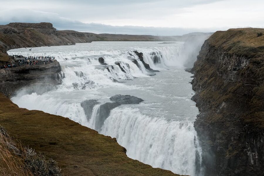
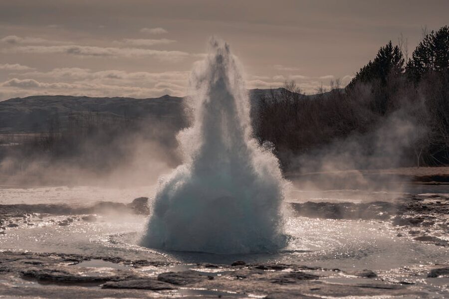
Start with the Golden Circle finishers: Geysir and Gullfoss. The Geysir geothermal area is where English got the word “geyser.” The original Great Geysir is mostly dormant, but Strokkur next to it goes off every six to ten minutes, blasting water 15 to 30 metres up. It’s one of the rare big-name attractions that consistently delivers. Allow 25 minutes. Gullfoss is a five-minute drive on, and is a properly enormous two-tier waterfall with multiple viewing levels and a café in the visitor centre. Allow 40 minutes.
From Gullfoss, drop south on Route 30 then east on Route 1 to Hvolsvöllur. The Lava Centre here is a relatively new museum about Iceland’s volcanic and tectonic story, and it’s actually good. The exhibit design explains things rather than waving its hands at “the forces of nature.” There’s a free entrance area and a paid main exhibition. Lunch in their café is a reasonable mid-day stop. Allow an hour and a half.
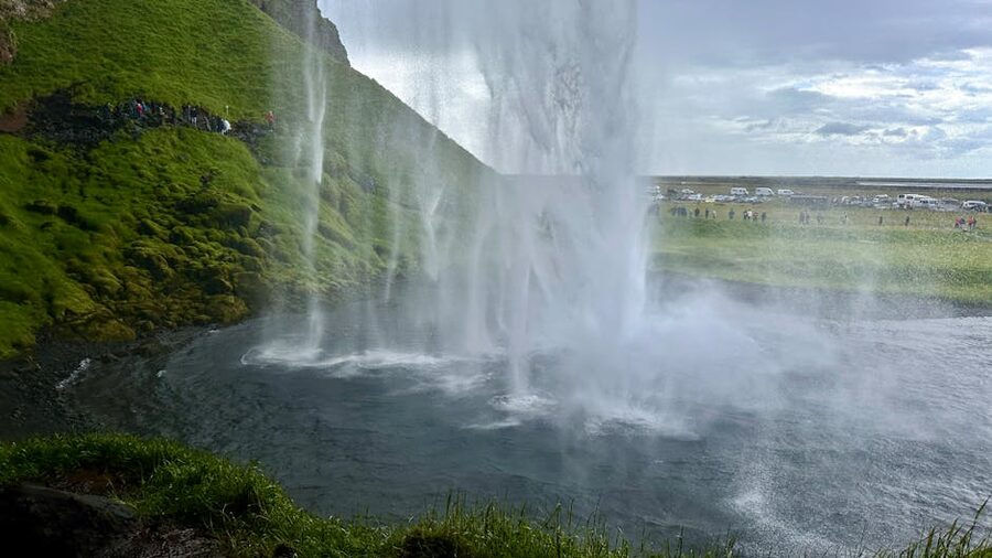
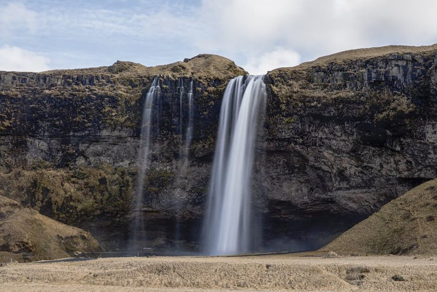
Twenty kilometres east of the Lava Centre is Seljalandsfoss, the first of the south coast’s signature waterfalls. Seljalandsfoss is unusual because there’s a path running behind the curtain. The path soaks you. Wear waterproofs and put your phone in a sealed pocket. Walk the paved path 10 minutes north to Gljúfrabúi, a smaller waterfall hidden inside a rock cleft. You wade up a tiny stream to reach it. Worth it. Parking 700 ISK via the Parka.is app, enforced.
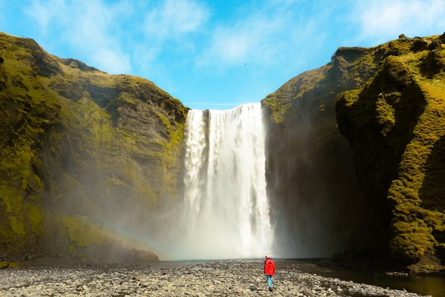
From Seljalandsfoss, 30 km east is Skógafoss. Sixty metres tall, 25 metres wide, sheer drop, full curtain. There’s a viewing platform where you can stand close enough to be drenched on the windward day. There’s also a steep staircase to the cliff top above the falls, which is worth it for the view if your legs have anything left. Allow 45 minutes.
The next decision is the Sólheimasandur DC-3 plane wreck. It’s a crashed US Navy plane on a black sand plain, a 40-minute walk each way from the car park or a paid shuttle. I did the walk. I’d skip it now. It’s an hour and twenty minutes of flat featureless sand for a look at a wrecked fuselage that’s photogenic in the right light and unremarkable in the wrong light. If you have any doubt at all, drive on.
Dyrhólaey is a dramatic headland with sea arches, a lighthouse, and (in summer, May to mid-August) a puffin colony on the cliffs. It’s closed during nesting between 7pm and 9am. If you have time after the plane wreck decision, do it; it’s a 25-minute round-trip detour. There’s better puffin-watching later in the trip if puffins are your target.
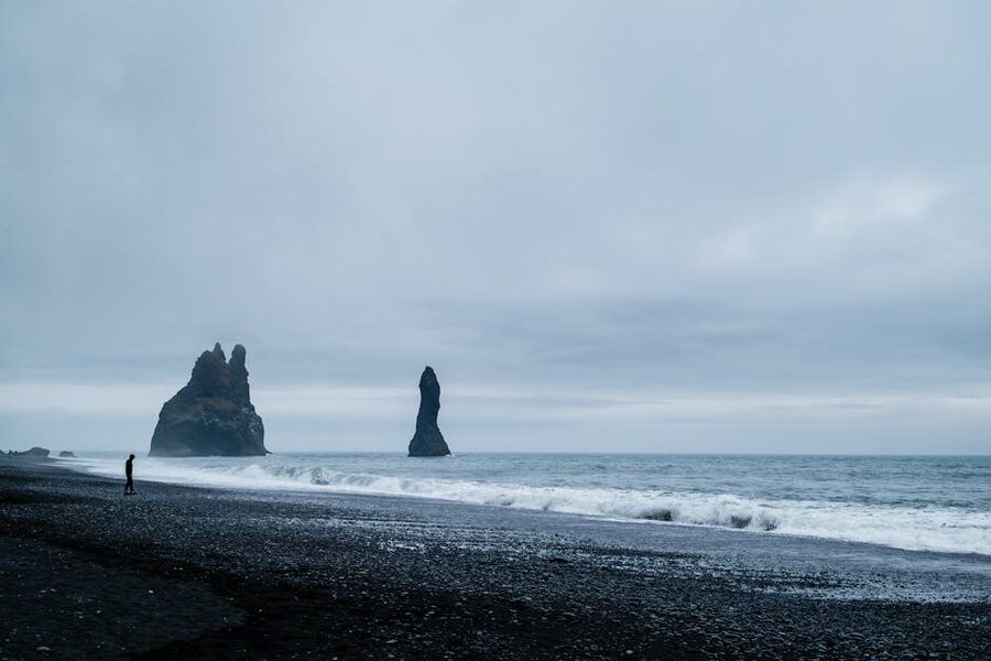
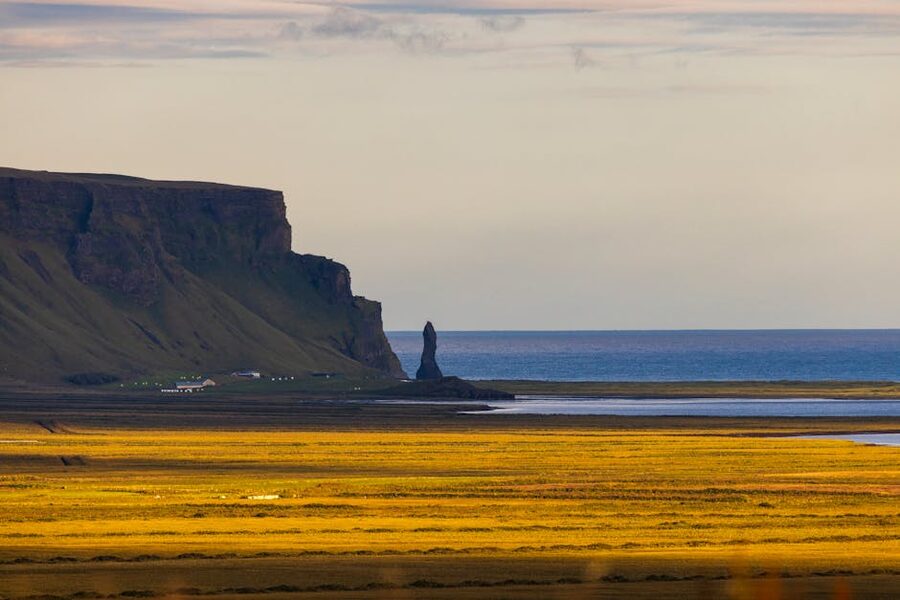
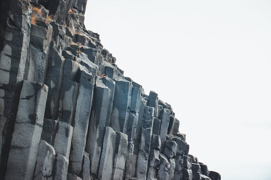
The day’s final stop is Reynisfjara, the black sand beach with the basalt columns and the sea stacks. It is also lethal. Sneaker waves at Reynisfjara have killed six people since 2013, including a nine-year-old in August 2025. The waves that kill people are not the ones already breaking on the beach. They are surges that come in without warning and pull people out. Read the warning flag before you walk past it: yellow, orange, red. During red conditions the Hálsanefshellir cave is closed and access to the lower beach is restricted. Do not turn your back on the water. Do not paddle. I’m not exaggerating. Treat this like the most dangerous coastline you’ll ever stand on, because it might be.
Reynisfjara, 2026 update: persistent easterly winter storms in early 2026 stripped huge volumes of sand from the beach, and for a period the basalt columns stood at the new shoreline rather than well above it. Sand has been returning since March. Access to the lower beach and the cave is still controlled by the warning-flag system. Check the SafeTravel Iceland page before you go.
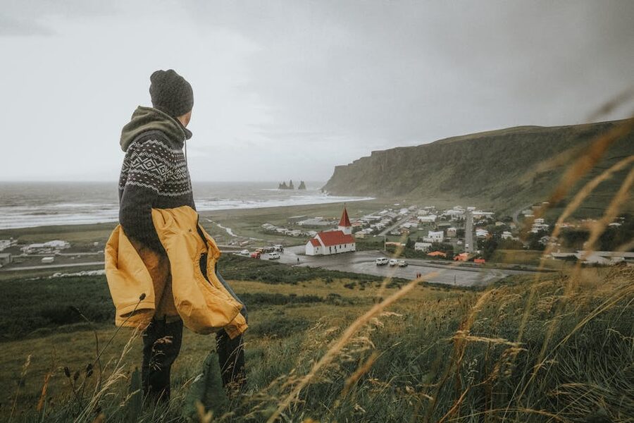
Sleep tonight in Vík, a tiny cliff-top village (population 750) with a handful of guesthouses, one supermarket, and a famous black-roofed church on the hill that you’ll see in every photo set. Hotel Vík í Mýrdal is the central mid-range option. If everything in Vík is booked (and it will be in summer), push 30 minutes further east to Kirkjubæjarklaustur and try Hunkubakkar Guesthouse. Colourful family-run cottages, slightly more peaceful than central Vík.
Day 2 quick numbers
- Total drive: 245 km, 4 hours moving plus stops
- Stops to attempt: 6–7 from Geysir, Gullfoss, Lava Centre, Seljalandsfoss, Gljúfrabúi, Skógafoss, plane wreck, Dyrhólaey, Reynisfjara
- Parking fees today: 750–1,500 ISK (€5–€10) at most major stops, paid via Parka.is
- Lava Centre admission: 5,400 ISK (~€36) for the full exhibition
Day 3: Vík to Höfn via Vatnajökull
Distance: about 270 km. Driving time: 3 hours 45 minutes plus stops. Sleep: Höfn.
Day 3 is the day Iceland reveals what it can do at a scale you can’t quite take in. The first stop, ten minutes west of Kirkjubæjarklaustur off Route 1, is Fjaðrárgljúfur, a two-million-year-old river canyon with a viewing path running 100 metres above the water. Allow 45 minutes including the short walk to the canyon-end platform. There’s a 1,000 ISK parking charge at the upper car park.
From Fjaðrárgljúfur you drive east through the Eldhraun lava field. At around 565 km², it is the largest single lava flow in recorded history, created by the Laki eruption of 1783 and 1784. That eruption killed roughly a quarter of Iceland’s population and triggered a famine across Europe. The field is now covered in pale green moss that takes a century or more to recover from being walked on. There are designated parking pull-outs with marked trails. Use them. The Eldhraun is also the closest thing on earth to the moon, which is why NASA brought Apollo 11 astronauts here for training in 1965 and 1967.
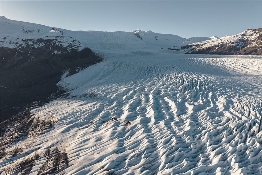
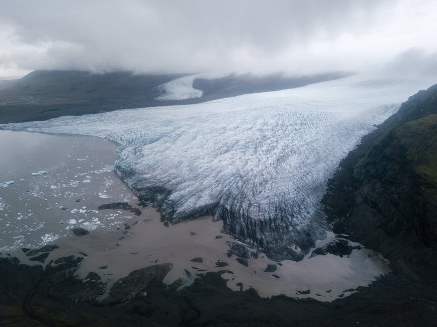
From here Vatnajökull dominates the horizon. At about 7,800 km² it covers around 8% of Iceland and is Europe’s largest glacier by volume. (Switzerland’s Aletsch is also called “Europe’s largest” but is the largest in the Alps, not in Europe full-stop.) Vatnajökull has been retreating around a metre of thickness per year since the 1990s, which means everywhere you’ll see today looked thicker and longer two decades ago. The next stops are all inside Vatnajökull National Park.
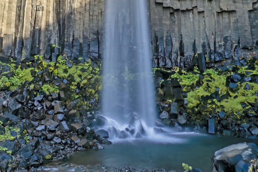
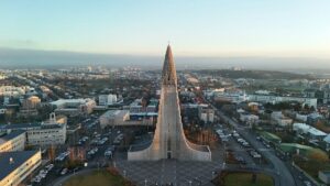
Skaftafell is the main park visitor centre with a large car park (700 ISK on Parka.is) and a choice of walks. The classic option is the 30 to 45-minute steep climb up to Svartifoss, a 20-metre waterfall over hexagonal black basalt columns that you’ll recognise from the design of Hallgrímskirkja in Reykjavík. If hiking up isn’t your thing, the flat 90-minute Skaftafellsjökull loop takes you close to the snout of the glacier.
A pacing warning: Skaftafell also offers guided glacier hikes and ice cave tours. Both are worth doing in their own right. They also each eat 3 to 4 hours plus travel time, which means you’ll lose Jökulsárlón today and arrive in Höfn after dinner. If a glacier hike is on your list, budget Day 3 as “glacier hike plus Svartifoss” and accept that you’ll skip the rest. Don’t try to fit everything.
From Skaftafell continue east. A short detour leads to Svínafellsjökull viewpoint, a free 15-minute look at another outlet glacier tongue. (This was where part of Interstellar‘s ice planet was filmed, if you care.) Then comes the day’s headline: Jökulsárlón.
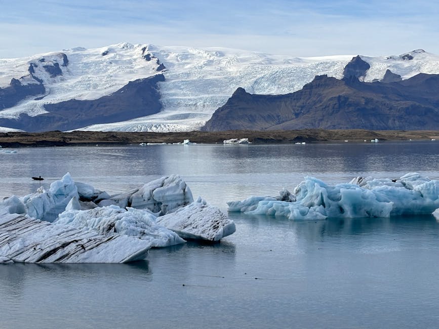
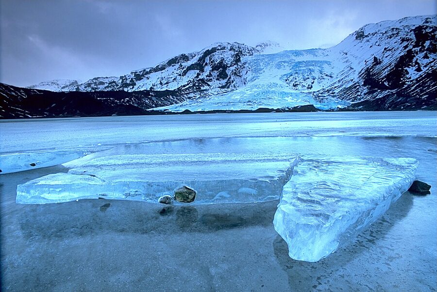
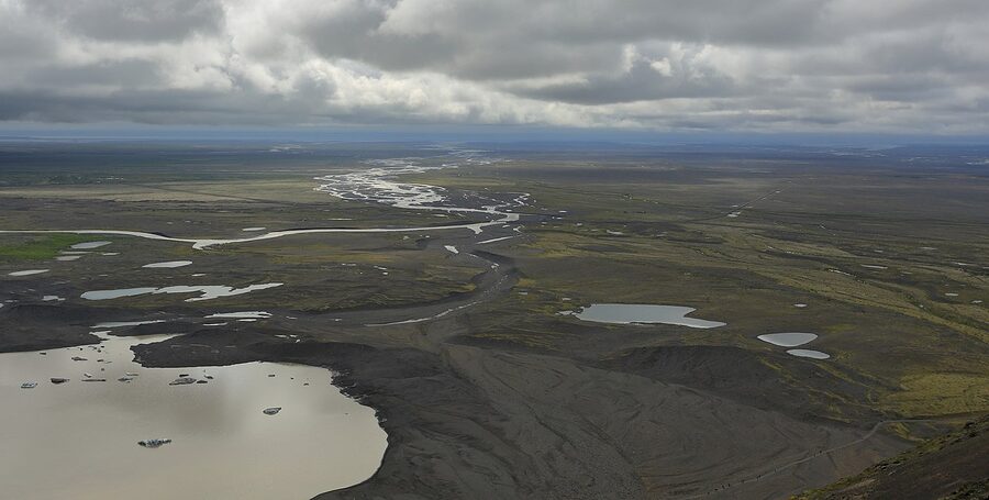
Jökulsárlón is a lagoon at the base of Breiðamerkurjökull, one of Vatnajökull’s southern outlet glaciers. Icebergs calve off the glacier into the lagoon, drift around for years, and eventually wash out to sea through a short river. The lagoon didn’t exist before about 1934; it has formed entirely from glacier retreat in the last 90 years and is one of the most visible markers of climate change in Iceland. Allow at least an hour. Boat tours among the icebergs run between May and October from around 9,500 ISK (~€64) and are worth the money if you have time.
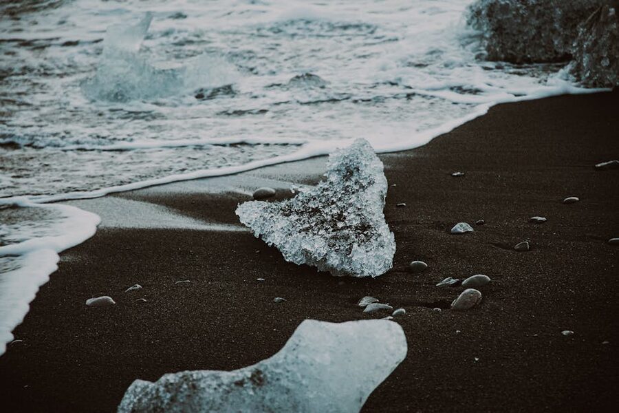
Cross the road from Jökulsárlón and you’re at Diamond Beach, where icebergs that have washed out of the lagoon end up on the black sand. In sunlight they glitter like the name suggests. More dramatic in winter than summer. Worth 30 minutes either way.
From Diamond Beach it’s an hour to Höfn (“Hop”, the lazy English pronunciation drives Icelanders mad. Closer is “hupn”). Höfn is the langoustine capital of Iceland, and the only sensible thing to eat here is langoustine. Hafnarbúðin, a no-frills harbourside diner that has been serving locals since 1982, does a langoustine sandwich (humarbátur) for around 4,500 ISK (~€30) that is genuinely brilliant and surprisingly affordable by Icelandic standards. It’s takeaway-style, so eat outside on a bench with a view of the harbour.
Sleep at Milk Factory, a design hotel in a converted dairy in central Höfn, or at the harbourside Hotel Edda Höfn. Both fill up early in summer. If they’re booked, push another hour east to Djúpivogur and check Hotel Framtid, which is well-reviewed and quiet. We’ve got more on Iceland’s specific car-rental traps in the Iceland car rental survival guide if you’re still finalising the booking.
Day 3 quick numbers
- Total drive: 270 km, 3h 45min moving plus stops
- Skaftafell parking: 700 ISK (~€5)
- Fjaðrárgljúfur parking: 1,000 ISK (~€7)
- Jökulsárlón boat tour: from 9,500 ISK (~€64), May–October
- Glacier hike from Skaftafell: from about 18,000 ISK (~€120), allow half a day
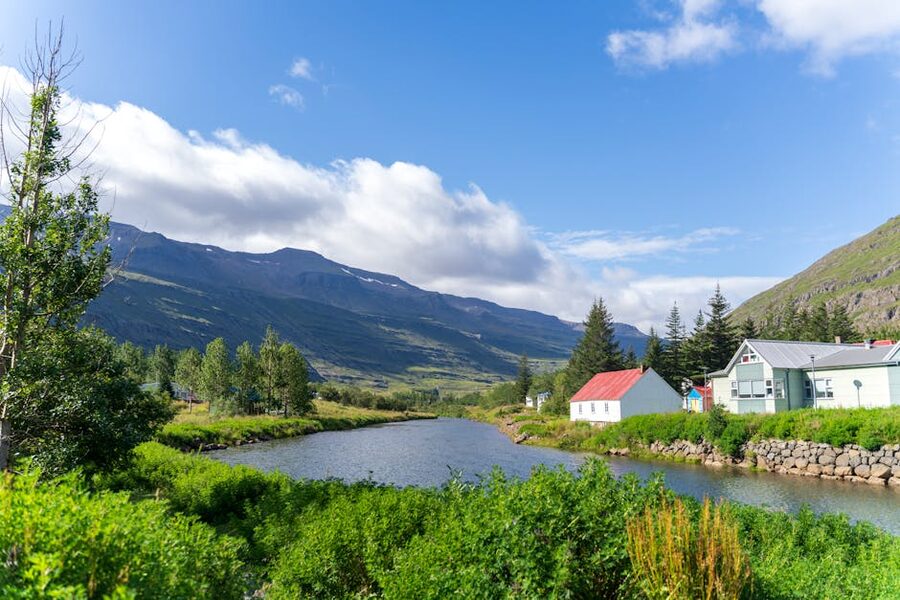
Day 4: Höfn through the East Fjords
Distance: about 280 km. Driving time: 4 hours plus very tempting stops. Sleep: Egilsstaðir or Seyðisfjörður.
The East Fjords are the quietest stretch of the Ring Road and, for my money, the best argument against rushing the trip. Most day-trippers from Reykjavík don’t come past Jökulsárlón, so from Höfn onwards the traffic thins to almost nothing.
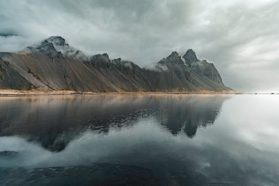
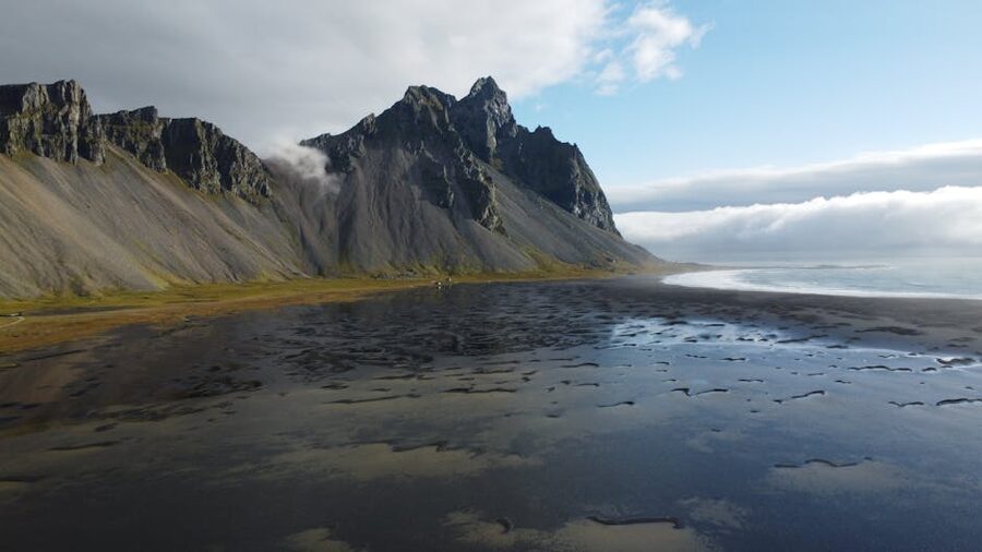
The first stop is Vestrahorn, the spiky black-peaked mountain at Stokksnes ten minutes east of Höfn. You can see it from Route 1 but the famous angle is from Stokksnes beach itself, which is on private land. The Viking Café at the gate charges around 900 ISK (~€6) entry. There’s also a Viking-village film set on site that’s a fun add-on if you’re into photography or have kids who’ll love it. Allow 45 minutes.
From Stokksnes, the drive through the East Fjords starts. You’ll be tempted to stop every few minutes. Use the marked pull-outs, not the lane.
Djúpivogur is a small fishing town about two hours from Höfn. It has Eggin í Gleðivík (“Eggs of Gleðivík”), a row of 34 stone egg sculptures by Sigurður Guðmundsson representing every bird species in Iceland. It’s an unexpected art installation in an unexpected place and I always recommend a stop. There are also a couple of bird-watching hides nearby. Allow 30 to 45 minutes.
From Djúpivogur continue north on Route 1. Two waterfalls come up in quick succession: Sveinsstekksfoss right off the road, and Folaldafoss a five-minute detour up Route 939. Note that GPS sometimes recommends you continue on the 939 over the mountain pass to reach Egilsstaðir. Don’t. It’s a windy, exposed gravel pass that saves no time and closes regularly in bad weather. Stay on Route 1.
An unexpected stop worth thirty minutes: Petra’s Stone Collection in Stöðvarfjörður. Petra Sveinsdóttir was a local woman who collected rocks and minerals her entire adult life. Her collection eventually took over her house and garden, and after her death in 2012 her family kept it open as a small museum. It is genuinely charming, and a very Icelandic kind of life-project to spend time looking at.
The stretch of Route 1 from Reyðarfjörður into Egilsstaðir runs through a valley that, in summer, has waterfalls coming down both sides every few hundred metres. It is one of the most quietly memorable bits of driving on the whole trip. Egilsstaðir is the largest town in East Iceland (population about 2,500) and a sensible place to refuel and pick up groceries from the Bónus.
Now you have a choice for the night and for tomorrow morning’s start.
Seyðisfjörður or Egilsstaðir?
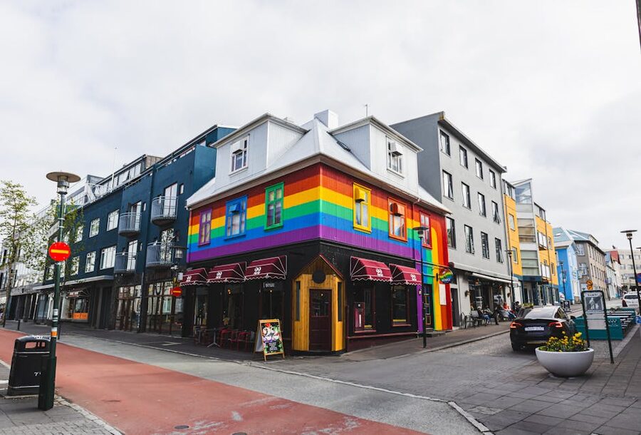
Seyðisfjörður is 30 minutes from Egilsstaðir over Route 93’s mountain pass. The drive is properly spectacular and the village itself is a fjord-side pocket of colourful 19th-century timber houses, many of which were prefabricated in Norway and shipped over. The rainbow-painted street leading to the blue Lutheran church (Bláa Kirkjan) has become one of Iceland’s most photographed streets. The road over the pass closes in winter from time to time but is reliable in summer.
Stop at Fardagafoss on the way over the pass, a 45-minute round-trip walk to a small waterfall that almost no one visits. Hotel Aldan in central Seyðisfjörður is split across two historic buildings (the bank and the post office) and is genuinely lovely. If you’d rather sleep practically and skip the morning drive back over the pass, stay in Egilsstaðir at Icelandair Hotel Hérað or Lyngás Guesthouse.
One alternative if you specifically came for puffins: Borgarfjörður Eystri, an hour off the Ring Road from Egilsstaðir each way, is the best puffin-watching spot in Iceland. The Hafnarhólmi viewing platform hosts over 10,000 puffins each summer (May to mid-August) on wooden boardwalks that put you within a few metres of them. Free. The catch is that it’s a 2.5-hour-plus commitment including viewing time, so you’re choosing between Borgarfjörður Eystri and Seyðisfjörður today. Pick one.
Day 4 quick numbers
- Total drive: 280 km, 4 hours moving plus stops (more with detours)
- Stokksnes/Vestrahorn entry: 900 ISK (~€6)
- Petra’s Stone Collection: 1,800 ISK (~€12)
- Borgarfjörður Eystri: free, but 2.5+ hours round-trip from Route 1
Day 5: East Iceland to Mývatn
Distance: about 250 km. Driving time: 3 hours 30 minutes plus stops. Sleep: Lake Mývatn area.
From Egilsstaðir, Route 1 climbs out of the eastern valleys and crosses a long stretch of high plateau before dropping down to Lake Mývatn. The first easy stop is Rjukandi, a multi-tiered waterfall about 40 minutes out, with a five to ten-minute walk up from a parking pull-out. Allow 25 minutes.
If wildlife is a priority, East Iceland is the only part of the country with wild reindeer. They were imported from Norway in the 18th century and have only thrived here. From October to April the herds come down to lower pastures and you can sometimes spot them simply by driving slowly with your eyes open. In summer they retreat to the highlands and you’d need a guided trip to see them.
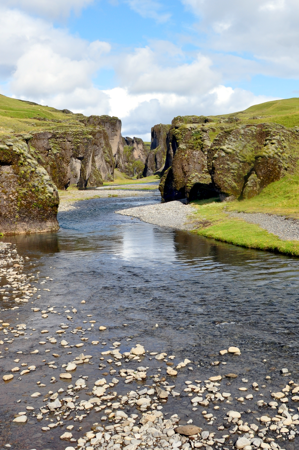
Optional detour: Stuðlagil Canyon
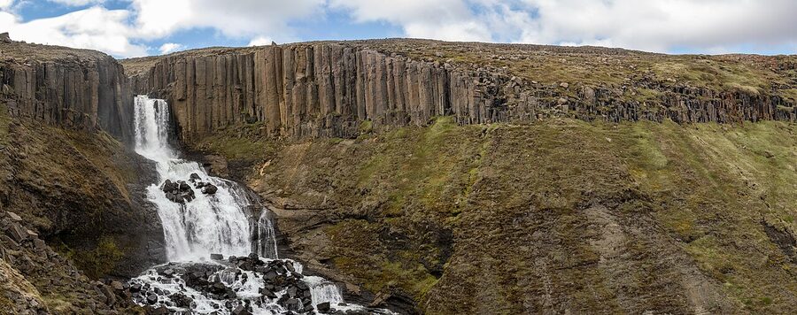
If you have an extra three hours, and you’re a photographer, Stuðlagil is worth a detour. The basalt-column canyon was only revealed in 2009 when the Kárahnjúkar hydroelectric project lowered the Jökla river’s flow, exposing what is now the largest collection of basalt columns in Iceland. To reach the more impressive east-side viewpoint, turn south off Route 1 onto Route 923 and drive 15 km to the parking area. There’s a 4 km round-trip walk to the viewpoint. Parking 1,000 ISK. The river runs vivid turquoise from March to July and silty grey later in summer.
If you take Stuðlagil, you’ll need to skip either Dettifoss or Mývatn Nature Baths today. Three big stops plus driving doesn’t fit into one day.
Dettifoss
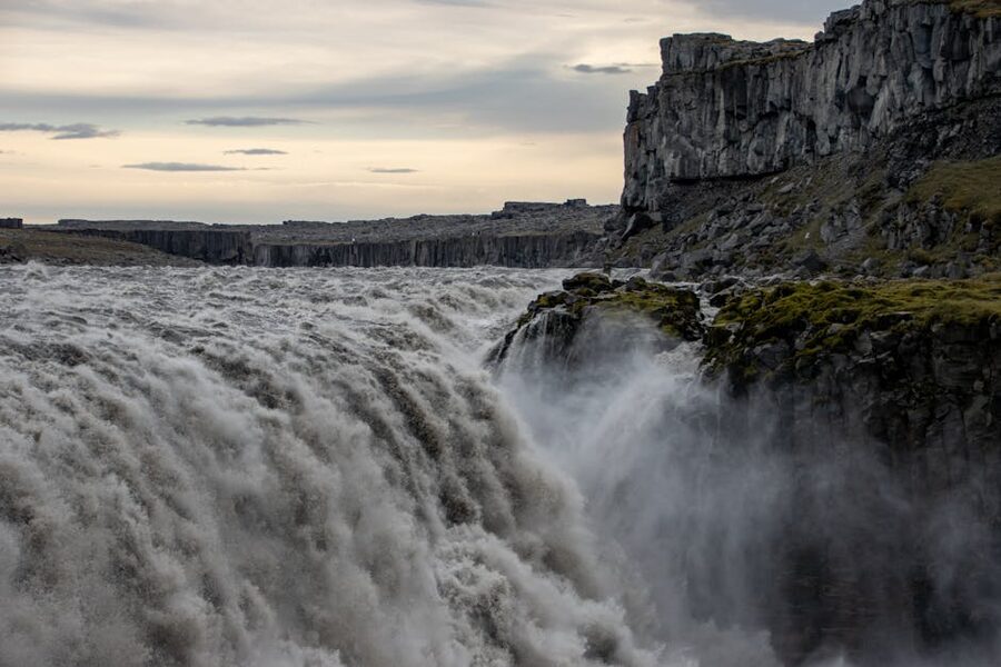
Dettifoss is Europe’s most powerful waterfall by volume, with around 500 cubic metres per second going over a 100-metre-wide, 45-metre-high drop. The scale is genuinely difficult to take in. Two roads lead to it: Route 862 on the west side is paved and leads to a slightly removed viewpoint; Route 864 on the east side is gravel and leads to a closer, more intense viewpoint. Most visitors take 862. If you have a 4×4 and the weather’s good, 864 is the better experience. Both can close in bad weather. Allow an hour, including the short walk to Selfoss upstream.
Hverir and Lake Mývatn
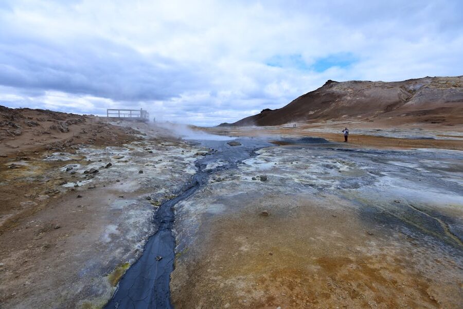
From Dettifoss it’s about 90 minutes south to the Mývatn area. Stop first at Hverir (also called Námafjall), a small geothermal area with bubbling mud pots, steam fumaroles, and iron-stained ground. The smell is sulphurous and the site is small but unforgettable. 30 to 45 minutes is enough.
End the day at the Mývatn Nature Baths. If you skipped both the Blue Lagoon and Sky Lagoon on Day 1, this is your chance for an Icelandic geothermal soak. The Mývatn baths are similar in concept to the Blue Lagoon (milky-blue mineral water, outdoor setting) but a fraction of the crowds, half the price, and with a sweeping view across the Mývatn area. Adult entry around 7,500 ISK (~€50). Bring a towel; rental is steep.
Sleep at Laxá Hótel, a design hotel a couple of kilometres from the lake with great views, or Fosshótel Mývatn, well-reviewed with an on-site restaurant. Budget travellers can look at Skútustaðir Guesthouse, a farm-stay south of the lake.
Day 5 quick numbers
- Total drive: 250 km, 3h 30min moving plus stops
- Stuðlagil parking: 1,000 ISK (~€7); add 3 hours including walk
- Mývatn Nature Baths: from 7,500 ISK (~€50)
- Dettifoss: free; both 862 and 864 access roads can close in bad weather
Day 6: Mývatn morning to Akureyri
Distance: about 110 km. Driving time: 1 hour 40 minutes plus stops. Sleep: Akureyri.
Day 6 is the relaxed day of the trip. You finish off the Mývatn highlights in the morning and drive a short two-hour leg to Akureyri for the night.
Start with Grjótagjá, the small lava cave with a hot spring inside it. Until the 1970s, locals bathed in the spring; the water has since become too hot to safely soak in. The cave got famous as a Game of Thrones filming location in 2013. 2026 update: as of March 2026, access to the cave interior is closed due to vandalism, littering and dangerously hot water. You can still view the spring from the entrance, which is what most visitors do now anyway. Fifteen minutes is enough.
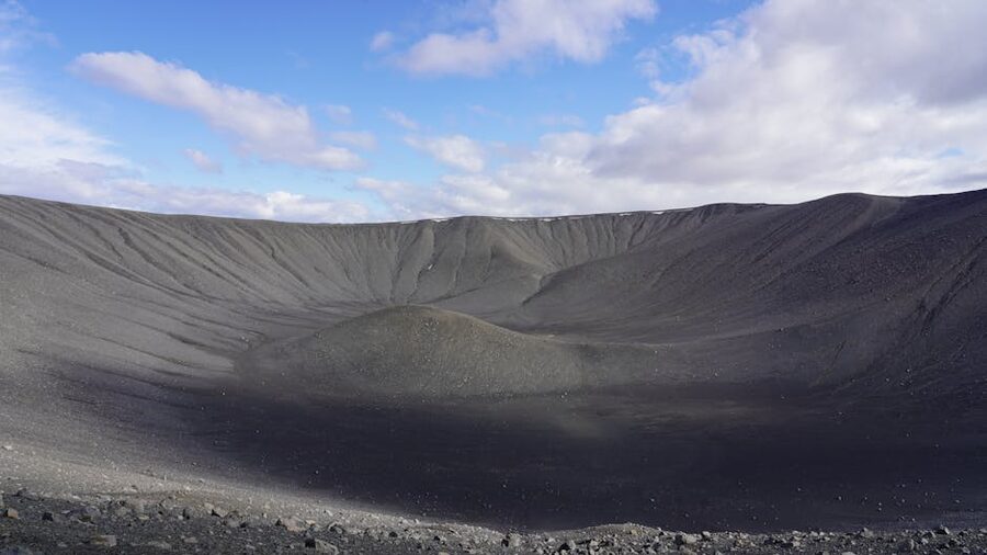
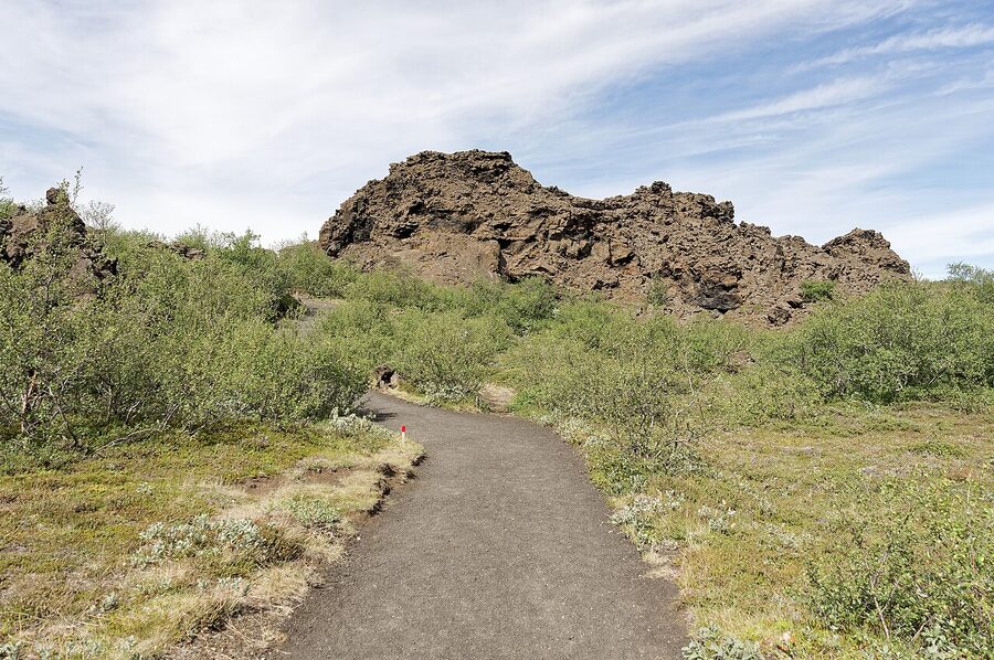
Hverfjall is a kilometre-wide tephra crater right next to Mývatn. The walk to the rim takes 15 minutes and is steep enough to feel it. If you walk the rim itself, allow 45 more minutes. The view is worth it. Then drive five minutes south to Dimmuborgir, a lava field full of striking rock formations that look exactly like the ruins of a small dark city. Several marked walks of varying lengths; the Kirkjuhringur (Church Circle) loop is the easiest. There’s a café and toilets at the entrance. 45 minutes to an hour.
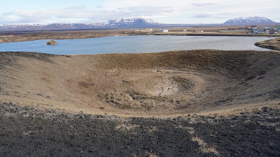
Two more quick Mývatn stops if you have time: Höfði, a small wooded peninsula with rock formations rising from the lake (30 minutes), and Skútustaðagígar, a cluster of pseudo-craters formed when lava flowed over wet ground and made steam explosions (30 minutes). Skútustaðagígar is also the area’s best bird-watching spot.
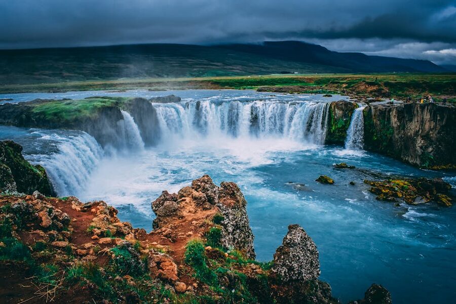
From Mývatn, head west on Route 1. The non-negotiable stop on the way to Akureyri is Goðafoss, the “Waterfall of the Gods,” named because in the year 1000 AD an Icelandic chieftain named Þorgeir Ljósvetningagoði reportedly threw his pagan idols into the falls when Iceland adopted Christianity. The waterfall is a 30-metre-wide horseshoe right off Route 1; you can’t miss it. Viewpoints from both banks. 30 minutes.
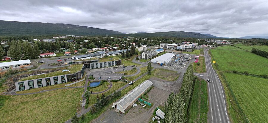
Akureyri (“the capital of the north”) is the largest town in north Iceland, with a population of about 19,500. It’s the proper “town” stop of the trip and if you arrive by mid-afternoon you’ll have plenty of time to explore. Things I’d do here:
- Forest Lagoon. Opened in 2022, sits in trees overlooking Eyjafjörður, has a sauna and a cold plunge, and is a fraction less crowded than the Blue Lagoon. If you skipped Vök and Mývatn, this is your last chance for an Icelandic geothermal soak. Adult entry around 6,990 ISK (~€47). 90 minutes is enough.
- Akureyrarkirkja. The church above the town. Walk up the steps for the best view down over the harbour and fjord.
- Bæjarins Beztu Pylsur in Akureyri is a hot-dog stand worth knowing about. So is the Brynja ice-cream parlour, which has been making the same single soft-serve flavour since 1939 and queues out the door on summer evenings.
- Dinner. Akureyri’s restaurant scene is surprisingly good for a town this size. Kaffi Ilmur does decent local food in a 100-year-old timber house; Strikið upstairs has the best fjord view.
Sleep at Hotel Kea, the central 4-star where I have stayed and would book again, or any of the smaller central guesthouses.
Day 6 quick numbers
- Total drive: 110 km, 1h 40min moving plus stops
- Forest Lagoon: 6,990 ISK (~€47)
- Goðafoss: free, parking free
- Akureyri municipal pool: 1,400 ISK (~€9), one of the better small-town pools in Iceland
Day 7: Akureyri to Reykjavík
Distance: about 380 km. Driving time: 4 hours 30 minutes plus one detour. Sleep: Reykjavík.
Day 7 is the second-longest driving day, and the one that catches people out. 380 km on the odometer before any detours. Start by 9am if you can, and stop driving by mid-afternoon. Two genuine detour options on the way back, and you can only sensibly do one.
Option A: the Vatnsnes Peninsula
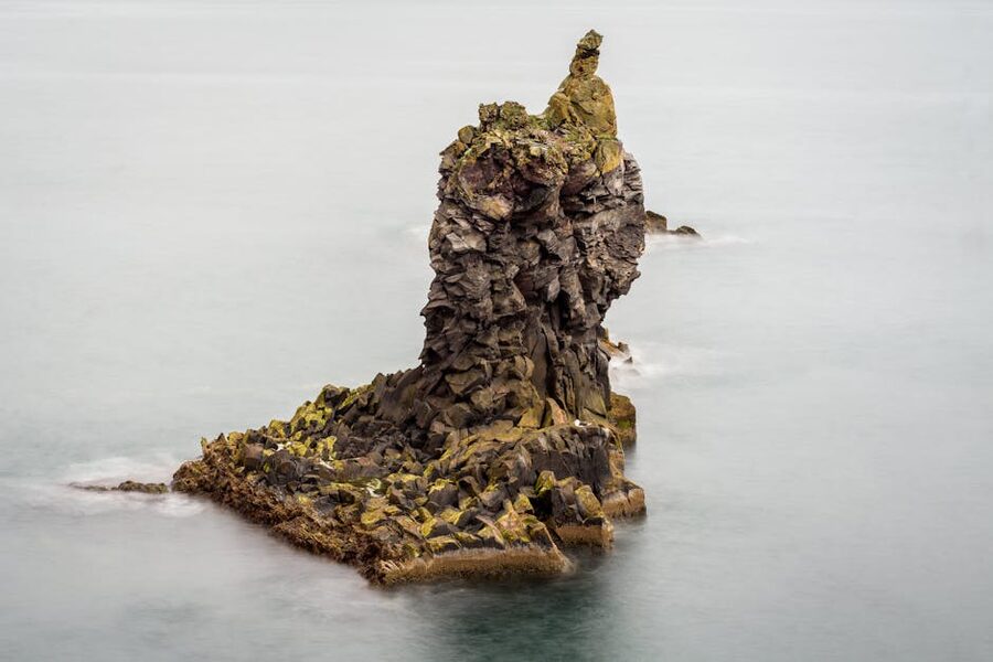
A 2 to 3-hour detour adds Hvítserkur, the basalt sea stack often described as a rhino, and the Icelandic Seal Center at Hvammstangi. East Iceland is the only place to see reindeer; Vatnsnes is one of the best places to see seals, both wild and at the dedicated research centre. If the sky cooperates, Hvítserkur at sunset (or, in summer, late evening) is one of the classic Icelandic photographs.
Option B: Grábrók and Kolugljúfur
A less time-consuming pair of stops closer to Borgarnes. Grábrók is a 3,000-year-old volcanic crater with a 30-minute climb to the rim on wooden steps and a gravel path. Views from the top extend to the Snæfellsnes Peninsula on a clear day. It is a perfect leg-stretcher between long drives. Kolugljúfur is a narrow canyon with a dramatic waterfall just off Route 1, worth 25 minutes.
If you’re a photographer chasing a signature shot, pick Vatnsnes. If you want a gentler day with the option of a Borgarnes overnight, pick Grábrók and Kolugljúfur.

Either way, you’ll pass Borgarnes, a small coastal town an hour north of Reykjavík with a genuinely good Settlement Centre that covers the saga period and the original Norse arrival in detail. If you’re sleeping in Borgarnes rather than Reykjavík tonight (which is a sane move if your Day 8 flight is mid-morning), Hotel Hamar is a comfortable mid-range option. Otherwise, push through to the city.
Sleep in Reykjavík at one of the central options. Hotel Rangá is technically east of the city but worth knowing about if your last night is more about northern lights spotting than urban dinner. In central Reykjavík itself, KEX Hostel and Guesthouse Galtafell are the budget and mid-range options I’d consider.
Day 7 quick numbers
- Total drive: 380 km, 4h 30min moving plus detour
- Hvítserkur: free, parking free
- Icelandic Seal Center: 1,500 ISK (~€10)
- Grábrók: free, signposted on Route 1, 30-minute climb to rim
Day 8: Reykjavík and the flight home
You’ve effectively driven the loop. Day 8 is the buffer day for whatever you’ve still got planned and your departure. Reykjavík rewards a half-day of proper exploration:
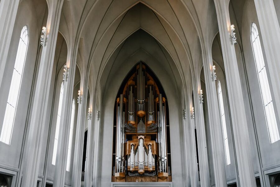
- Hallgrímskirkja. The 74-metre concrete church on the hill, modelled on the basalt columns at Svartifoss you saw on Day 3. Take the lift up the tower for arguably the best view of the city, around 1,500 ISK (~€10).
- Sun Voyager. The stainless-steel sculpture on the waterfront near Harpa. The artist insisted it’s a “dream boat” rather than a Viking ship, but everyone reads it the other way. Iconic Reykjavík photograph.
- Harpa Concert Hall. Glass building by the harbour, designed by Olafur Eliasson. Worth a wander whether or not you’re going to a concert.
- Laugavegur. The main shopping street, lined with souvenir shops and Icelandic-design boutiques.
If you skipped both the Blue Lagoon and Sky Lagoon on Day 1, today is the better day for either. A long soak after seven days of driving is genuinely lovely, and the Sky Lagoon’s 4pm to 7pm window is usually the quietest. Pre-book a slot.
For more on Reykjavík beyond the airport-day list, see the dedicated Reykjavík city guide with my full take on the neighbourhoods, restaurants and what to skip.
Then it’s the airport drive (40 minutes from central Reykjavík to Keflavík), the rental return, and home. The summer queues for car drop-off are real. Budget an hour at the rental return office, especially in July and August.
What this itinerary skips, and why
Seven days of driving means real trade-offs. Here’s what I leave out, and what I’d add if you had eight or nine days instead.
- The Snæfellsnes Peninsula. Often called “Iceland in miniature”: glacier, waterfalls, lava fields, black sand beaches packed into one peninsula. Deserves at least a full day, ideally two. If you have eight or nine days, this is the first thing I’d add, slotting between Borgarnes and Reykjavík on Day 7 or 8.
- The Westfjords. One of the most remote and dramatic parts of Iceland. The roads are slow and the distances stack up. Budget three extra days minimum for a proper Westfjords trip. The Westfjords are not a “fit it in” addition to a 7-day Ring Road plan; they’re a separate trip.
- The Highlands. Only accessible in summer via F-roads that need a real 4×4 with high clearance. Landmannalaugar is the most popular destination. Possible as a long day-trip from the south coast with the right vehicle, but not on a tight 7-day Ring Road.
- Húsavík and whale-watching. Mentioned as an option on Day 5. Not in the main line because it’d cost you something else. If whale-watching is non-negotiable, add an extra day in the north.
- The Tröllaskagi Peninsula. The fjord-fingered detour between Akureyri and the west, including Siglufjörður and the swimming pool at Hofsós. Lovely with an extra half-day on Day 7.
- Krafla Crater area. Often included on Diamond Circle itineraries. I skip it here because it overlaps significantly with Hverfjall and Hverir, both of which are already in the Day 5–6 plan.
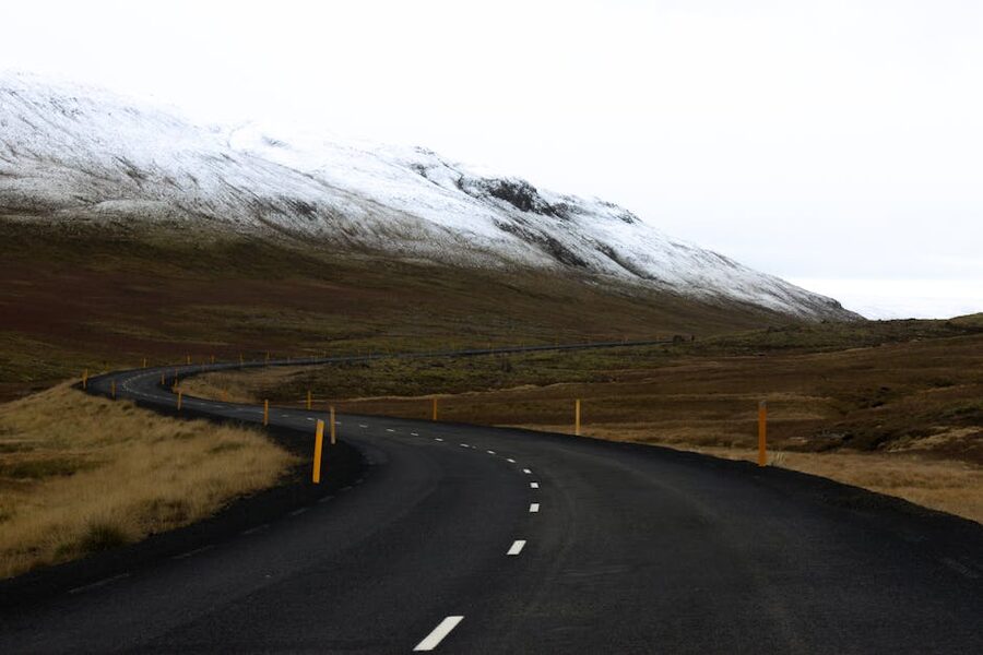
If you’re going in winter
I’d generally suggest skipping the full Ring Road in winter and focusing on the south coast instead. Sections of Route 1 close regularly between November and March (the East Fjords stretch between Breiðdalsvík and Egilsstaðir is particularly prone), winter daylight in Iceland drops to four or five usable hours in December, and a 300 km driving day can eat all of it and leave you arriving in the dark having seen nothing. Storms can also throw any plan in the bin in 24 hours.
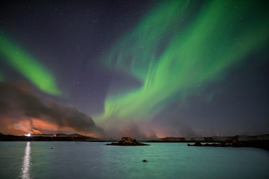
If you’re set on doing it, budget at least 10 days for the loop, rent a 4×4 with proper winter tyres (a 2WD is not enough), and have a backup plan for every overnight in case a road closes. Check road.is and the SafeTravel Iceland app obsessively. The northern lights season runs roughly mid-September to mid-April, and the loop in late September or early October sometimes works as a compromise: shoulder weather, longer days than December, and a real shot at the aurora. I’ve covered the aurora-specific planning in when and where in Iceland for the northern lights.
If the northern lights are the main reason you’re considering a winter loop, also consider that Tromsø in Norway and Abisko in Sweden are statistically more reliable for clear skies. See the Tromsø vs Abisko comparison for the trade-offs.
Getting there: flights and ferries
Most travellers fly in to Keflavík (KEF). Icelandair, Play and PLAY’s competitors run routes from most major North American and European cities. From the UK, expect 3 hours direct from London or Manchester. From mainland Europe, 3 to 4 hours from Frankfurt, Copenhagen or Paris. From the US east coast, 5 hours from Boston or New York.
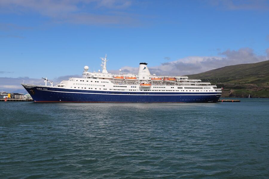
The single ferry option is the Smyril Line route from Hirtshals (Denmark) to Seyðisfjörður (Iceland), via the Faroe Islands. It runs once a week, takes 2 to 3 days each way, and you can take a car. It’s an experience and a half if you have the time. It’s not cheap and it’s not fast.
The 7-day Ring Road, summarised
Total distance: about 1,500 km of driving over seven days. Total cost for two: roughly €4,500 to €6,500 mid-range. Best window: mid-June to early August for endless daylight and the best chance of weather that doesn’t fight you. Direction: anti-clockwise unless you have a specific reason otherwise. Skip the Westfjords, slow down for the Eastfjords, eat the langoustine in Höfn, treat Reynisfjara like the dangerous coastline it is, and book Vík and Mývatn months ahead.
The single piece of advice I’d give that nobody else gives, after two laps of the loop: leave time on the schedule for nothing in particular. The best moments of both my Iceland trips were not Skógafoss or Jökulsárlón. They were a layby on the Eastfjords road where the cloud lifted off Streiti for ten minutes, a coffee from a thermos at a pull-out near Möðrudalur, and a pod of common dolphins running alongside the ferry from Heimaey at midnight. Build buffer into each day. Iceland rewards looking up at the right moment, not ticking off the next stop.