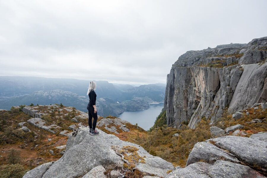
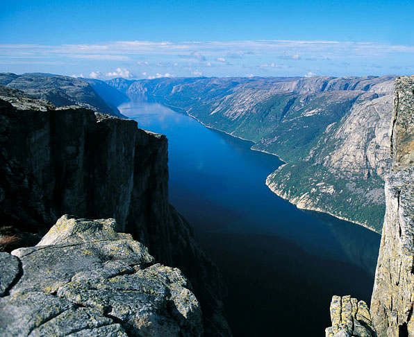
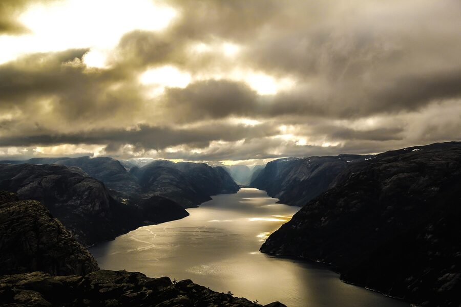
Pulpit Rock sits 604 metres above the Lysefjord. There are no railings. The platform is roughly 25 by 25 metres of bare granite that ends in a clean vertical drop, and on a still day in July the queue for the photo at the corner cycles every ninety seconds. Roughly 350,000 people make the hike each year, more than walk to Trolltunga, and a handful die on it. The walk from the trailhead is 8 kilometres return, takes about four hours at a steady pace, and starts twenty minutes outside Stavanger by bus. None of which the official trail page tells you in plain language.
The interesting trick of a trip to Stavanger is that you are doing two things, and most guides treat them as the same thing. They aren’t. Stavanger is a small city of 130,000 people that walks in 90 minutes and rewards a slow day. Preikestolen is a hike that rewards an early start and a willingness to share the cliff with several hundred strangers. You can do both in 48 hours. You can do them well in three.
This is the version of the trip I’d send a friend, with the prices, the bus times, the where-to-eat list, the cliff-edge truth nobody puts in a tourism-board paragraph, and the alternatives if the hike isn’t on. I’ve done it in a wet October and a clear June, and the answer to the question of which trip is “right” is mostly about how much weather you’re willing to absorb.
In This Article
- The decision tree, before anything else
- Stavanger walks in 90 minutes
- Gamle Stavanger and the 173 white houses
- The Domkirke is older than England’s Magna Carta
- The Norwegian Petroleum Museum is genuinely good
- The three swords and the kingdom
- Nuart and what’s on the walls
- Where the city eats
- Where to stay
- Stavanger logistics, briefly
- Preikestolen and what it actually is
- Getting to the trailhead from Stavanger
- The hike, kilometre by kilometre
- The cliff edge, plainly
- When to hike, and when not to
- What to bring
- Lysefjord by boat: the alternative
- Kjerag, for the harder version
- One day, two days, three days: the verdict
The decision tree, before anything else
Three scenarios cover most of what people want from this corner of Norway, and the right answer is almost always one of them.
One day, only the hike. Fly in from Oslo or Bergen the night before, sleep in Stavanger near the bus station, take the 07:00 Tide bus to Preikestolen, hike up, hike down, eat in Stavanger that evening, fly out. Tight, doable, and you have seen exactly one thing.
Two days. The version most people should do. Day one is the hike. Day two is Stavanger, slow: Gamle Stavanger before the cruise ships, the Domkirke at noon, the Norwegian Petroleum Museum after lunch, dinner somewhere with cod on the menu and a window onto Vågen. This is enough time to make the trip feel coherent.
Three days. Add the Lysefjord cruise, the Iron Age Farm at Ullandhaug, a beach afternoon at Sola, and an evening walk through whatever the most recent Nuart festival left on the walls. Stavanger turns into a small destination rather than a hike base.
If the forecast for your hike day is grim and you don’t have a buffer, take the Lysefjord cruise instead. The weather rarely cancels the hike entirely, but a heavy fog day at the top is a real disappointment when you’ve walked four hours for a view of cloud.
Stavanger walks in 90 minutes
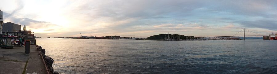
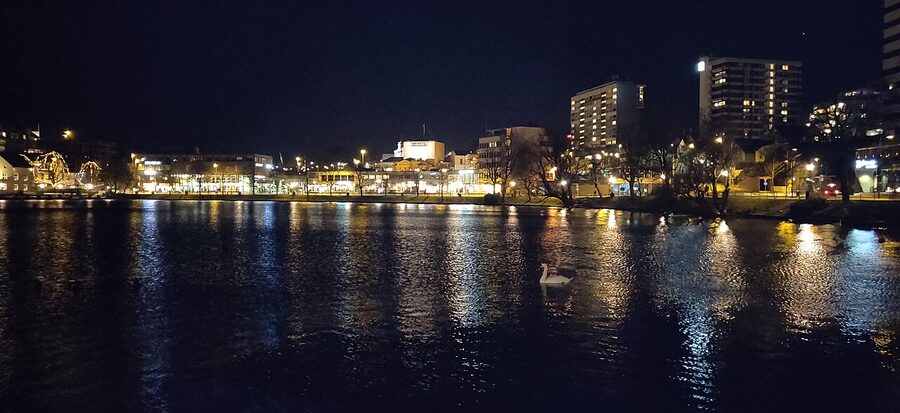
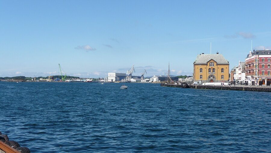
The shape of Stavanger is unusual for a Norwegian city. The harbour, called Vågen, runs north into the centre and the old town wraps around the western side of it. The cathedral sits at the inland end of the water. The Petroleum Museum sits at the harbour mouth, on the eastern shore, in a building shaped like the rig decks it explains. Everything you’ll do in Stavanger sits inside a circle a kilometre across, and the centre of that circle is the harbour itself.
This is not a city that needs a transport plan. The bus station is a 12-minute walk from the cathedral. The airport bus drops you at the bus station. Most hotels are within five minutes of the harbour. If you are basing yourself anywhere in town you’ll likely never use a taxi, and the Kolumbus city bus app is only worth installing if you’re heading out to Sola or Ullandhaug.
Stavanger is also flat by Norwegian standards. There’s a small hill behind the cathedral, called Valbergtårnet, with a watchtower at the top and a 360-degree view of the city, but most of the centre sits at sea level. The local joke is that the only real climb in Stavanger involves a four-hour walk to a cliff.
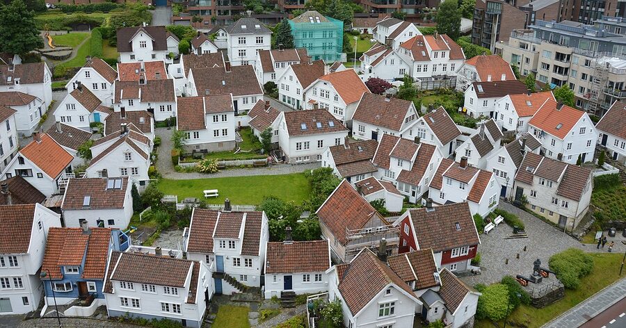
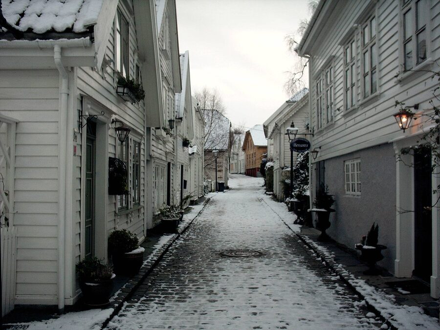
Gamle Stavanger and the 173 white houses
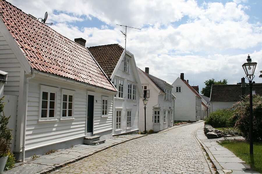
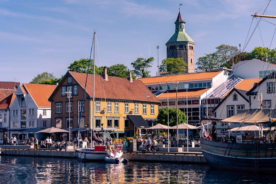
Cross the harbour from the cathedral side and you walk into Gamle Stavanger, the wedge of old wooden city that survived because it was unfashionable for long enough not to be torn down. There are 173 protected white houses on cobbled lanes that follow the slope of the western shore, and unlike Bryggen in Bergen, these are still mostly residential. People live here, hang washing in the back gardens, complain about tourists peering in the windows. The lanes are narrow enough that two prams don’t pass.
Most of the houses you walk past were built in the boom that ran from the 1810s through the 1860s, when Stavanger turned itself into the herring capital of northern Europe. Three good runs in a row, an enormous shoal that came inshore most years between 1820 and 1870, and the city’s population trebled. The wooden houses went up fast on what had been gardens and farmland on the western shore. When the herring stopped coming in the 1870s the city pivoted to sardine canning and the same houses housed the canners.
The houses are low and tight together, painted white because the trade ordinance from the 18th century said so and because a coat of white paint was the cheapest weatherproofing. Window boxes, slate roofs, wooden gutters that drip onto your head if you walk too close after rain. There are flagpoles in some of the gardens and rosebushes in most of them. It is, to be plain, very pretty, and it gets unpretty fast on a cruise-ship day between 11:00 and 14:00 when the Royal Caribbean disgorges three thousand people through it. Get there at 09:00 and the lanes are empty except for a couple of locals walking a labrador.
The Norwegian Canning Museum is worth the 110 NOK (~€9.50) entry. It’s a small museum about sardine canning, which sounds dull and isn’t. From roughly 1880 to 1970 Stavanger ran on canning fish, and at its peak there were around seventy canneries in the city, employing women who did the soldering and labelling on long lines of zinc tables. The museum has the original presses, the labels (the old ones are genuinely good design), and on the first Sunday of the month they fire up the smoking ovens and you can taste fresh-smoked sardines off the line. Open Tuesday to Sunday 11:00 to 16:00, closed Mondays.
If you only have an hour, walk up Øvre Strandgate from the harbour, cut left along Hammergate, drop down past the canning museum, and come back along the lower path. That loop hits the best bits of the old town and ends you back at Vågen for a coffee. If you have two hours, add the climb up Valbergtårnet for the view.
The Domkirke is older than England’s Magna Carta
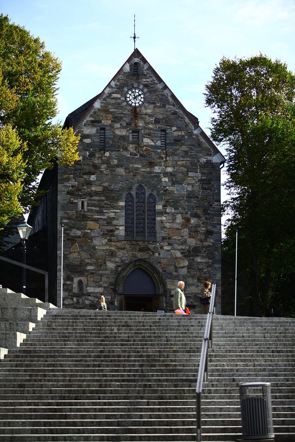
Stavanger Domkirke is the oldest cathedral in Norway still in continuous use, founded in 1125 under King Sigurd Jorsalfar. That date matters: it puts the foundation of this building 90 years before the Magna Carta, 246 years before the Black Death reached the city, and roughly the same year the first Notre-Dame in Paris was getting a major rebuild. Stavanger as a town exists because the cathedral was built here. The first bishop, Reinald, was an Englishman from Winchester who sailed up the coast with masons and chose this spot for the diocese.
The cathedral itself is small by European standards. The Romanesque nave is pure 12th century, all rounded arches and thick walls and slit windows. The Gothic chancel at the eastern end is a late 13th-century replacement after a fire of 1272 destroyed the original. The contrast between the two halves is the easiest way to read the building: stocky, sober, archaic in the nave, taller and more confident with bigger windows in the chancel. There is a 17th-century pulpit in the south wall that’s a piece of high-Baroque carved wood, donated by a local merchant whose face appears on it twice. Lutheran cathedrals don’t go in for ornament, and the Domkirke is mostly bare stone, but the pulpit and the painted epitaph paintings on the columns are worth a slow look.
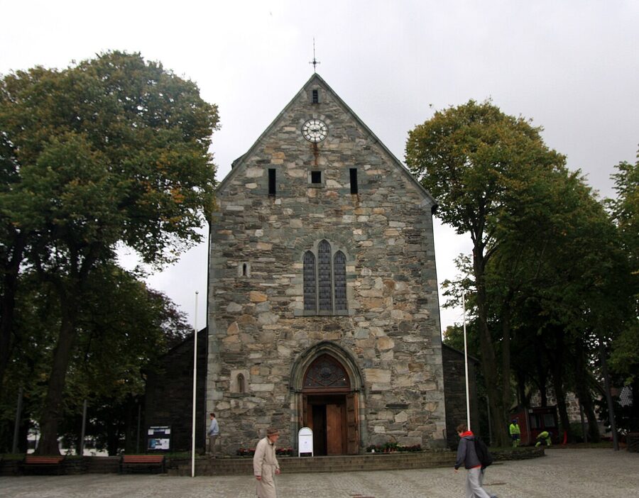
Entry is 60 NOK (~€5.20), open Monday to Friday 10:00 to 16:00 and Saturday 10:00 to 14:00, with Sunday morning reserved for services. There’s a cafe in the south transept that does a decent flat white if you’re in the area at 11:00. The graveyard outside is small and well kept, and the fountain at the western end of the square is the original 1860s ironwork.
The Norwegian Petroleum Museum is genuinely good
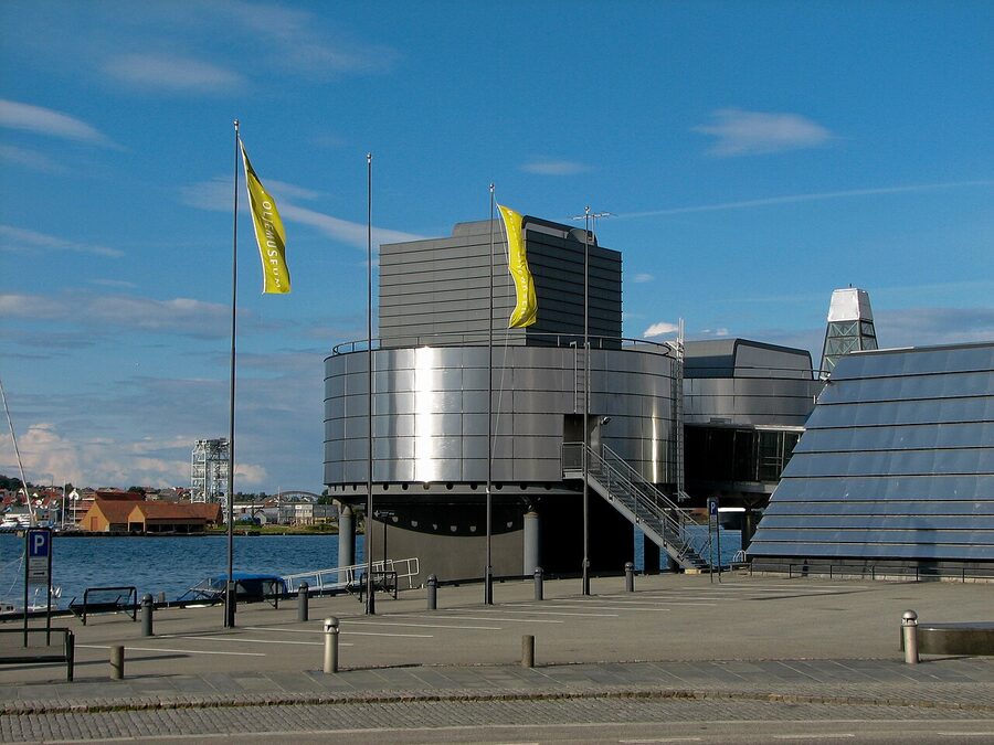
This is the museum almost everyone tells you to skip and almost everyone is wrong. It explains how Norway became Norway, which is to say a country that was poor in 1965 and one of the wealthiest per capita in Europe by 1985 because Phillips Petroleum hit oil at the Ekofisk field on Christmas Eve 1969, off the south coast. That single discovery, and the discoveries that followed in the 1970s, paid for the welfare state, the sovereign wealth fund (now valued at roughly 19 trillion NOK / €1.6 trillion), the public hospitals, the free universities, and indirectly the reason a Stavanger taxi driver makes more in a year than a London one.
The museum walks you through this without flinching. It includes the climate exhibit (the contradiction Norway hasn’t resolved: clean energy at home, fossil exports abroad), the safety section on the Alexander Kielland disaster of 1980 that killed 123 men, and the technical galleries on subsea engineering that I found genuinely interesting and didn’t expect to. There’s a working drilling-floor simulator. There’s a 1:1 model of a diving bell from the 1970s that’s claustrophobic to stand inside. The kids running it for school groups have read every panel and will answer questions for as long as you’re willing to ask.

Entry is 180 NOK (~€15.50). Open daily 10:00 to 19:00 in summer (June to August), 10:00 to 16:00 in winter. Allow two hours. The cafe on the upper deck has a good view of the harbour and serves a fish soup that’s better than the price suggests. Skip the gift shop oil-rig replicas; they’re plastic.
The three swords and the kingdom
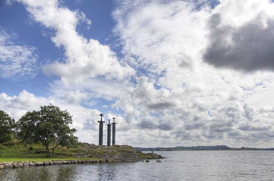
About 6 kilometres from the city centre, on a small beach on the western edge of Hafrsfjord, three bronze swords stand 9 metres tall, planted hilt-down in the rock. The sculpture is by Fritz Røed, was unveiled by King Olav V in 1983, and commemorates the Battle of Hafrsfjord in around the year 872, when Harald Fairhair defeated the last of the petty kings of western Norway and unified the country into a single kingdom. The three swords represent the three kings; the largest is Harald’s, planted deepest. They’re peace swords; they cannot be drawn.
This is the moment Norway as a political idea begins. The unification was probably less neat than the saga makes it sound, and Harald’s reign was contested for decades after, but the broad point is that the country has its origin in this bay, on this beach, in roughly the year 872, and the monument is a reasonable attempt to mark that. It’s also a 20-minute bus ride from the city (route 16, towards Madla, get off at Hafrsfjord) and a 20-minute walk back along the shore if the day is clear.
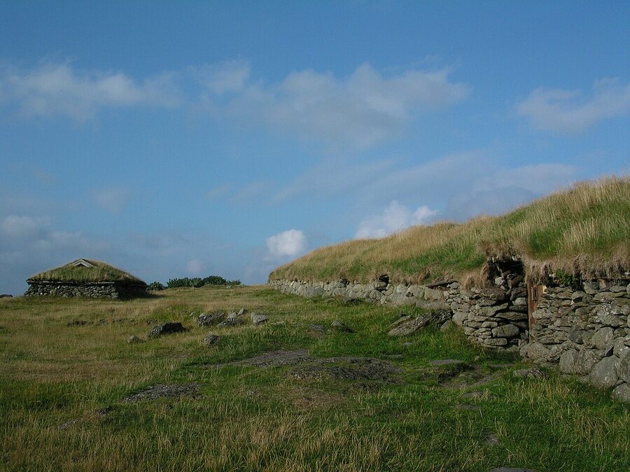
If you want to make a half-day of it, the Iron Age Farm at Ullandhaug is two stops further on the same bus and a five-minute walk uphill. It’s a reconstruction of a 4th-century farmstead on the original foundations, with a longhouse, a smithy, and grass roofs that were added by the Stavanger archaeology museum in 1972. They sometimes have demonstrations of weaving and forging in summer; check the museum’s events page before you go. Entry 90 NOK (~€7.80), May to August daily, more limited hours the rest of the year.
Nuart and what’s on the walls
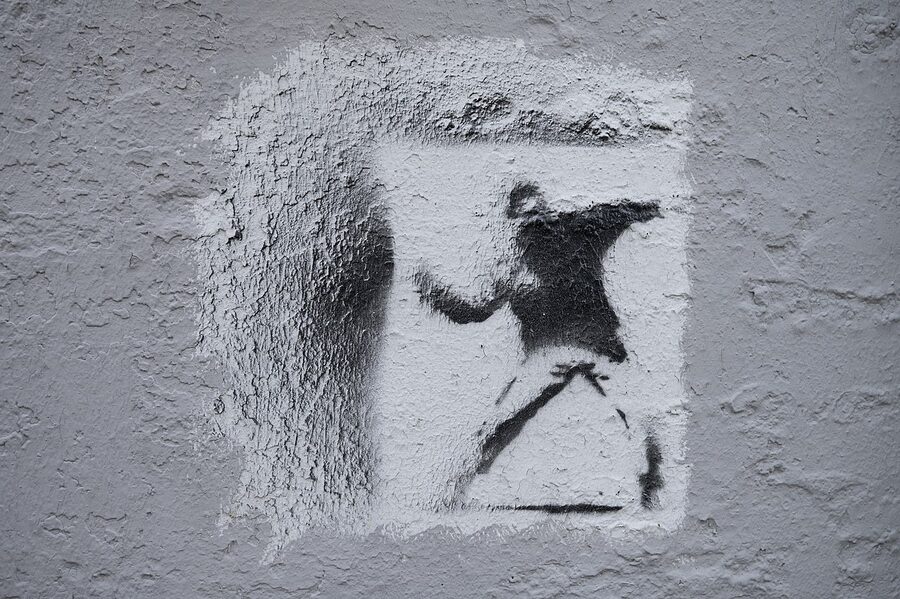
Stavanger is a street-art city, in the way Bristol or Berlin is, and that’s mostly because of one festival. Nuart began in 2001, runs every September, and has become the most influential street-art festival in Europe outside of the founding generation in the UK. The festival has commissioned work from Banksy, Vhils, Faith XLVII, Ericailcane, Pejac, Ron English, and dozens more. Most of the pieces stay up. Some are in the centre, some are on the gable ends of apartment blocks in the Storhaug district to the east, and a few are tucked in alleys you’d never find without a map.
The festival publishes an annual walking map, free on their website (nuart.no), with locations of the year’s commissions and a selection of the surviving pieces from previous years. If you have a half-day and you walk the map, you’ll see something like 25 to 35 pieces. The good ones make the walk feel like a museum that happens to be a city. The bad ones are bad. Tagging on top of commissioned work is a problem the festival doesn’t pretend to have solved.
If your trip falls in the second week of September, you can pay 750 NOK (~€65) for the Nuart Plus weekend pass and join the artist talks, the studio visits, and the live painting events at Tou Scene, the converted brewery in the east of the city that hosts most of the festival’s evenings. If your trip is at any other time, the walking map alone is enough.
Where the city eats

For a city of 130,000 people Stavanger eats an order of magnitude better than its size suggests. The reason is mostly oil money, the same reason Aberdeen had a boom in fine dining in the 1980s, and the consequence is that there is a lot of competition between a small number of very good kitchens.
The starting point is RE-NAA, the two-Michelin-star restaurant on the harbour run by Sven Erik Renaa. It is the most expensive restaurant in town (a tasting menu sits at around 3,200 NOK / €276 per person without wine), and it deserves the stars. Book three months in advance for a Friday or Saturday. If you want the same kitchen at a third of the price, walk into Renaa Matbaren in the basement of the same building. Mains 280 to 420 NOK (~€24 to €36), no booking needed for two before 19:00, and the kitchen is the same one running the upstairs tasting menu. The cod is what to order.
For sushi, Sabi Omakase is the other Michelin star in town, a tiny 10-seat counter on Pedersgata run by Roger Asakil Joya. Single seating per evening, 2,800 NOK (~€241) for the omakase, two months ahead for a booking. There’s a sister restaurant, Sabi Sushi, with a half-dozen branches around the city for a less ceremonial sushi run; the one at Skagen is closest to the harbour.

For dinner with a view of Vågen, Tango Bar & Kjøkken on Strandkaien is the reliable middle option. Mains 240 to 380 NOK, a New Nordic menu that changes monthly, and a wine list that wanders into Burgundy and back. The four-course set menu at 695 NOK (~€60) is the easy choice. Fisketorget, the fish market and restaurant on the harbour at Strandkaien, has a counter where they cook what you point to from the ice; a plate of the day’s catch with potatoes and butter is around 320 NOK and you eat it elbow-to-elbow with locals on stools. The fish soup is the cheapest decent hot lunch in the centre.
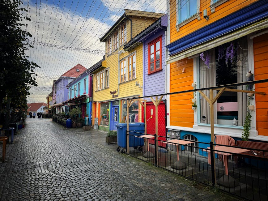
For coffee, Kokko Kaffebar on Pedersgata is the local third-wave place; the flat white is around 55 NOK and the rye sourdough they sell from the back is the best in town. Bøker og Børst, on Øvre Holmegate (the rainbow-painted street), is a bar-bookshop hybrid with a courtyard out the back, and it’s where most of the writers and design-school students drink on weeknights.
And for the most Stavanger thing you can eat, find a counter doing kavring, a dark, slightly sweet, twice-baked rye bread that’s specifically a Stavanger thing and that locals eat with brunost or smoked mackerel. Sirkus Renaa on Steinkargata, the Renaa group’s bakery and pizzeria a few minutes from the cathedral, runs a steady rotation of Norwegian baking and is the easy bet for it.
Where to stay
Stavanger has the standard Norwegian-city hotel pattern: a handful of comfortable mid-range chains in the centre, two slightly nicer business hotels at the harbour, and a small set of independents up the slope. Prices are oil-money prices, so what looks expensive isn’t, by Norwegian standards. Expect 1,400 to 2,400 NOK per night for a double in the centre, breakfast usually included.
The harbour-side default is Clarion Hotel Energy, a 268-room business hotel on the eastern side of Vågen with a rooftop bar called Lobby Bar that has the best evening view of the city. Doubles from around 1,650 NOK in shoulder season, breakfast generous and properly Norwegian (smoked fish, cheeses, pickled herring, the works).
For something more central and cheaper, Comfort Hotel Square sits two minutes from the cathedral and the bus station and runs around 1,150 to 1,400 NOK for a double. Rooms are small but the location is unbeatable for an early Preikestolen bus.
Thon Hotel Maritim on Kongsgate is the reliable Thon offering: not exciting, very functional, decent breakfast, around 1,400 NOK. It’s five minutes from the harbour. Scandic Stavanger City, near the railway station and the bus terminal, is the easiest option if you’re catching the early bus and want to be a 90-second walk from the platform. Around 1,500 NOK.
For a bigger hotel with a swimming pool, Radisson Blu Atlantic Hotel is the largest in town, sits opposite the city park, and runs 1,600 to 2,200 NOK depending on season. The lobby is a 1970s set-piece, full of original Olav V-era panelling, and the breakfast room has a panoramic view of the park.
If you’d rather sleep at the trailhead than in the city, Preikestolen Mountain Lodge (Preikestolen Fjellstue) is a 35-room cabin-style hotel right at the car park where the trail starts. Doubles from around 2,200 NOK including breakfast. The benefit is you can be on the trail at 06:00 before any bus arrives. The cost is the lodge sits 40 km outside Stavanger and you’ll likely want to come back into the city anyway. The smaller Veslebu Preikestolen BaseCamp next door has cheaper cabin and dorm options for hikers on a tighter budget.
For a beach base 15 minutes from the airport, Sola Strand Hotel sits on the long sand beach at Sola, near the runway. It’s a half-hour bus ride from the city, but the rooms look directly at the North Sea and the breakfast is the best at any hotel I’ve stayed at in Norway.
Stavanger logistics, briefly

Stavanger Airport (SVG) sits at Sola, 14 kilometres southwest of the city. Flybussen runs every 20 minutes between the airport and the bus station, takes 25 minutes, and costs 145 NOK (~€12.50) one way or 250 NOK return. There’s an SAS, Norwegian, and Widerøe link to Oslo every 30 to 60 minutes during the day; the flight is 50 minutes. Bergen is a 35-minute flight or a 5-hour drive via the Boknafjord crossings. London Heathrow is around 1 hour 50 minutes by direct BA or SAS service.
If you’re coming overland from Bergen, the Fjord Line ferry from Bergen to Stavanger takes 5 hours and runs daily in summer (less often in winter). It costs 350 to 600 NOK foot passenger one way, more with a car. The drive is faster than the ferry but the ferry has a cafeteria and a sun deck, and on a clear day the route through the islands south of Bergen is one of the better short ferry runs in Europe.
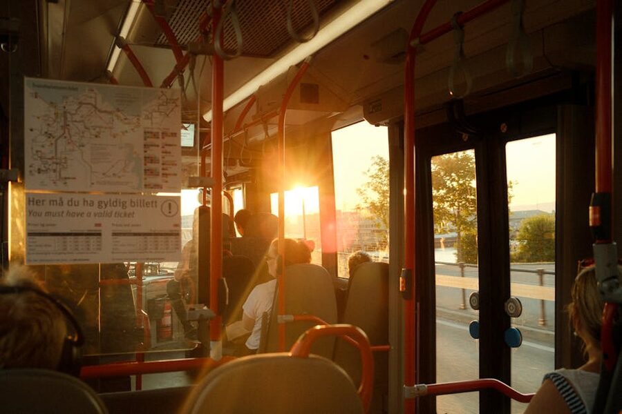
Within the city, you’ll mostly walk. The Kolumbus app handles bus tickets if you need them. Single rides are 45 NOK (~€3.90), a 24-hour pass is 110 NOK. Cycle lanes are good if you rent a bike, and the city’s electric-scooter situation is the same as the rest of Europe (chaotic, but workable). For the airport bus, buy from the driver or via the Flybussen app; they don’t take cash.
Preikestolen and what it actually is
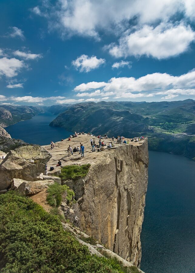
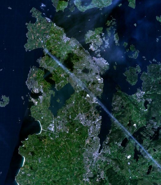
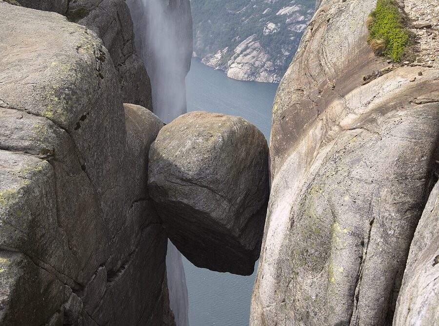
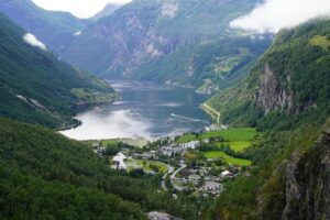
Preikestolen, in English Pulpit Rock or Preacher’s Chair, is a roughly square slab of granite jutting from the western cliff of Lysefjord, 604 metres above the water. The platform is around 25 metres on a side. There are no railings, no warning signs at the edge, no marked safe zone. The geological background is straightforward: the slab is part of the granite of the Rogaland coast, fractured along three planes, with the southern edge held by a single fissure that geologists last surveyed in 2013 and judged stable for the foreseeable future. The crack across the back of the platform that gets photographed often is real, and it’s also been there since at least the 19th century.
Around 350,000 people walk to it each year, almost all of them between May and October. It is, by some measures, the second-most-photographed rock in the world after Uluru. The hike is rated moderate by the Norwegian Trekking Association and it deserves the rating. The trail rises 500 metres over 4 kilometres, with three serious uphill sections, and it is genuinely demanding for anyone not in some kind of regular walking shape. The downhill is harder than the uphill on tired knees.
The other thing to know is that the trail used to be a much rougher scramble. Between 2013 and 2018, a team of mostly Nepali stonemasons (the Sherpa Trapper company that has rebuilt much of Norway’s heaviest-trafficked trails) built around 4,500 stone steps on the worst of the climb, replacing the old root-and-mud scramble with a steady, walkable staircase. The trail is much less treacherous now than it was a decade ago, but it is also a stone staircase for long sections, which is its own kind of awkward.
Getting to the trailhead from Stavanger
This is the part most guides get wrong, because the route changed in 2020 when the Ryfast tunnel opened and the old ferry-and-bus route became unnecessary. Here’s the current state.
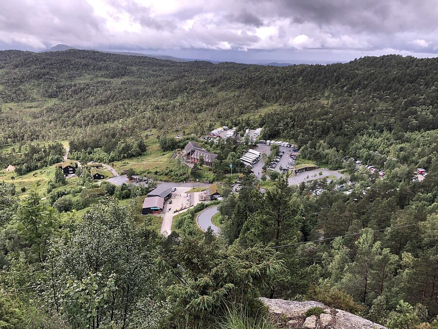
By bus. The simplest option. Tide Reiser runs the seasonal Preikestolen Express bus from Stavanger bus station (Byterminalen) to the Preikestolen Mountain Lodge car park, daily from late April to late October. The ride takes 50 minutes via the Ryfast tunnel under the Boknafjord. Price is 290 NOK (~€25) return, 200 NOK one way. There are typically 4 to 6 departures a day in peak season; the first leaves at 07:00 and the last return is around 19:30. Buy on the Tide app or at the bus station kiosk; the bus does sell out on July weekends, so book the night before if you can.
The bus drops you in the lodge car park, 30 metres from the trailhead. There’s a small ticket booth that sells the parking pass if you’ve driven (250 NOK / €21.50 per car, summer only) and a kiosk that sells overpriced sandwiches. There are toilets. There’s a cafe inside the lodge that does coffee and waffles.
By car. Drive from Stavanger via the Ryfast tunnel (toll: 190 NOK / €16.40 each way for a small car, billed automatically to your registration). The drive is 40 kilometres and takes around 45 minutes. Parking at the trailhead is 250 NOK per day, paid at the booth. The road from Solbakk to the lodge is winding but in good condition; in winter it can be closed by snow above 400 metres, in which case the trail is closed too.
By the old ferry route. The Tau ferry from Stavanger still runs (it’s the local commuter route), and you can technically get to Preikestolen via Tau and a local bus, but it’s slower than the Ryfast tunnel and there’s no good reason to do it unless you’ve decided you want a ferry ride for its own sake. The bus from Tau to the trailhead runs only seasonally and the connection times are unreliable.
If you’re staying at the Mountain Lodge itself you skip the transport entirely. The trail starts 30 metres from the front door. This is the play if you want to be on the trail at 06:00 to beat the bus arrivals and have the platform to yourself for the first 90 minutes.
The hike, kilometre by kilometre
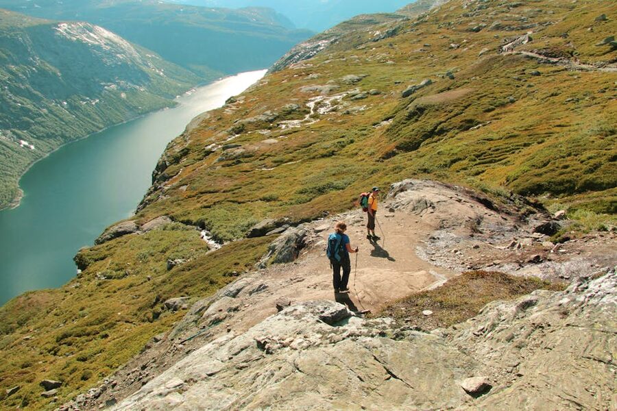
From the lodge car park you climb immediately. The first kilometre rises about 200 metres, on a stone staircase that the Sherpa team rebuilt between 2014 and 2017. This is the hardest section of the day, and there’s nothing to do except walk slowly. There are no views worth stopping for in this stretch; it’s a forest climb on stone steps. Allow 30 to 40 minutes.
The second kilometre flattens out and runs across a high marsh on a wooden boardwalk. There are 1,400 metres of duckboard here, laid in sections from 2008 onwards. You’ll cross a small lake, called Tjødnane, on its eastern shore. This is the easiest walking of the day. Allow 25 minutes.
The third kilometre is the second climb, another 200-metre rise, mostly on stone steps with some scrambling at the top over bare granite. This section is the slowest. There are pools to fill water bottles from (clean, cold, drinkable). Allow 45 minutes.
The fourth kilometre is the ridge approach. From the top of the second climb you walk a flat granite plateau for about 800 metres, with the cliff on your left and the ridge on your right. The first time the platform comes into view it’s about 200 metres ahead, lower than where you’re standing. Most people stop here for a photograph; this is the angle every postcard uses. Walk on. The trail descends slightly to the platform itself.
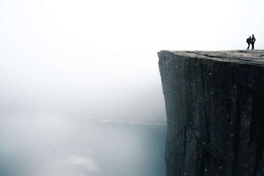
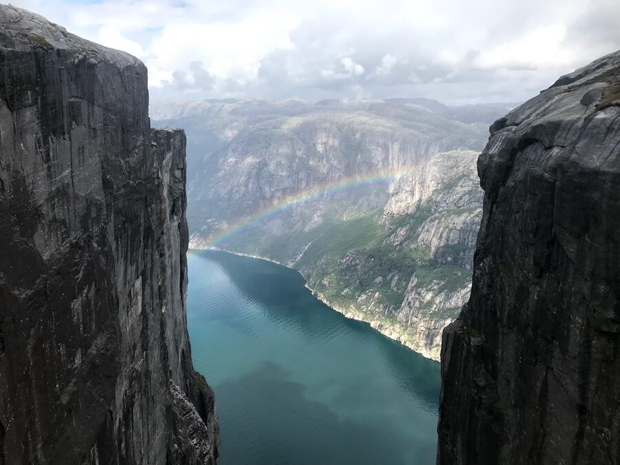
The fourth kilometre’s last 200 metres are the part nobody quite prepares you for. The trail comes onto the platform from the inland side, you take a few steps forward, and the ground is suddenly gone. The platform is wider than it looks in photographs (about 25 by 25 metres) and so most people aren’t immediately at the edge, but the change from “walking on a hill” to “standing on a cliff at 600 metres” happens in about thirty seconds.
The way back is the same trail in reverse. Allow about the same time as the climb, slightly less because most of it is downhill, slightly more because your knees will be sore on the steps. Total return walk: 8 kilometres, about 4 hours at a steady pace, longer if you stop for photographs and lunch on the platform. Five hours is normal for first-timers. Three is fast.
The cliff edge, plainly
This section exists because the official tourism page doesn’t include it, and most blogs don’t either. The platform has no railings and the rules around it depend entirely on common sense. People die at Preikestolen. The trail association doesn’t publicise totals, but the consensus among Stavanger guides is that the rate is one or two deaths every couple of years, almost all from people sitting too close to the edge with their feet over, slipping on wet rock, or being knocked over by a sudden gust. The Lysefjord channel funnels wind upwards, and the gusts on the platform on a windy day can be sudden and strong.
What this means in practice. Don’t sit with your feet over the edge. Don’t pose for the leaning-out photograph; if you slip there’s nothing to grab. Don’t let children run on the platform. If the wind is gusting, stay 4 metres from the corner. If the rock is wet from rain or fog, be even more conservative. Norwegians are remarkably relaxed about all of this; you’ll see locals sitting at the edge with their feet dangling, and they have decades of climbing in this terrain. You probably don’t.
None of this should put you off the hike. Several hundred thousand people complete it every year without incident. But it’s the kind of cliff where one moment of inattention is the whole thing, and that’s worth taking seriously.

When to hike, and when not to
The real hiking season is May to October. The trail itself is technically open year-round, but from November through April it’s snow-covered for long stretches and requires winter equipment (microspikes at minimum, often crampons, and ideally an ice axe for the icy ridge sections). Several people die on the winter ascent each decade, and the official advice from the Norwegian Trekking Association is that winter Preikestolen is for experienced winter hikers only.
The shoulder months tell their own story. April is a coin flip; the snow is usually retreating but the trail can be icy in patches and the bus only starts running in the last week. May is good once the bus is on, days are long (sunrise around 04:30 in late May), and the crowds haven’t peaked. June and July are the busiest months by far; expect 1,000 to 3,000 people on the trail on a sunny weekend day, and a queue for the corner photo. August is similar but quieter in the second half. September is the sweet spot in my view: the bus still runs, the trail is dry, the days are still 14 hours long at the start of the month, and the crowds drop by a third compared to August. October is wetter and quieter; the bus runs to late October.
The single biggest factor is weather, not season. A clear day in October is better than a foggy day in July. Check the YR forecast (the Norwegian state weather service, free at yr.no) the night before and the morning of. The forecast for Preikestolen specifically is reliable to about 12 hours out and is published at yr.no/sted/Norge/Rogaland/Strand/Preikestolen.
If you’re committed to a winter ascent, hire a local guide. Outdoorlife Norway and Go Fjords both run guided winter Preikestolen days from Stavanger, with included gear, transport, and a 1:6 guide-to-client ratio. Around 1,800 NOK (~€155) per person. Don’t try it solo unless you have winter mountain experience already; the trail is genuinely treacherous in February and the white-out conditions on the plateau are real.
What to bring
The minimum kit list, working from the feet up.
- Hiking boots with ankle support, broken in. Trainers will get you up the trail in dry summer but they’re not ideal on the wet stone steps and the descent will punish your ankles. Don’t buy new boots for this hike; the stone steps will eat virgin leather.
- Thick socks, plus a spare pair in the pack.
- Layers. The temperature on the platform can be 8 degrees colder than the car park because of altitude and exposure to wind. A thin merino base, a fleece, and a waterproof shell is the canonical Norwegian three-layer setup. Even in July, take the shell.
- Two litres of water minimum per person. There are streams to fill from on the trail (the water in Norwegian mountains is genuinely drinkable, and locals do, but use a filter if you’re not sure).
- Lunch and snacks. The kiosk at the lodge is overpriced. Pack a roll, an apple, a chocolate bar. There’s nowhere to buy food on the trail.
- Sun cream. The platform is south-facing and the granite reflects strongly. Pale-skinned hikers will burn in three hours on a clear day.
- A small first-aid kit with blister patches. The Sherpa-built steps are uneven enough to give you a hot spot if your boots aren’t well-fitted.
- Rain shell, even on a cloudless morning. The weather changes on the plateau, and arriving at the platform in a downpour wearing a cotton T-shirt is genuinely miserable.
What to leave behind: tripods (the platform is too crowded to set one up safely), drones (formally banned within the Lysefjord protected area; fines if caught), big speakers (yes, people bring them, no, don’t be that person). And if you’re carrying poles, use them; they help on the descent.
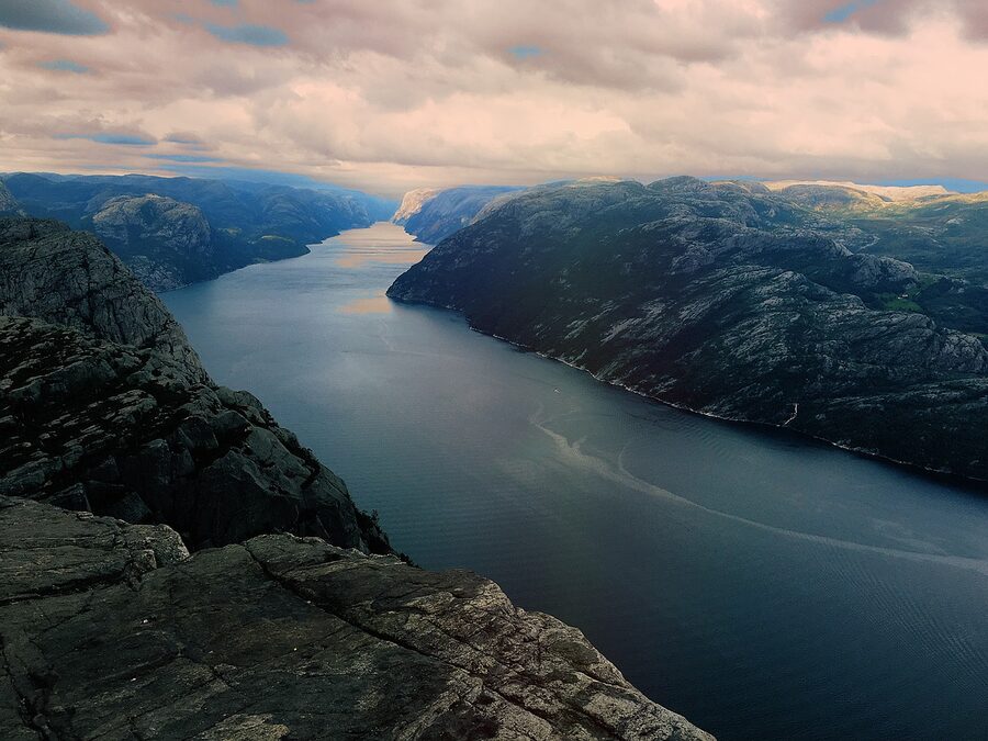
Lysefjord by boat: the alternative
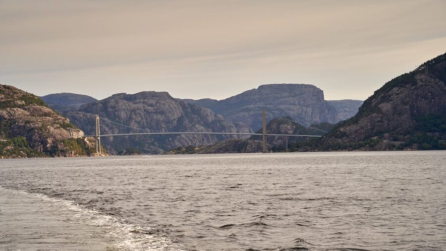
If the hike isn’t an option, or if you’ve done it and want to see Preikestolen from the other angle, the Lysefjord cruise is the alternative. Rødne Fjord Cruise runs the standard 3-hour return trip from Stavanger harbour into the fjord, getting you within about 50 metres of the base of the Pulpit Rock cliff and stopping at Hengjane waterfall before turning. The boat goes most of the way to Lysebotn at the head of the fjord, but doesn’t quite reach it. Departures are at 10:00 and 14:00 in summer, less often in shoulder season; the price is around 690 NOK (~€59) for adults. Heated indoor saloon, outdoor decks, a small cafeteria.
The cruise is less dramatic than the hike but it shows you something the hike can’t: the scale of the fjord from the water. Standing on the platform you see the fjord; from the boat you see how high the platform is. Both views are worth having; if you have three days, do both.
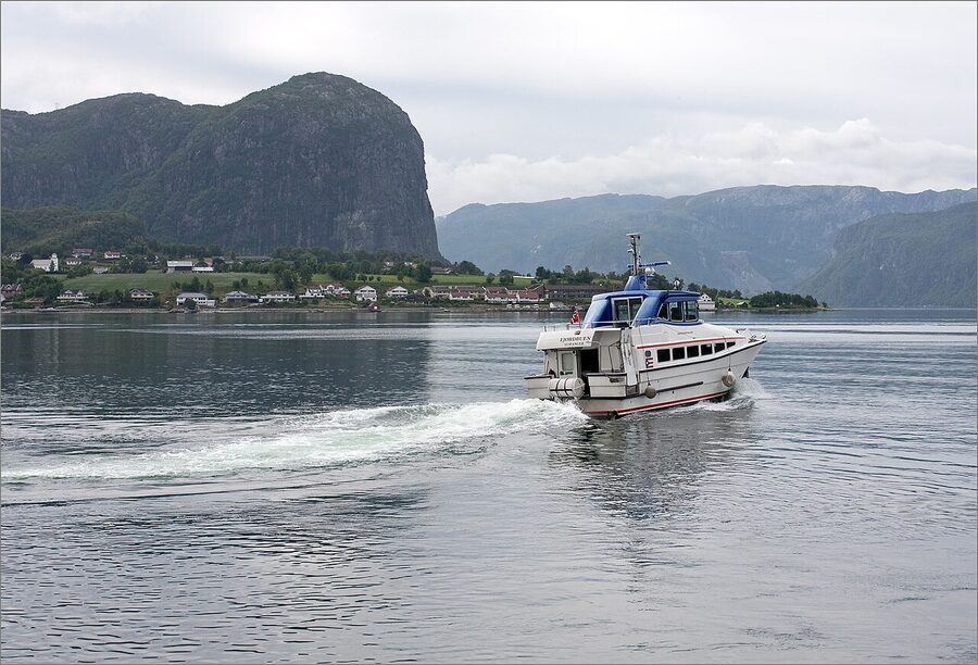
For a more atmospheric trip, look at Norled’s car ferry from Lauvvik to Lysebotn (summer only, end of May to early September). It’s a 2.5-hour ride to the inland end of the fjord, which is the deepest point and the cliff section. It costs around 280 NOK (~€24) one-way as a foot passenger, and it returns the same way. Far fewer tourists, far slower, and the view is the slow reveal of the fjord rather than the back-and-forth of the cruise.
Kjerag, for the harder version
If you’re a confident hiker and you’ve already done Preikestolen, or you want a less crowded version of the same idea, Kjerag is 50 kilometres further into the Lysefjord and 480 metres higher. The plateau sits at 1,084 metres above sea level. The hike from the Øygardstøl car park is 12 kilometres return, with three serious climbs (the Norwegian name for this kind of hike is a “tre-kneik”, three knees), and takes 6 to 7 hours. It is a properly hard day-hike.
The reward is the Kjerag plateau itself, with views down the full Lysefjord, and the Kjeragbolten boulder: a roughly 5-cubic-metre rock wedged into a vertical chimney 984 metres above the water. If you want the leg-dangling photo, that’s where it is. The drop beneath your feet, if you stand on the boulder, is just under a kilometre; the catch on getting onto the boulder is a 1-metre step from the side of the chimney with no handholds.
Logistics. The seasonal bus from Stavanger to Øygardstøl runs from late May to mid-September, taking around 3 hours each way and costing 590 NOK return. Most people who do Kjerag stay overnight at Lysebotn or drive themselves; the day-trip from Stavanger by bus is technically possible but tight. The trail is open from June to September only; outside that window the road to Øygardstøl is closed by snow.
If you have one day at the cliff edge, do Preikestolen. If you have two days and you’re a comfortable hill walker, do Preikestolen one and Kjerag the other. They’re different trips.
One day, two days, three days: the verdict
Two days is the answer for most people. One day works if all you want is the photo at the cliff. Three days is what the trip becomes when you decide Stavanger is a place to spend time rather than a place to leave on the 07:00 bus. If your trip is part of a wider Norway loop, two days plus the morning of a third (for the Petroleum Museum) is plenty.
If you’re chaining cities, Stavanger is the easiest add-on to Oslo: a 50-minute flight, daily, and a different feel for the country. From Bergen the ferry is the more interesting choice, even if the drive is faster; the route through the islands south of Bergen is one of the better short ferry runs in Europe. If you’re heading north afterwards, the standard Norwegian routing is Stavanger to Bergen, then up the coast to Lofoten by air, and then back overland on the Bergen Line via the Flåm branch. If your trip is in winter and you’re chasing the lights instead of the cliff, the Stavanger trip swaps for the comparison piece on Tromsø versus Abisko further north.
The other thing the trip teaches, if you do it slowly, is that Stavanger is not a small Bergen. It’s a smaller, flatter, oil-funded, slightly more confident city with its own architecture and food and history. Bergen is the obvious second-city option in western Norway. Stavanger is the less obvious one, and it rewards a closer look.
Walk back from the Pulpit Rock platform on a clear evening in late June, the sun still well above the horizon at 21:00, and the descent is slow and quiet. The bus back into Stavanger leaves at 19:30 in summer, and the harbour is still in evening light when you arrive. The fish soup at Renaa Matbaren is open until 22:00. That’s the version of the day that makes the trip make sense.
.jpg)
.jpg)