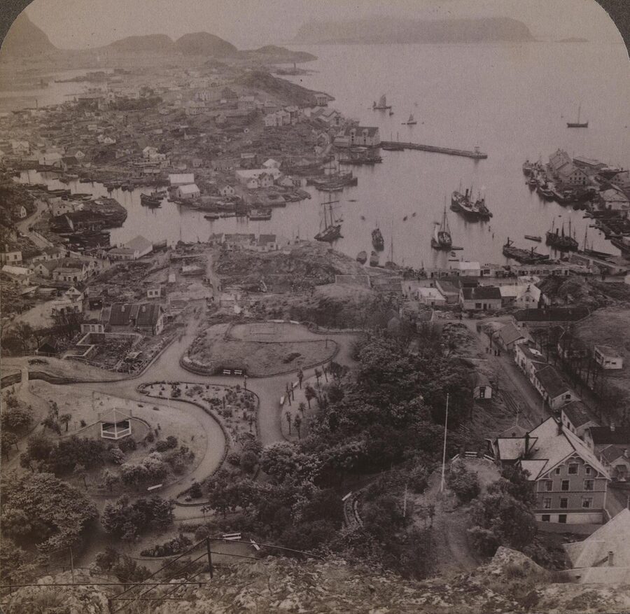
Geiranger has 250 winter residents and roughly 800,000 visitors a year. Most of them come ashore between 09:00 and 16:00, in summer, off cruise ships, and the village population multiplies by something close to thirty when six hulls are tied up at once. The first time I worked that out on the wooden bench by the kayak shed I thought I had the maths wrong. Then a Hurtigruten pulled in and I watched 800 people walk past me in the time it took to drink a coffee. The fjord that UNESCO inscribed in 2005 as one of the most scenically outstanding pieces of geology on the planet is, for a quarter of every day in summer, a queue.
That is the working brief for this guide. Geirangerfjord is worth every kilometre you will drive to get to it, and the postcard side is as good as the photographs suggest. The practical version of the trip is shaped by three things the listicles bury: the cruise-ship rhythm of the village, the fact that the road over Trollstigen and the road up Dalsnibba are both seasonal closures, and the slow-motion landslide on the Åkerneset cliff that the Norwegian state pays geologists to watch full-time. I have done the fjord twice, once as a cruise stop in May and once on a five-day base out of Stranda in late September, and I will say which version is which.
In This Article
- The 15-kilometre branch nobody calls by its proper name
- When to go, plainly
- The cruise-ship reality, in numbers
- The Seven Sisters, the Suitor and the abandoned farms
- The Skageflå hike: do this if you do nothing else
- Dalsnibba: 1,500 metres of altitude and a road that costs to drive
- Eagle Road, Ørnesvingen and the photo nobody owns
- Trollstigen: the road, the closure, the verdict
- The fjord cruise: the right one and the wrong one
- Kayaking: the option the brochures rarely show
- The Norwegian Fjord Centre and the slow landslide
- Where to base: Geiranger, Hellesylt, Stranda or Ålesund
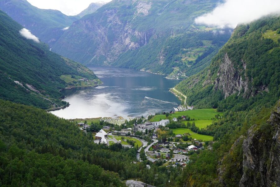
- Geiranger village itself
- Hellesylt and Stranda
- Ålesund: the practical gateway
- Eating in and around the village
- Logistics: the four ways in
- The Hellesylt-Geiranger ferry, route by route
- The road from Trollstigen, viewpoint by viewpoint
- Two specific things to skip
- What to pack
- Three days, used well
- What this fjord is not
The 15-kilometre branch nobody calls by its proper name
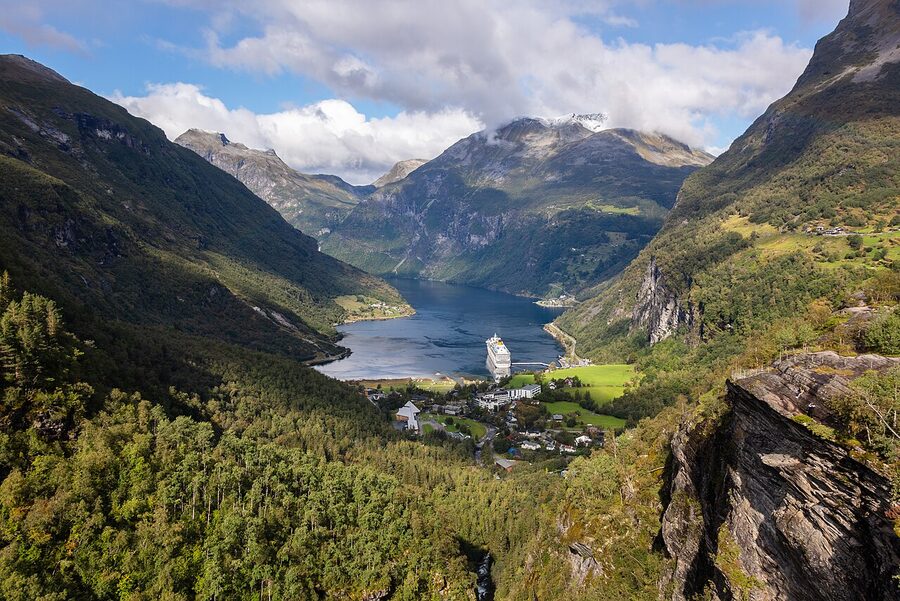
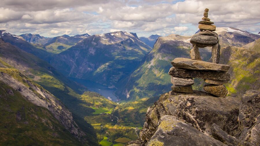
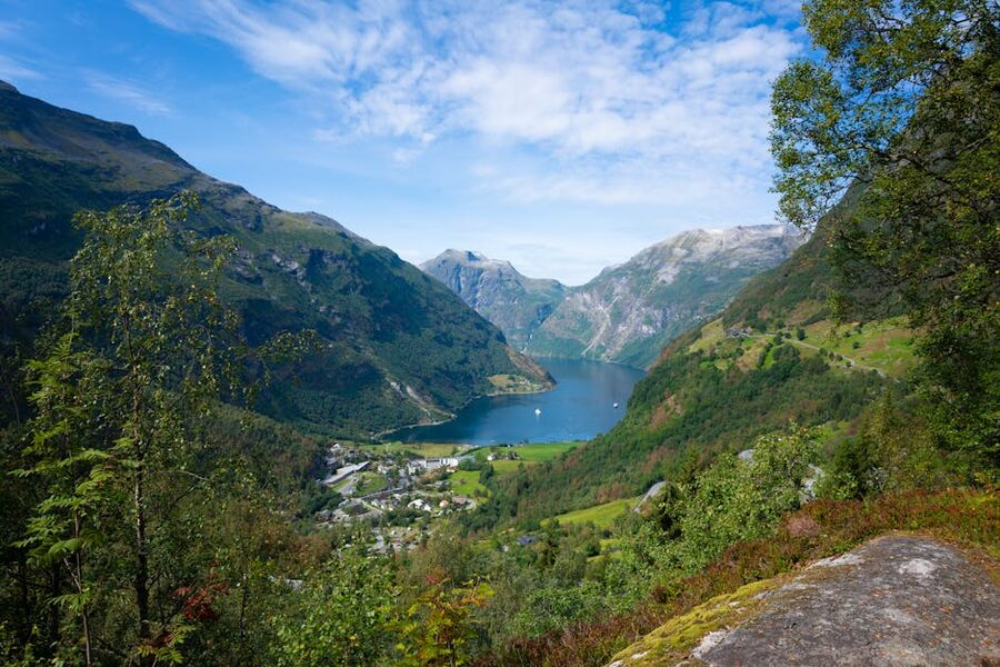
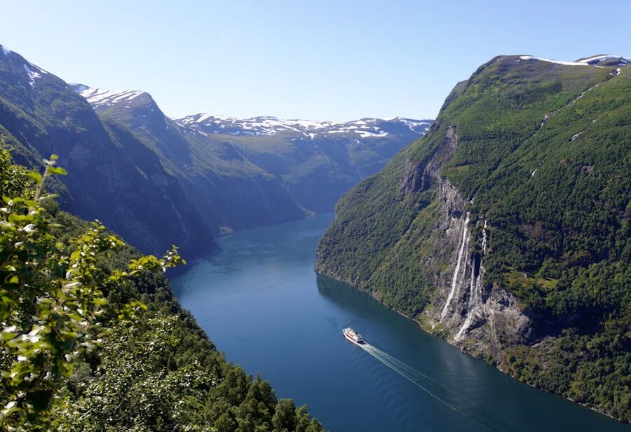
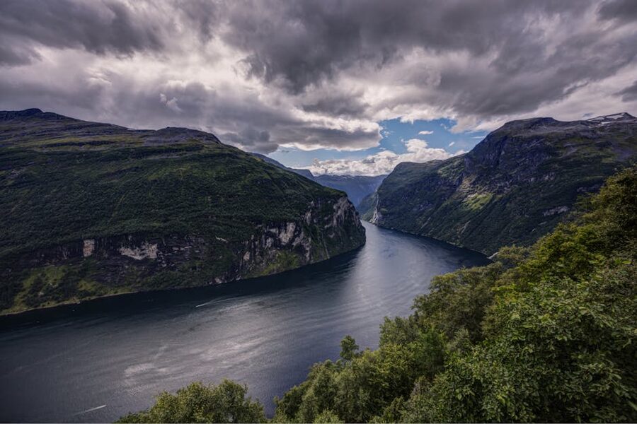
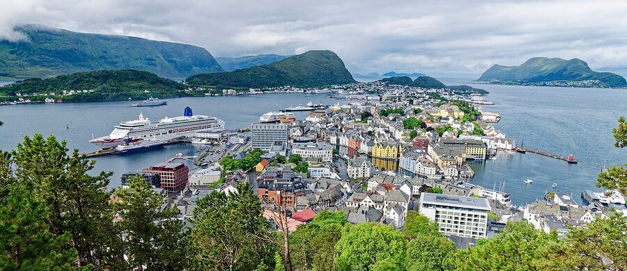
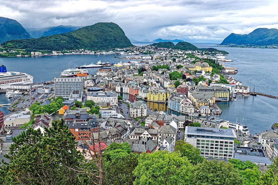
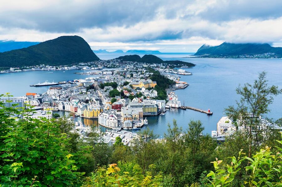
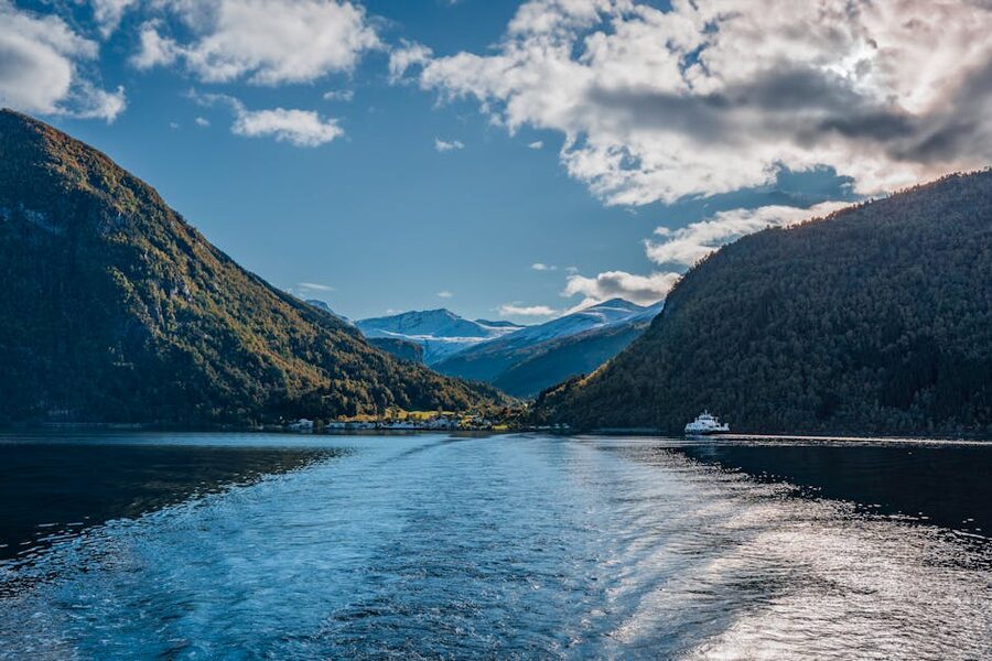
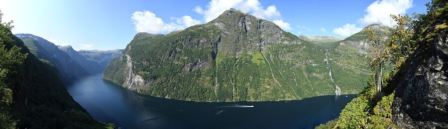
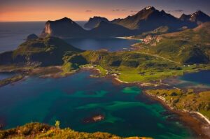
Geirangerfjord proper is short. It is a 15-kilometre arm that branches east off Sunnylvsfjorden, which itself feeds into the much larger Storfjord that runs all the way out to Ålesund and the Atlantic. When people say they are going to Geiranger they almost always mean the 15-kilometre dead-end with the village at one end and Hellesylt at the other. The Seven Sisters waterfalls, the Suitor opposite, the abandoned Skageflå and Knivsflå farms on the cliffsides, the Eagle Road switchback into the village, the Dalsnibba viewpoint above it: all of that fits inside that single arm. UNESCO inscribed it together with Nærøyfjord in the Sognefjord system in 2005, under the criteria that ranked them among the world’s longest and deepest fjord landscapes and added the words “outstanding” and “exceptional” without flinching.
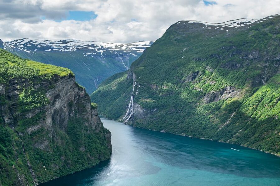
The geology is the standard fjord story sharpened: glaciers carving Triassic-age gneiss for two-and-a-bit million years, the last retreat about 11,500 years ago, walls that lift more than a kilometre out of water that goes 260 metres deep. What makes Geirangerfjord look the way it does in photographs is the combination of the depth, the width (around 600 metres at its narrowest, less than a kilometre at its widest) and the cliffs that come straight up without the cushion of a coastal shelf. Stand at sea level in the village and crane your neck. The headache is part of the attraction.
When to go, plainly
This is the section the cruise-line marketing departments would prefer you skip, so I will be specific. There are five Geirangers, depending on when you arrive, and the differences between them are larger than the differences between Norwegian fjords.
Late May to early June is the underrated window. The road over Trollstigen reopens in the second or third week of May depending on snowmelt; the Geirangerfjord Service road up Dalsnibba opens in late May. The waterfalls run hard with melt. Cruise traffic is still light, which means the village walks like a village. The catch is that some of the smaller mountain restaurants and viewpoint cafés have not yet opened for the season, and weather is volatile. I would take it.
Late June through August is peak cruise season. On a high-traffic week in July the port logs five or six ships in a single day, with the largest delivering 3,000 passengers each. The village population swings from 250 to over 5,000 between 09:00 and 16:00. Restaurants lift prices, the path up to Hotel Utsikten queues, and the Hellesylt-Geiranger ferry crossing goes from a calm hour with cliffs to a packed deck where you cannot get to the rail. Going in summer is fine if you are prepared to be somewhere else during the daylight cruise hours; pre-book a hike, a kayak or a Stranda day-trip and treat the village as a sunset stop.
Early September to mid-October is the quiet sweet spot. The big lines stop calling around the third week of September, the smaller expedition vessels keep going for another fortnight, and by the first weekend in October the village exhales. The Trollstigen road usually closes some time in the second half of October, weather-dependent; once the gate goes down it stays down until May. The Dalsnibba road closes earlier, generally in late September. Plan around those two dates if you want both.
Late October to early May is the winter Geiranger almost no foreign visitor sees. The 63 over Trollstigen is closed. The 63 up Dalsnibba is closed. The road into the village from the north (the Eagle Road) is plowed but exposed and slow. The way in is the long route via Stranda and the ferry, which runs reduced winter sailings. The village has perhaps 80 to 120 hotel rooms operating in winter, the cafés that open keep odd hours, and the only cruise traffic is the Hurtigruten coastal ferry which adds a December-to-February detour into the fjord on its weekly run. It is genuinely beautiful and almost completely silent, but it is a different trip and you need a 4WD with proper winter tyres.
If I had to pick one week for someone planning their first time, I would send them to the second week of September. The Trollstigen road is still open. The Dalsnibba road is still open. The cruise calls have dropped to two or three a day and the second half of those days are quiet again. The light is low by 17:00. The hotel rates fall by something like a third compared to mid-August.
The cruise-ship reality, in numbers
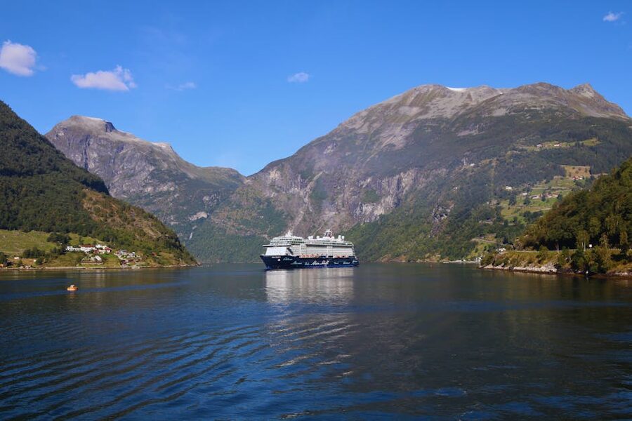
Geirangerfjord recorded around 175 cruise calls in 2024 according to Stranda Hamnevesen, the harbour authority that runs the port. The total annual passenger volume sits between 600,000 and 800,000 depending on which year and which counting method, against a year-round resident population of 250. The match is unbalanced and the village has stopped pretending otherwise.
The Norwegian parliament passed legislation in 2018 requiring zero-emission operations in the world heritage fjords (Geirangerfjord and Nærøyfjord) by the start of 2026. After two delays, a softer version of that rule is now in force: from 1 January 2026 ships under 10,000 gross tonnes must run zero emissions inside the heritage zone, and the larger cruise vessels must use shore-power or low-sulphur fuel and carry plug-in hybrid systems by 2032. What this means in practice is that the air quality in the village is measurably better than it was three years ago (you no longer see the layer of brown haze that used to sit at fjord level on still days), and the smaller Hurtigruten / Havila / Future of the Fjords vessels glide in silently. The bigger ships still arrive and still smell faintly of bunker fuel for the first hour after docking. The village has not become quieter; it has become marginally cleaner.
If you are coming on a cruise, the practical advice is short. You will be ashore for somewhere between four and seven hours. Of that, the first hour and last hour are eaten by the tender or gangway queue and the safety walk to the village. That leaves three to five usable hours. The single best use of those hours is the public bus up to Dalsnibba (about 75 minutes round-trip including stops) followed by lunch at Westerås Farm above the village. The single worst use is the on-board “fjord cruise excursion” priced at 1,200 NOK (~€103) per person, which is the same boat ride the Hellesylt-Geiranger car ferry does for 290 NOK (~€25) walked-on.
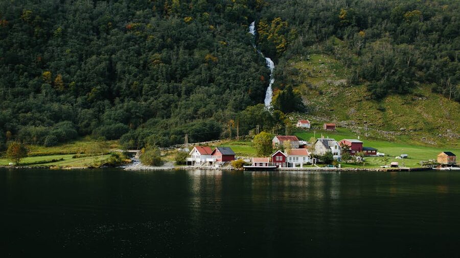
The Seven Sisters, the Suitor and the abandoned farms
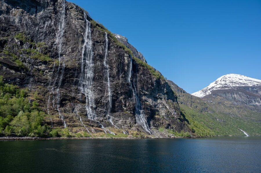
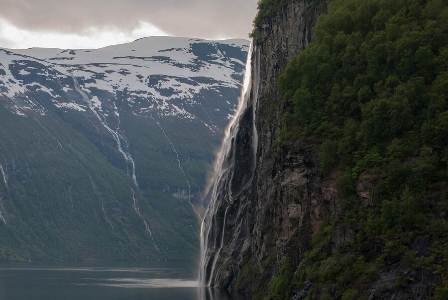
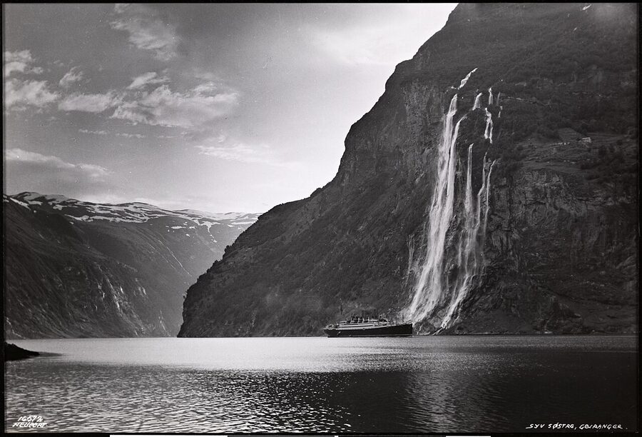
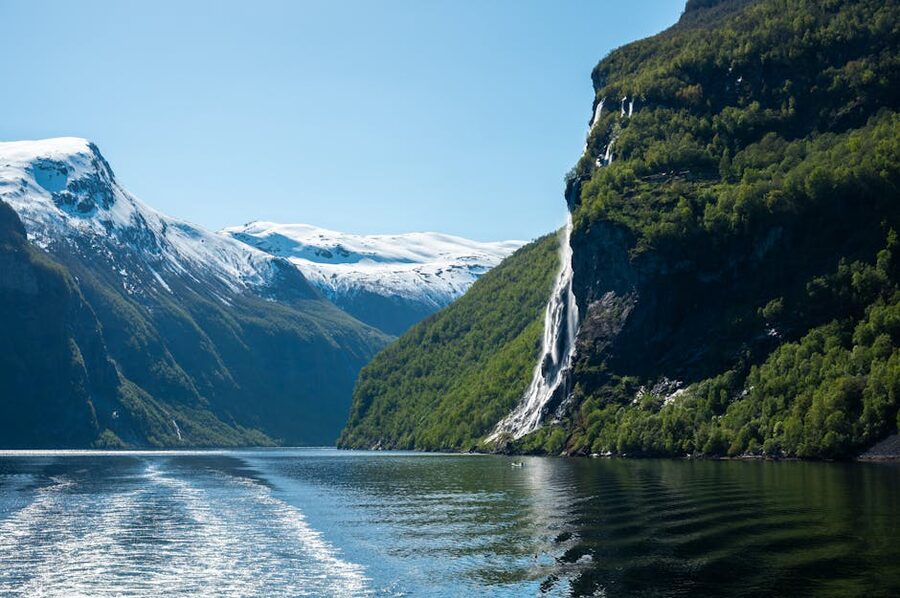
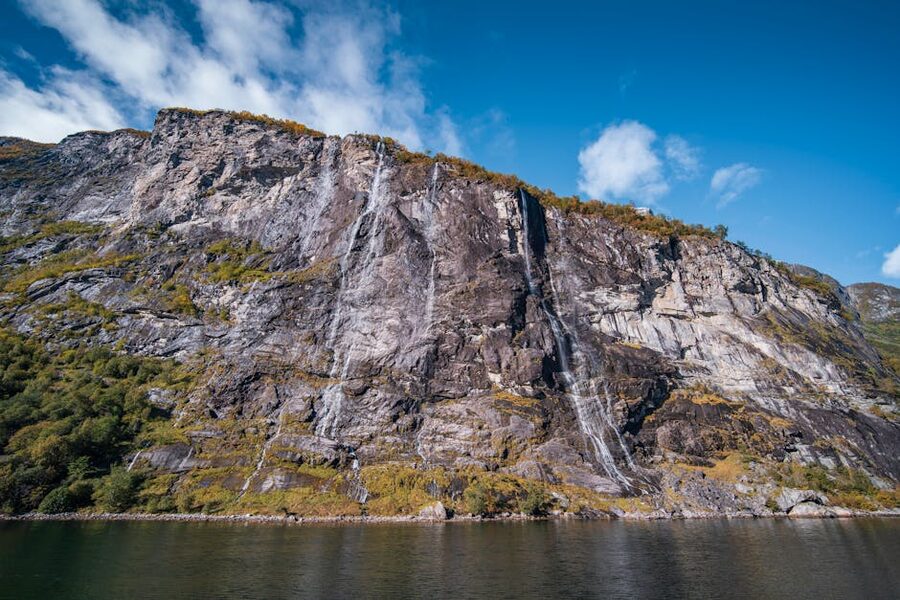
Halfway down the fjord, on the north wall about 7 kilometres from the village, the Seven Sisters fall in seven separate threads from a height of around 250 metres. The middle thread is the largest; the outer two go from a trickle to nothing in a dry August. Directly opposite, on the south wall, a single stockier waterfall called Friaren (the Suitor) stands proud. About 800 metres downstream of the Suitor is a smaller, finer fall called Brudesløret (the Bridal Veil). The story locals will tell you, and that the ferry crew tell over the public address with a knowing pause, is that the seven sisters are sisters who refused the suitor across the fjord, and he has been drinking ever since.
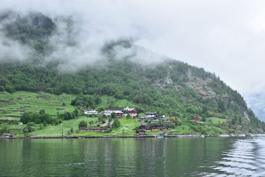
What the legend does not tell you, and what makes Geirangerfjord different from every other waterfall fjord in Norway, is that the cliffsides above and beside the falls used to be farmed. From the 17th century to the early 20th the cliffs supported a sequence of mountain farms perched 200 to 350 metres above the water on grass terraces that look impossible at first glance and then, when you have stared long enough, look merely terrifying. Skageflå, on the south wall just past the Seven Sisters, is the most famous; Knivsflå on the north wall sits directly above the falls themselves. Blomberg, Matvik and a handful of smaller homesteads make up the rest. Goats and sheep were lifted up by ladder and rope. Children were tied to the cliffs during play; the family that lived at Skageflå reportedly pulled the wooden access ladders up after themselves when the tax inspector tried to climb them.
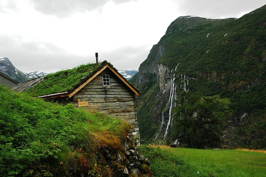
The farms were abandoned between 1900 and 1962, the last to go being Knivsflå. They are preserved as cultural heritage sites and the buildings are still standing, lichen-blackened and slightly collapsed, looking exactly as you would want a Norwegian abandoned farm to look. The Norwegian Fjord Centre in the village (more on that below) tells the story properly with photographs of the families taken in the 1920s and 1930s.
The Skageflå hike: do this if you do nothing else
If you are going to do one thing on foot at Geirangerfjord, do the hike up to Skageflå. There are two ways to start it. The classic version takes the Geirangerfjord Service ferry from the village pier (220 NOK ~€19 single, summer schedule only, late May to early September), gets off at the small Skageflå dock the boat will drop you at on request, and walks up. The path from the pier to the abandoned farm climbs about 400 metres in 1.5 kilometres of switchbacks. It is steep but not technical. From the farm you carry on for another half-hour to the Homlongsætra summer pasture, which is the photo viewpoint for the Seven Sisters and the fjord. The full round trip walk is about 4 to 5 hours including time on the farm; with the boat, you are out of the village for around 6 hours.
The longer version starts at Geiranger village itself and does the whole thing on foot via the Vesterås Farm trail. Add about 90 minutes each way. It is the proper hike but it adds 250 metres of elevation that the boat saves you, and the early section follows the road which is busy with cruise-passenger minibuses in summer.
What to bring: water (no tap source on the trail), proper hiking boots (the path is loose stone in places and the descent is harder than the ascent), and rain gear. The cliffside has its own weather. I have done it twice and once been rained on for the entire descent.
Dalsnibba: 1,500 metres of altitude and a road that costs to drive
Dalsnibba is the high viewpoint above the village, on the Geirangerfjord Service mountain road, and it is the single most photographed place in this part of Norway. The viewing platform sits at 1,476 metres above sea level, with the village 1,400 metres straight down and the fjord visible all the way to the Seven Sisters bend. The road up is the privately operated Geirangerfjord Service road; you pay a 320 NOK (~€27) toll per car at the gate. The road opens in late May and closes in late September, weather-dependent. There is a small café at the top, a steel platform with a glass front cantilevered over the cliff, and parking. There is no hike to it; the road literally takes you to the platform.
If you do not have a car, the Geiranger Sightseeing bus runs a 90-minute Dalsnibba round-trip from the village pier in summer, several departures a day, around 470 NOK (~€40). It is the right call if you are off a cruise ship; the bus times are aligned with the typical port-call window. Local taxis from the village will do the round trip for somewhere around 1,400 NOK (~€120) split across the car, which makes sense for three or four travelling together.
The verdict on Dalsnibba: it is worth it if the weather is clear. If the cloud is sitting on the village (which is how it spends a lot of June), the platform sits inside the cloud and you have paid 320 NOK for a wall of grey. Check the webcam before you commit. There is a live feed at the top.
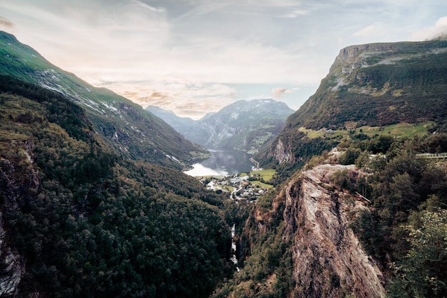
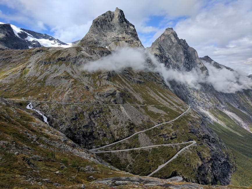
Eagle Road, Ørnesvingen and the photo nobody owns
The road into Geiranger from the north (the Eidsdal-Geiranger leg of national tourist route 63) climbs out of the village in eleven hairpins called Ørnevegen, the Eagle Road. About two-thirds of the way up there is a viewing platform built in 2006, Ørnesvingen, with parking, a small water feature that frames the photograph, and a near-vertical drop down to the fjord. This is the single best photograph you can take in the area without leaving tarmac. The light is good in the morning (the village is lit; the cliffs across are in shadow) and excellent in the late afternoon (low light running across the water).
The Eagle Road is what gets you in or out of Geiranger if you are coming via Trollstigen and the Norangsdalen valley. It is open year-round in theory but the upper hairpins close briefly in storms. Allow 25 minutes from the village to the top of the road; allow another 90 minutes from there to the bottom of Trollstigen.
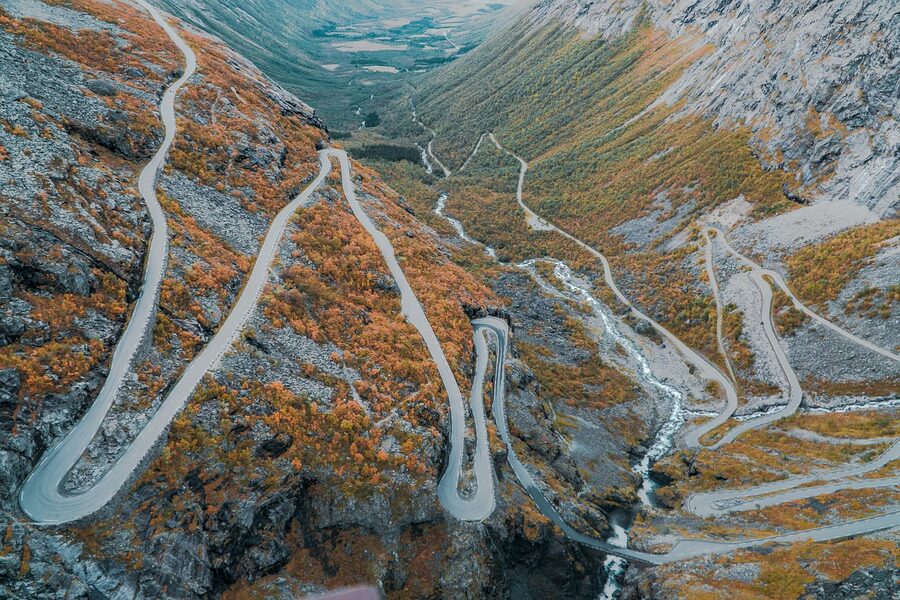
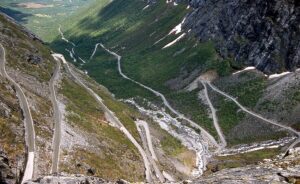
Trollstigen: the road, the closure, the verdict
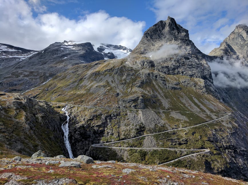
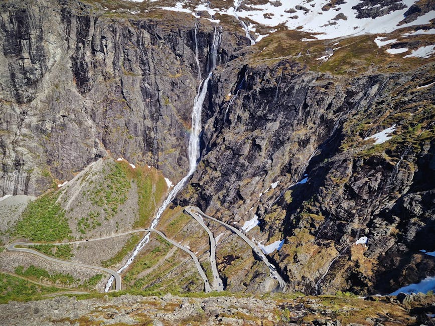
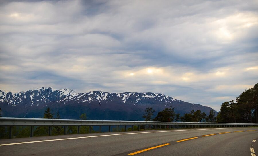
Trollstigen, the Troll Ladder, is the country’s most photographed mountain road and the obvious approach to Geirangerfjord from Åndalsnes and the Romsdal valley. It climbs from sea level to 858 metres in eleven hairpins on grades that hit 12 percent. The road is closed every winter, generally from mid-October to mid-May (the first to close, the last to open of any major Norwegian pass) and the exact dates depend on snow. The Norwegian Public Roads Administration website carries the live status; if you are travelling at the shoulders of the season, check it the day before.
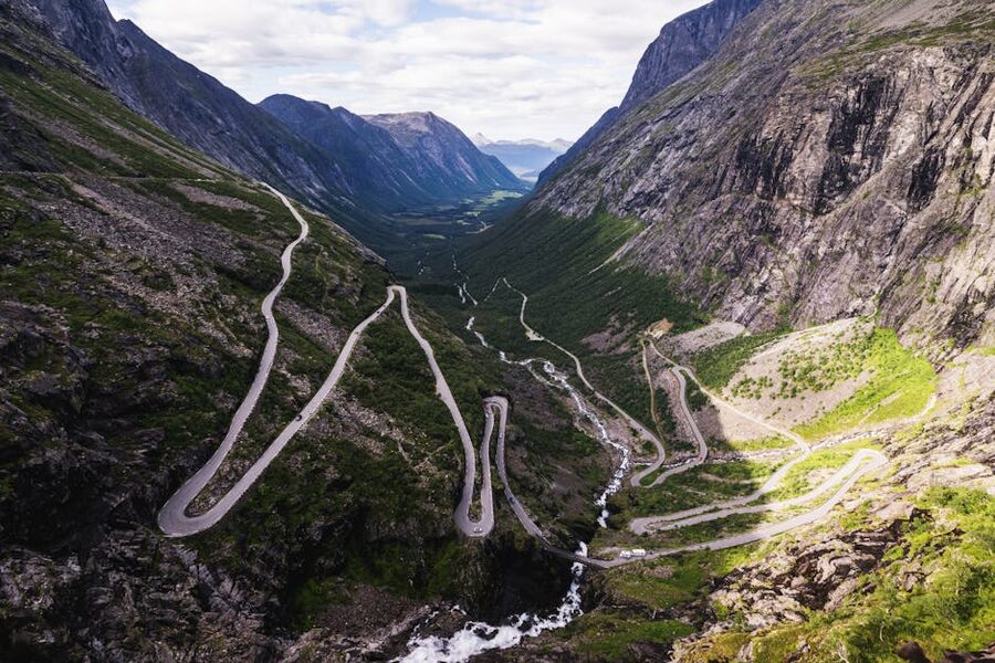
The viewing platform at the top, designed by Reiulf Ramstad in 2012, has been the standard Trollstigen photo for a decade. As of 2026 it is partly closed for stabilisation and accessibility work after one of the cantilevered platforms cracked in 2024; the toilets, café and lower viewing area are open, the upper platform is fenced. The work is meant to finish in late 2026. Even in its current state the stop is worth it; you can walk to within a few metres of the cliff edge on the lower wooden boardwalk and see the road below you.
From the top of Trollstigen to Geiranger village by car is about 2 hours 15 minutes, including the Linge-Eidsdal car ferry crossing of the Norddalsfjord (every half hour in summer, 200 NOK per car ~€17). The drive runs through the Valldal valley with strawberry farms in summer (real ones; you can stop and pick) and then up the Eidsdal valley to the Eagle Road. If you are doing the full road-trip loop with Trollstigen northbound and the Eagle Road southbound, this is the order that lets you take the photo at Ørnesvingen with the right light.
The fjord cruise: the right one and the wrong one
There are three ways to be on the water in Geirangerfjord and they cost very different amounts of money for very similar views.
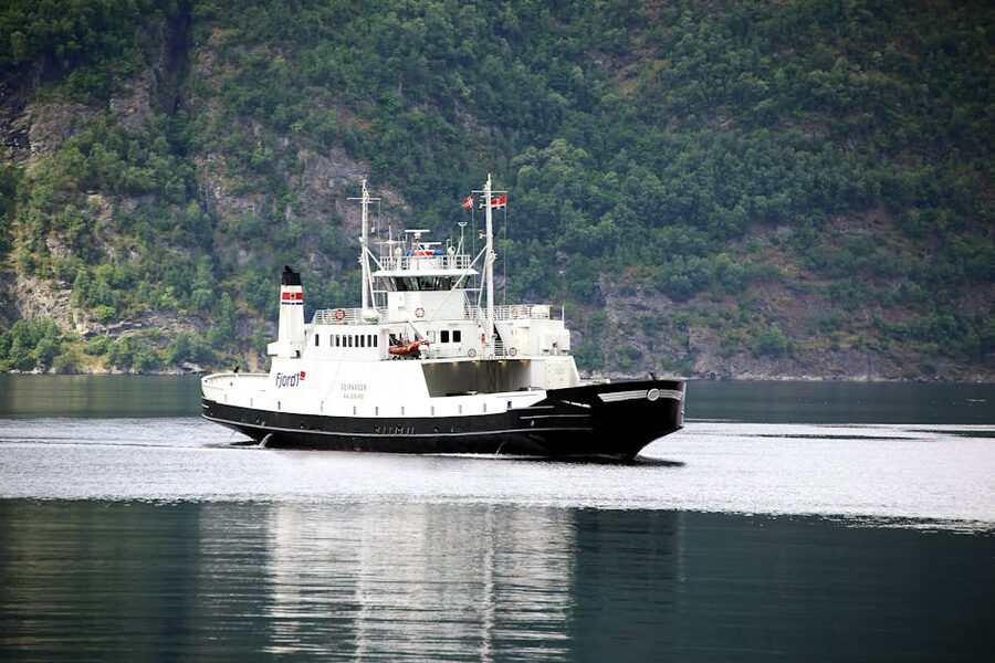
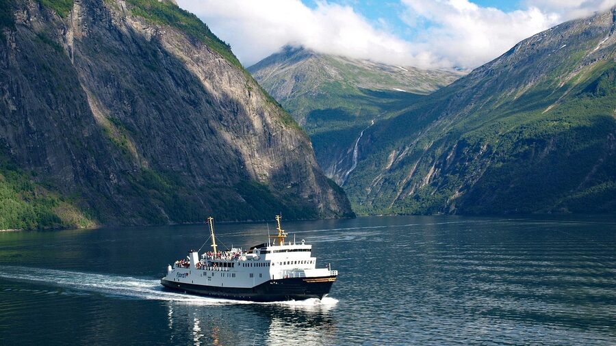
The Hellesylt-Geiranger car ferry is the locals’ boat. It runs four to six times a day in summer between mid-May and the end of September, takes about an hour each way, costs 290 NOK (~€25) walk-on per adult or about 730 NOK (~€63) for a car plus driver. The boat is run by Fjord1 and as of 2026 it is the all-electric replacement vessel, MS Aurora, which is silent. You get the full length of Geirangerfjord, both walls, the Seven Sisters and the Suitor. Walk to the front of the upper deck and stay there. This is the best value experience on this fjord.
The Geiranger Fjordservice sightseeing boats from the village pier do shorter loops, typically 90 minutes out to the Seven Sisters bend and back. The fare runs 410 NOK (~€35) per adult and the boats are smaller, lower to the water, and have a guide on the PA. They are the right choice if you do not want to commit to a one-way crossing or arrange a return ferry. The standard 12:00 sailing fits cruise-call timings.
The RIB tours are the third option and the noisy fast cousin of the others. Around 850 NOK (~€73) per person for a 90-minute trip, fast inflatables, full-body weatherproof suits provided. They go closer to the waterfall spray and faster between viewpoints. They are the right choice if you have done the village ferry already and want the same fjord at a different speed. They are the wrong choice on a cold or wet day; even with the suits, you will be miserable.
If you only do one thing on the water, take the Hellesylt-Geiranger car ferry one way. This is also the cheapest possible way of seeing the entire fjord at length, and it’s the one I’d send any first-timer towards.
Kayaking: the option the brochures rarely show
Geiranger Adventure runs the kayak operation out of a small shed near the camping ground at the head of the fjord. They do guided trips of 3 to 4 hours from May to September, about 950 NOK (~€81) per person including kit, which is the standard Nordic kayak guide-trip rate. The wind is fickle so the trips usually stay in the inner half of Geirangerfjord, looping past the Bridal Veil and back. There are also full-day trips that paddle out to Skageflå and combine the abandoned farm walk with the kayak return; that one is excellent and runs around 1,600 NOK (~€137).
The cliffs change scale completely from a kayak. From the village ferry the wall on the south side reads as a postcard; from a sea kayak 200 metres off the same wall it is a wall, and you can hear the small waterfalls that the bigger boats throw past at 12 knots. If you have done a kayak guided trip in another fjord and know what you are doing, this is the place to stretch the kit.
The Norwegian Fjord Centre and the slow landslide
The Norwegian Fjord Centre, Norsk Fjordsenter, is the small museum on the bench above the village pier. Entry is 165 NOK (~€14), open daily 10:00 to 17:00 from May to September with shorter winter hours. It earns the visit on two grounds. First, it is where the abandoned-farm story is told properly with original photographs, ladder fragments and family documents from Skageflå and Knivsflå. Second, it has the public exhibit on the Åkerneset slide.
The Åkerneset story matters. There is a section of the Sunnylvsfjord cliff, around 90 kilometres of road from Geiranger village but only about 35 kilometres in a straight line, that is sliding into the fjord at a measurable rate. The estimates are around 50 million cubic metres of rock; the geologists’ modelling expects an eventual collapse to generate a tsunami in the high tens of metres in Geiranger and the surrounding villages. The 1934 Tafjord landslide, on the next fjord arm north, killed 41 people in the same way; survivors of that event are why the monitoring exists. Stranda runs evacuation drills twice a year. There is a public siren in the village and a marked evacuation route that goes uphill, fast, towards Hotel Utsikten. None of this is hidden; the centre tells the whole story without melodrama. The display includes the live monitoring data feed from the cliff, updated every 15 minutes.
The probability of the slide happening during your three-day visit is, on the published estimates, very small. The reason it is in this guide at all is that you will see the evacuation signs around the village and at every hotel and it is better to know what they refer to.
Where to base: Geiranger, Hellesylt, Stranda or Ålesund
The right base depends on whether you want to be in the village at sunrise (Geiranger), in a quieter fjord village an hour out (Hellesylt or Stranda), or in a small Art Nouveau city with restaurants that stay open late (Ålesund). I have stayed in three of the four; the fourth I have stopped through enough times to have an opinion.
Geiranger village itself
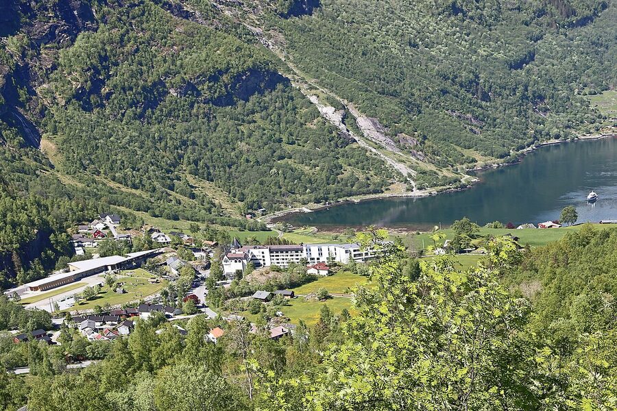
Staying in the village means you are awake before the cruise ships arrive and asleep after they leave, which is the entire point. It is also where the rates are highest and the rooms book out earliest; check availability six months out for July. The hotels split into two clusters, the high ones above the village (Hotel Union, Hotel Utsikten) and the lower ones by the fjord (Havila / Hotel Geiranger, Grande Fjord, the campsites).
Hotel Union Geiranger is the historic option, family-owned for over a century, with a vintage-car museum in the basement and the only proper spa in the village. Rates from 2,800 NOK (~€240) for a fjord-view room in high season. It is the right choice if you are committing to a longer stay; the spa pays for itself on a wet day.
Hotel Utsikten is across the road. Same height, slightly better fjord view, plainer rooms, marginally cheaper. From around 2,500 NOK (~€215). Local tip: the breakfast buffet at Utsikten is better than at Union.
Grande Fjord Hotel sits at the foot of the Eagle Road, fifteen minutes’ walk from the village along the water. Rooms from around 2,300 NOK (~€197). The hotel runs its own small distillery (Geiranger Brenneri) and the breakfast is properly good. The walk into the village is along the road which is busy in cruise hours; you trade convenience for quiet.
Havila Hotel Geiranger (formerly Hotel Geiranger, now run by Havila) is the central village option with the smallest rooms but the shortest walk to anything. From around 2,400 NOK (~€205). The bar terrace is the village’s best public space at sunset.
Solhaug Fjordcamping is the cabin alternative for travellers who want kitchenette space and a porch. Cabins from around 1,400 NOK (~€120). Walk into the village is 10 to 15 minutes along the water.
Hellesylt and Stranda
Hellesylt is a working village at the mouth of the Sunnylvsfjord, 60 kilometres by ferry or 60 kilometres by road from Geiranger, with a 50-metre waterfall running through the middle of it. It is much quieter than Geiranger, has a third of the hotel rooms and roughly a fifth of the cruise traffic. The cruise ships that do stop here are the smaller expedition vessels. Hellesylt Hostel is the budget pick. The village has two small restaurants and a bakery, and the morning ferry to Geiranger leaves at 09:00 and 11:00 in summer. As a base you save money and you get the fjord ferry crossing in both directions, which is two hours of cliffs every day.
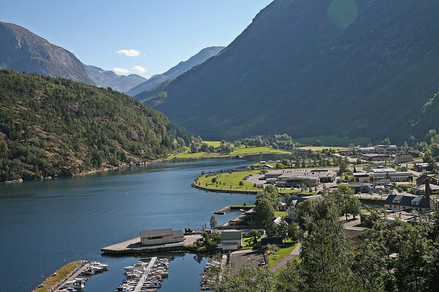
Stranda, 25 kilometres from Geiranger via Sunnylvsfjord and the Stranda-Liabygda ferry, is the small ski-and-fishing town that operates as the practical service centre for the area. It has a Co-op, a Kiwi supermarket, two petrol stations, a hospital and (in summer) the cheapest hotel rooms inside an hour of the fjord. Stranda Hotel from around 1,600 NOK (~€137) in summer. From late November to early May Stranda is the ski centre for the area; the Strandafjellet pistes and the off-piste runs above them are some of the better-regarded in western Norway. If you are in this area in winter and know how to ski, base here and the fjord becomes a side-quest.
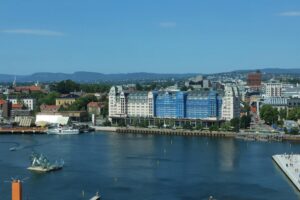
Ålesund: the practical gateway
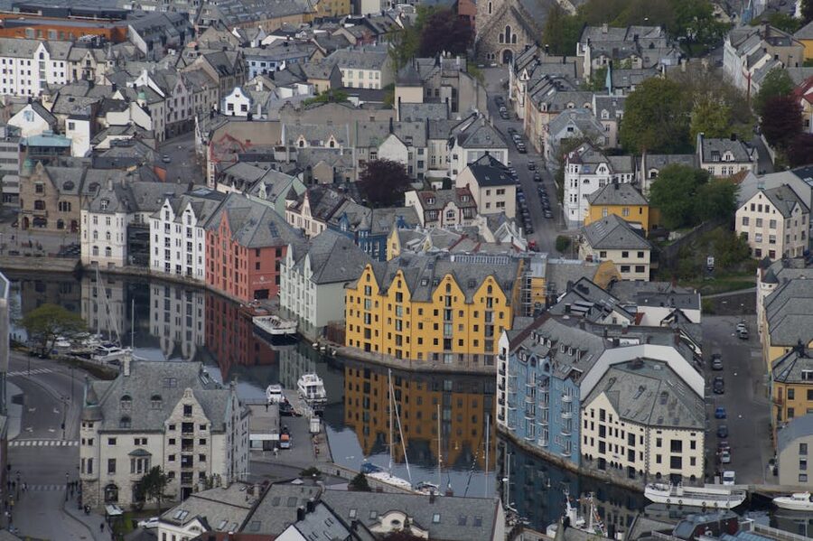
Ålesund (pronounced more or less “OAL-uh-soon”) is the small Art Nouveau city 110 kilometres west of Geiranger, on the coast at the mouth of Storfjord, and the practical gateway for most travellers reaching this fjord by air. The airport is the country’s eighth-busiest, with direct flights from Oslo (50 minutes), Bergen, London Gatwick (Norwegian, summer only) and Amsterdam. The drive from Ålesund city centre to Geiranger via Stranda and the Stranda-Liabygda ferry is about 2 hours 30 minutes. By bus the FRAM 250 service does the same trip in around 4 hours.
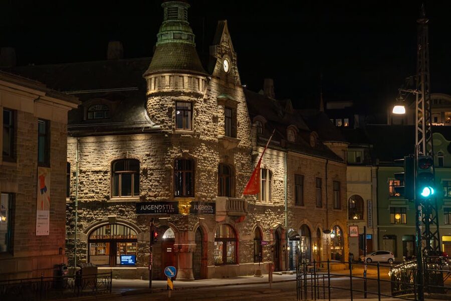
The reason the city looks the way it does is one specific January night in 1904. A paraffin lamp tipped over in a cowshed at Aalesund Preserving in the small hours of 23 January. The fire moved south, hit drying cod-fish stockpiles, jumped to the wooden warehouses, and within 15 hours had taken 850 buildings and made 10,000 of the city’s 11,500 residents homeless. There was one death (an elderly woman who returned to her house for a handbag). Kaiser Wilhelm II of Germany, a regular summer visitor to the area, had personal sympathy for the city and sent four shiploads of food, wood and money within the week. The rebuild that followed, in 1904 and 1905, used the contemporary Jugendstil style (Norwegian Art Nouveau) with stone, brick and stucco rather than wood. The result is a city with one of Europe’s largest concentrations of pre-war Art Nouveau architecture.
For a Geirangerfjord base, Ålesund makes sense if you want one trip in to the fjord (long day, leave at 06:30, back by 22:00) and the rest of the time in a real small city with restaurants. If you are doing two days at the fjord, base at Geiranger or Hellesylt and use Ålesund for the start and end nights only.
Hotels: Hotel Brosundet is the boutique pick, in a converted 1905 warehouse on the harbour, from about 2,400 NOK (~€205). Scandic Parken is the larger chain option opposite the Aksla steps, from about 1,600 NOK (~€137). For a longer stay or a family, the apartments around Storfjord are usually better value than hotel rooms.
Eating in and around the village
The dining scene in Geiranger is shaped by the cruise rotation: peak demand for two hours a day, then long quiet evenings. The places that take the evenings seriously are the ones to find.
Brasserie Posten sits in the old post office building on the harbour. Three courses around 690 NOK (~€59), good local fish, the kind of restaurant where the chef wanders out to ask whether the cooking on a piece of arctic char was right. Open evenings only. Book ahead in summer.
Westerås Farm (Westerås Gard), up the switchback road five minutes above the village, is the lunch and view stop. Goat from the farm itself, lamb in summer, a cured-fish board with arctic char and gravlax. Around 280 NOK (~€24) for a main. The terrace is the photo. Westerås also has cabins to stay in if you want a higher base than the village.
Olebuda, on the harbour, is the casual pick: pizza and pasta, around 230 NOK (~€20) for a main, open through the day and useful when the cruise rush has shut everywhere else. Avoid 12:30 to 14:00 in cruise weeks.
Naustkroa, also harbourside, is the local fish-and-chips place. Cod, halibut, steamed shrimp by weight (350 NOK ~€30 for half a kilo, served with bread, butter and a beer). Best eaten on the bench outside.
Geiranger Brenneri at Grande Fjord Hotel runs distillery tours by appointment (around 350 NOK ~€30) with a tasting at the end. The aquavit is good. The gin is properly good.
What to eat: locally, look for fjordfisk (whatever the boat brought in that morning), goat from the cliffside farms (sweeter than you expect), and cloudberries (multebær) on dessert in late summer. What to skip: the over-priced cruise-port bistros around the pier itself, especially anywhere with three menus in three languages chalked outside.
Logistics: the four ways in
There are four practical ways to reach Geiranger and they each shape the trip differently.
By car from Oslo, allow 7 to 8 hours via Otta and the Sunnylvsfjord, or 9 hours via the Bergen Line approach through Lærdal and Sognefjord. The Otta route runs through Lom and Geiranger Service road; the alternative comes via Hellesylt. Both are excellent drives in summer; both have closed stretches in winter. If you are doing the country in a wider loop, see the Oslo guide for the start city and the Bergen Line scenic train if you want to swap a section of the drive for the railway and connect at Flåm or Voss.
By car from Bergen, allow 7 hours via Sognefjord and the Norddalsfjord ferry. This is the route that combines well with the Lofoten islands road trip further north for travellers wanting fjords and Arctic island scenery in one fortnight.
By bus and ferry combination, the FRAM 250 service from Ålesund to Geiranger runs once or twice daily in summer for about 380 NOK (~€33), takes around 4 hours and uses the Stranda-Liabygda crossing. In winter the service is cut to a single weekday run.
On a cruise, you do not pick the time and the call duration is short. Read the cruise-call section above; the bus to Dalsnibba and lunch at Westerås are the best four hours.
The Hellesylt-Geiranger ferry, route by route
The ferry from Hellesylt is one of the most-photographed boat rides in northern Europe and the section above is the price-and-times entry. The full route, in order, north shore first as you sail east towards the village:
Out of Hellesylt the boat passes the Hellesylt waterfall and turns north into Sunnylvsfjorden. Watch the south wall: the abandoned Blomberg farm sits on a green ledge at about 200 metres for the first ten minutes. The fjord narrows past Sunnylven church (you can see it from the boat). The Geirangerfjord proper begins at the bend after about 25 minutes; the cliffs close in.
About 35 minutes in, on the south wall, the abandoned Skageflå farm sits at 250 metres above the water, looking exactly like its photograph in the Norwegian Fjord Centre. Five minutes after Skageflå, on the same wall, the Suitor waterfall and downstream the Bridal Veil. Look across at the same time and you have the Seven Sisters opposite.
About 50 minutes in, on the north wall directly above the Seven Sisters, the abandoned Knivsflå farm. The boat slows here for photographs (this is the staged stop the captain announces). Twenty more minutes and the village comes into view, followed by the cruise ships if it is high season, then the pier.
The reverse route from Geiranger gives you the same in reverse. If you are picking one direction for photographs, do Hellesylt to Geiranger in the morning (light over the south wall) and the return in the afternoon if you must (light over the north wall). The return is rarely as quiet as the outbound; cruise passengers often take the late ferry to a port elsewhere.
The road from Trollstigen, viewpoint by viewpoint
Coming in from Åndalsnes, the standard order of stops is:
1. Trollstigen platform, kilometre 12 north of Stigfossen. Free, parking, toilets, café open in season. 858 metres altitude.
2. Stigfossen viewpoint, halfway down the hairpins. Free, layby parking only. The waterfall is loud.
3. Gudbrandsjuvet, 16 kilometres south of Trollstigen on the 63. Free, with a 2008 Reiulf Ramstad architect-designed bridge over the gorge that is genuinely interesting in itself. 15 minutes is enough.
4. Valldal, the strawberry valley. The roadside stalls sell punnets in season for 60 NOK (~€5). Pick-your-own at Sylte Gard if you have an hour.
5. The Linge-Eidsdal car ferry, every 30 minutes in summer, 200 NOK per car, 15 minutes’ crossing.
6. The Eidsdal-Geiranger road, 24 kilometres, climbing to the Eagle Road plateau and then dropping to the village.
7. Ørnesvingen, the photo platform at hairpin 7 of the Eagle Road. Free, parking.
8. The village.
The whole leg, from Trollstigen platform to the village, is 105 kilometres and takes 3 hours including the ferry and a single 15-minute viewpoint stop. With Stigfossen, Gudbrandsjuvet, Valldal and Ørnesvingen all done properly it is a 5-hour day.
Two specific things to skip
Two things are routinely on Geiranger top-10 lists and are not, in my view, worth the time.
The Flydalsjuvet rock photograph. There is a viewing area off the road south of the village where, in 2008, somebody noticed a rock outcrop that, when shot from the right angle, looks like the photographer is standing on a thin spike of stone with an 800-metre drop on three sides. It became a viral photograph and the queue to recreate it is now 30 to 60 minutes long in summer. The actual rock is not on the cliff; it sits on a wider ledge five metres back from the genuine drop. The photograph is, in the polite Norwegian phrase, “an arrangement”. Skip it. Drive 200 metres further down the road, park at the proper Flydalsjuvet pull-off where the Diego Delso shot earlier in this guide was taken, and have the same view without the queue.
The local “Geiranger Skywalk” bus tour. A 90-minute round-trip on a coach to a viewpoint that is 20 minutes’ walk from the village if you have legs. 320 NOK (~€27) per person; less than five minutes of usable photo time at the top. If you have rented a car, drive it. If you have not, take the bus to Dalsnibba instead.
What to pack
For three or four days at the fjord in summer: a waterproof shell jacket (not a plastic poncho), proper hiking boots, two warm layers including a fleece, a buff for wind, a head torch for the long evenings if you are camping, and reef-shoes or trainers you do not mind getting wet for the kayak. Mosquitoes are present in calm weather along the water; pack spray. The local one to look for is Mygga, sold at every petrol station.
For winter: full winter kit. Studded boots, microspikes, an insulated jacket rated to -15°C, gloves you can drive in, a 4WD with proper Nordic winter tyres if you are renting a car. Most international rentals out of Ålesund airport ship cars on Nordic winter tyres from 1 November to 31 March; check before you book. The road from Stranda to the village is plowed but exposed in places; allow more time than the GPS suggests and never drive at night in a snowstorm. There is no fuel between Stranda and Geiranger village.
Three days, used well
If you have three full days, this is the order I would do them in.
Day one: arrive in the morning via Trollstigen and the Eagle Road. Stop at the Trollstigen platform, Gudbrandsjuvet, Valldal for lunch, the Linge-Eidsdal ferry, and Ørnesvingen for the photograph at sunset. Sleep at one of the high hotels above the village.
Day two: ferry from Geiranger to Hellesylt and back at 09:00, returning at 13:00. The full fjord both ways. Lunch at Naustkroa from the second ferry. Afternoon hike up to Westerås and then up further to the Vesterås viewpoint or the Storsæterfossen waterfall (a 90-minute round-trip walk that ends behind the falls). Dinner at Brasserie Posten.
Day three: drive (or bus) up to Dalsnibba in the morning. After lunch, kayak with Geiranger Adventure for three hours in the inner fjord. Late afternoon, the Norwegian Fjord Centre. If the weather is clear, sunset at Flydalsjuvet again before dinner.
If you have a fourth day, drop the kayak from day three and put a Skageflå hike in instead, taking the morning ferry out to the dock and walking back via Vesterås. It is the better single experience but it eats most of a day.
What this fjord is not
Geirangerfjord is not Norway’s best-kept secret. It is, by visitor count, one of Europe’s busiest single-attraction destinations, with a tourism economy and a calendar that runs the place. Going there expecting solitude in July will end in disappointment. Going in late September with a base outside the village and the right two hikes booked will not.
The cliffs do what they do regardless of who is watching. The waterfalls run hard in June and softer in August. The abandoned farms keep getting harder to reach because the access paths erode, and the foundation that maintains them is on a small budget. The cruise ships will keep coming until the regulations stop them, which they will only partly. The road over Trollstigen will keep closing in October. The Åkerneset cliff will keep moving. None of that diminishes the fjord. It just shapes when and how to see it.
Get to the village before the boats. Stay until after they have left. Walk up at least one of the abandoned-farm paths. Take the Hellesylt ferry both ways at least once in your life. The rest is detail.